Route from Saint-Clément to Bubry

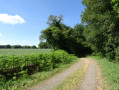
Following wide paths and sunken lanes through the villages, this route will introduce you to Bubry’s rich rural heritage, including traditional houses, wells and bread ovens… A walk through lush greenery with magnificent views over the steep-sided Sarre valley.

Details

n°57562645
Creation:
Last update:
Last review:
  • Walking
    Activity: Walking
  • ↔
    Distance: 5.74 mi
  • ◔
    Average duration: 3h 00 
  • ▲
    Difficulty: Easy

  • ⚐
    Back to start: Yes
  • ↗
    Ascent: + 449 ft
  • ↘
    Descent: - 420 ft

  • ▲
    Highest point: 568 ft
  • ▼
    Lowest point: 259 ft
  • ⚐ Country: France
  • ⚐ City: Bubry (56310)
  • ⚑
    Start/End: N 47.998714° / W 3.163411°
  • Hour-by-hour weather

Photos

Description of the walk

Bubry, Étang Fleuri car park (D3 towards Persquen, turn right at Kerbras).

(S/E) Leave the Étang Fleuri on your left and head straight up towards Stanqueline. Stay on this road at the junctions. You’ll arrive at the Croix de Kerantalm.

(1) This is the highest point in the commune at 177 m and the former site of the Saint-Colomban Chapel, which was moved to Saint-Clément. Turn right and continue to Saint-Clément, ignoring any other turnings.

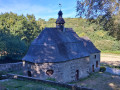
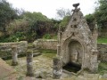
(2) Enter the village to explore the chapel.

(3) Retrace your steps.

(2) Turn right, then left towards Kerotennec. Turn right before the houses and take the sunken lane on the right to reach Stang Du, directly beneath a power line.

(4) At the well, take the path, then the road on the right to leave the village. Head down the road to the left and, after 350 m, enter the field on the right (before the 103-metre mark).

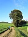
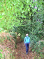
(5) Turn slightly left at the tree, then join the path through the woods on the right. Follow the path as it bends left, then right. Enjoy the view over the Sarre Valley before turning right to join a wide path.

(6) At the farm track, turn right, then turn left onto theGR®341. Follow it to the left, then right, to emerge at Coët Sar Braz.

(7) Continue along the road until you reach a crossroads (elevation 98).

(8) Cross the junction and follow the road straight ahead. Turn left towards the village of Haben and take the path on the left. Stay on this path, which bends left, then right. Continue straight ahead. At the fork, turn right.

(9) At the junction, leave the GR®. Turn right towards Bieuzen.

(10) Walk through the hamlet and continue along the road. At the crossroads, turn right (north) and carry on straight ahead. At the bend (elevation 161), head straight ahead along the farm track which takes you back to the Étang Fleuri (S/E).

Waypoints

  1. S/E : mi 0 - alt. 459 ft - Étang Fleuri
  2. 1 : mi 0.39 - alt. 548 ft - Kerantalm Cross
  3. 2 : mi 0.89 - alt. 541 ft - Saint-Clément Junction (Return)
  4. 3 : mi 0.99 - alt. 558 ft - Saint-Clément Chapel
  5. 4 : mi 1.78 - alt. 407 ft - Stang Du
  6. 5 : mi 2.2 - alt. 331 ft - Manebutur Wood
  7. 6 : mi 2.87 - alt. 289 ft - Sarre Valley farm track
  8. 7 : mi 3.25 - alt. 374 ft - Coët Sar Braz
  9. 8 : mi 3.64 - alt. 328 ft - Road junction at Toul er Gleut
  10. 9 : mi 4.49 - alt. 440 ft - Route de Kermain
  11. 10 : mi 4.82 - alt. 495 ft - Bieuzen
  12. S/E : mi 5.74 - alt. 459 ft - Étang Fleuri

Notes

This route is included in the Morbihan Departmental Plan for Walking and Hiking Routes and has been accredited by the French Hiking Federation. You can follow the yellow signposts. There is an information board with a map and details of heritage sites at the start.

Worth a visit

This route is organised by Lorient Agglomération. Find out more: https://www.lorient-agglo.bzh/a-vivre/to...

- Étang Fleuri: powered the two mills at Manéantoux (18th–20th centuries).
- Saint-Clément: 18th-century village and chapel.
- Stang Du: well and bread oven (19th century).
- Sarre Valley: Natura 2000 site, a tributary of the Blavet
- Coët Sar Bras: bread oven.
- Le Haben: 17th–18th-century farmhouses.
- Bieuzen: 17th–18th-century farms.

Always be cautious and plan ahead when you're outdoors. Visorando and the author of this route cannot be held responsible for any accidents occurring on this route.

The GR® and PR® markings are the intellectual property of the Fédération Française de Randonnée Pédestre.

Reviews and comments

5 / 5
Based on 1 review

Reliability of the description
5 / 5
Ease of following the route
5 / 5
Route interest
5 / 5
les mille pattes
les mille pattes

Overall rating : 5 / 5

Date of your route : Nov 19, 2024
Reliability of the description : ★★★★★ Very good
Ease of following the route : ★★★★★ Very good
Route interest : ★★★★★ Very good
Very busy route : Yes

Hello, we really enjoyed the walk, which was described very well in your guide. The route is very well signposted, with one detour clearly indicated by signs and very clear directional markers. The section through the woods is quite steep, but the autumn scenery is magnificent despite the damp weather we’ve had. See you soon; Les Mille Pattes.

Machine-translated

Other walks in the area

For more walks, use our search engine .

The GPS track and description are the property of this route's author. Please do not copy them without permission.