Route de Pouvourville via Pech David and Ramonville-Saint-Agne

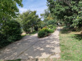
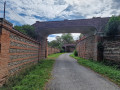
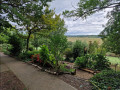
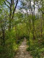
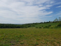
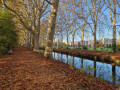
A lovely walk on the outskirts of Toulouse, linking Ramonville, Pouvourville and Pech David. This walk invites you to immerse yourself in lovely, shady and peaceful woodland and numerous parks. Follow the Chemin des Gaulois, on the outskirts of the Oppidum de Cluzel, and discover a place steeped in history that offers a magnificent view over the Garonne valley and the Toulouse region.

Details

63386217
Creation:
Last update:
Last review:
  • Walking
    Activity: Walking
  • ↔
    Distance: 6.44 mi
  • ◔
    Average duration: 3h 30 
  • ▲
    Difficulty: Moderate

  • ⚐
    Back to start: Yes
  • ↗
    Ascent: + 594 ft
  • ↘
    Descent: - 594 ft

  • ▲
    Highest point: 827 ft
  • ▼
    Lowest point: 509 ft
  • ⚐ Country: France
  • ⚐ City: Toulouse (31500|31400|31300|31)
  • ⚑
    Start/End: N 43.539528° / E 1.455561°
  • ❏
    IGN map(s): Ref. 2043ET, 2144O
  • Hour-by-hour weather

Photos

Description of the walk

Park at the foot of the radio mast on Chemin de Peyre d’Escale in Ramonville-St-Anne.
Access is available by public transport via bus route 54 (Estérel stop) or route 112 (Montjoie stop).

(S/E) Ignore the path leading down to the Chemin des Senteurs, which you will take on the return journey. Keep the mast on your right and follow theGR®653along the Chemin de Peyre d’Escale. On your left lies the northern slope of Vieille-Toulouse and its 18-hole golf course.

(1) Leave theGR®653and continue straight on, crossing the road carefully, towards Pech David/Oppidum de Cluzel/Parc du Manel.

(2) Turn right, following the yellow markings, still heading towards the Pech David Leisure Centre/Oppidum de Cluzel. You’ll reach a lovely, shaded woodland. Caution: this section can be slippery in wet weather! Wooden handrails and steps are provided to assist walkers on difficult sections.

(3) Carefully follow the road between the two junctions: Robert Thomas and Rivalsupervic. Cross at the Rivalsupervic junction and take the hairpin bend which leads onto a steep, uneven path that is slippery in wet weather. You’ll reach the junction with the Chemin de Cruzel.

(4) Turn left at the hairpin bend, then turn right to join the Sentier des Gaulois, which runs parallel to Chemin de Cruzel. Follow it to the Oppidum de Cluzel.

(5) Enjoy the view over the Toulouse conurbation and the River Garonne, then continue to the right for about 300 m, heading north-east, whilst continuing to follow the yellow markings along the Sentier des Gaulois.

(6) Leave the Sentier des Gaulois by turning right: this section is unmarked, so follow the GPS track carefully until you reach a roundabout.

(7) Cross the Chemin du Vallon with care, then head south-east again, following the red-and-white (GR®653) and yellow signposted route towards Pouvourville. Take care to follow the path on the left.

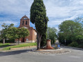
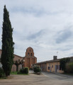
(8) Turn left to cross Pouvourville Park and reach the church: you can also go straight on to arrive at the same spot. There is a water point by the playground and the pétanque court.

(9) Go round the roundabout on the right to follow Rue de Fondeville, then turn right to go round the École Notre-Dame des Anges via Chemin de Cruzeville. Take care when crossing pedestrian crossings and walking along pavements.

(10) Turn onto the footpath on the left and follow it for about 1 km, through the numerous housing estates. You’ll emerge onto Rue de la Fontaine des Cerdans; turn left, then turn right at the small shaded square to rejoin the path and reach Avenue de Gleyze-Vieille.

(11) Cross at the pedestrian crossing, then turn left, heading north-north-east, along this avenue. Take care when crossing at pedestrian crossings and whilst walking along the pavements. Continue to the roundabout.

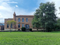
(12) Turn right onto Avenue Latécoère and walk alongside the château. You’ll come out onto Avenue de l’Aéropostale; turn left and walk for about 150 metres.

(13) Turn right to cross the Parc du Château de Soule: please note that opening times may vary depending on the season and weather conditions.

(14) Turn left to go round the château, leave the park and head for the roundabout on Avenue de Suisse. Turn right, then veer right again to go round a nature reserve, rejoin Avenue de Suisse, and follow it to the right. Then turn right onto Chemin du Coustelas. Take the opportunity to enjoy a tasty break at Fred l’Artisan, a bakery renowned for its many award-winning pastries and breads.

(15) Join theGR®653again and head uphill to the right, past the Jardin des Senteurs*, then on to the finish (S/E).

Waypoints

  1. S/E : mi 0 - alt. 817 ft - Car park, terrestrial TV aerial
  2. 1 : mi 0.61 - alt. 741 ft - Junction at Pouvourville School
  3. 2 : mi 0.81 - alt. 728 ft - Manel Park
  4. 3 : mi 1.27 - alt. 522 ft - Junction of Robert Thomas and Rivalsupervic - Garonne (fleuve)
  5. 4 : mi 1.64 - alt. 741 ft - Chemin de Cluzel
  6. 5 : mi 1.93 - alt. 732 ft - Cluzel Oppidum
  7. 6 : mi 2.13 - alt. 712 ft - T-junction
  8. 7 : mi 2.55 - alt. 699 ft - Chemin du Vallon
  9. 8 : mi 2.76 - alt. 741 ft - Pouvourville Park
  10. 9 : mi 3.09 - alt. 768 ft - Church roundabout
  11. 10 : mi 3.31 - alt. 781 ft - Turn left at the fork
  12. 11 : mi 3.8 - alt. 715 ft - Avenue de Gleyze-Vieille
  13. 12 : mi 4.19 - alt. 686 ft - Roundabout
  14. 13 : mi 5.05 - alt. 623 ft - T-junction. Château de Soule Park
  15. 14 : mi 5.21 - alt. 669 ft - Exit the park on the left
  16. 15 : mi 5.89 - alt. 587 ft - Coustalas, GR°°®°° junction
  17. S/E : mi 6.44 - alt. 817 ft - Car park, terrestrial TV aerial

Worth a visit

  • Fred l’Artisan Bakery (open from 6 am to 8 pm every day) – a bakery renowned for its numerous awards (best croissant, best brioche, best baguette, etc.)
  • Children’s playground at Pouvourville Park (8).
  • The Garden of Scents (S/E) is an ideal place to stop, relax and discover the rich natural scents of local and Mediterranean plants known for their fragrances, such as lavender, thyme, rosemary and other aromatic herbs.

Always be cautious and plan ahead when you're outdoors. Visorando and the author of this route cannot be held responsible for any accidents occurring on this route.

The GR® and PR® markings are the intellectual property of the Fédération Française de Randonnée Pédestre.

Reviews and comments

4.7 / 5
Based on 2 reviews

Reliability of the description
5 / 5
Ease of following the route
4.5 / 5
Route interest
4.5 / 5
Fa54
Fa54

Overall rating : 5 / 5

Date of your route : Nov 18, 2024
Reliability of the description : ★★★★★ Very good
Ease of following the route : ★★★★★ Very good
Route interest : ★★★★★ Very good
Very busy route : No

A varied and interesting route

Machine-translated

Lo cordior
Lo cordior

Overall rating : 4.3 / 5

Date of your route : Oct 14, 2024
Reliability of the description : ★★★★★ Very good
Ease of following the route : ★★★★☆ Good
Route interest : ★★★★☆ Good
Very busy route : Yes

To mix up our walks a bit (still in the same area: Lauragais / Montagne Noire!), we chose the south-western hillsides of the ‘Pink City’...
3/3:
1/3=> very interesting on the hillsides, above the Garonne, Pouvourville/Pech David: very popular with trail runners.
2/3=>( my fear! scores: 9/10/11) “It felt out of place amidst all those buildings: in the city!”
A must to reach the route… we were disappointed.
3/3= >fortunately, from Avenue Latécoère: the path near the Château and the Park, and the return via the Jardins des Senteurs trail...
and so a 3-and-a-half-hour walk.....

When the weather’s lovely: it’s lovely: it’s Visorandô!!!

Machine-translated

Other walks in the area

For more walks, use our search engine .

The GPS track and description are the property of this route's author. Please do not copy them without permission.