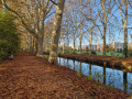
Route of the hillsides south of Toulouse

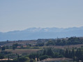
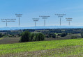
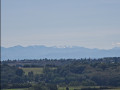
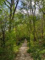
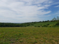
This beautiful walk through the hills south of Toulouse will take you on a journey of discovery through a wide variety of landscapes. You’ll walk in turn through lush green plains, peaceful woodland and charming hills which, at times, offer magnificent panoramic views of the majestic Pyrenees.
Part of the route also follows the famousGR®653, the Way of St James, adding a historical and spiritual dimension to this adventure. Get ready for a wonderful immersion in the heart of nature, where every stage reveals a new horizon to explore.

Details

62464221
Creation:
Last update:
Last review:
  • Walking
    Activity: Walking
  • ↔
    Distance: 12.86 mi
  • ◔
    Average duration: 7h 15 
  • ▲
    Difficulty: Difficult

  • ⚐
    Back to start: Yes
  • ↗
    Ascent: + 1,562 ft
  • ↘
    Descent: - 1,575 ft

  • ▲
    Highest point: 909 ft
  • ▼
    Lowest point: 499 ft
  • ⚐ Country: France
  • ⚐ City: Toulouse (31500|31400|31300|31)
  • ⚑
    Start/End: N 43.539531° / E 1.455489°
  • ❏
    IGN map(s): Ref. 2144O
  • Hour-by-hour weather

Photos

Description of the walk

Park in the car park by the radio mast.

(S/E) Start the walk heading south-east, leaving the mast on your left, towards the Chemin des Senteurs.
Take the opportunity to explore this themed trail, designed to awaken the senses through a wide variety of aromatic and fragrant plants.

(1) Leave the return path on your right and continue to the junction with the Chemin de Pechbusque, 150 metres further on. Follow this path to the left, then walk carefully along the road for about twenty metres before crossing over and joining a small path on the right that runs alongside the same road.

(2) Cross the main road (D35) carefully and follow the path below the field, keeping the woodland on your right. It is possible to take this section through the woodland, but this is not recommended in wet weather as the ground there is muddy (even in the height of summer!).

(3) Turn left at the junction, towards Ramonville/Auzeville/Blancas.

(4) Turn right at the junction, towards Mervilla/Pas del Loup, then follow the path south-east.

(5) Turn right at the junction, towards Mervilla/Bois Blanc.

(6) Turn left at the junction, towards Mervilla, and follow the red and white markings ofthe GR®653. Turn right 100 metres further on.

(7) Still on theGR®653, turn left onto the Route des Crêtes. On a clear day, there’s a sweeping view of the Pyrenees.

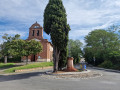
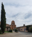
(8) Cross the pedestrian crossing with care and turn right towards Mervilla church. Then continue along theGR®, keeping the church on your right. Clear views of the Pyrenees on a clear day.

(9) Turn left onto the road towards Campistron, then leave the housing estate on your right, still following the red and white markings.

(10) Leave theGR®653(do not cross the stream) and turn right up a fairly steep climb of about 200 m until you reach a junction.

(11) Continue to the left, towards Vigoulet-Auzil/Gleyzette/Le Réganel.

(12) Carefully head up the Avenue du Lac on the right for about fifty metres to join the Chemin de la Rivière, which branches off to the left.

(13) Turn right just after the Placette du Grand Bois and follow a path (not shown on the IGN map) which climbs a steep slope to overlook Lake Vigoulet-Auzil. Caution: the path is slippery in wet weather. The path forms a near-circular route before descending back to the track you left earlier.
(Important note: make sure you follow the GPS track on this section, which is not shown on the IGN map, or switch to the OSM base map.
- It is possible to avoid this circular loop by following the Chemin de la Rivière for 100 m.

(14) Join the Chemin de la Rivière on the right and continue straight on at the end of the tarmac road.

(15) Turn right, towards Vieille-Toulouse/Vigoulet-Auzil/Parc de la Confluence. 100 m further on, cross the road and continue along the path on the right, which turns due north up a steep slope.

(16) Turn left at the junction and walk alongside the road for 20 metres, then follow the yellow markings along the Chemin d’Auzil, turning right.

(17) Carry on to the left at the junction, round a bend in the road, towards the Parc de la Confluence.

(18) Follow the hairpin bend to the right and continue towards Roche-Fleurie along the stream.
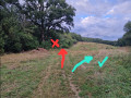
Take care when you reach the plain: do not follow the path that climbs up through the woods, but take the small, inconspicuous path on the right, which is clearly marked from there on.

(19) Carry on along the Ruisseau du Pont d’Auzil, despite the Yellow Cross markings.

(20) Carry on straight ahead along a narrow, uphill track. Turn left at the top of this climb.

(21) At the fork in the road just after this, follow the path on the left. Near the houses, turn left at each junction, leaving the tennis courts on your right.

(22) Continue along the path running alongside the fence and the cemetery, enter the woods and follow the path which descends slightly to the left. This section can be very muddy in wet weather. Cross the stream.

(23) Turn right onto a steep, slippery climb in wet weather. Continue straight on along the road until you reach the Route de Saint-Sernin (D95).

(24) Cross the road carefully and take the small path below the copse. (View of the radio mast, the starting point of this walk.)

(25) Take the path on the right (yellow markings). Join theGR®653at the junction beneath the power line.

(26) Continue straight on along theGR®, towards Pechbusque: a steep and muddy section in wet weather.

(27) Turn left at the church.

(28) Turn right at the cross of Christ, then immediately take the path opposite. (You can fill your water bottles at the water point by the village hall, next to the tennis courts.) Cross the road straight ahead and follow theGR® markings to rejoin the Chemin des Senteurs.

(1) Return to the car park (S/E) by taking the route back in the opposite direction to the way out.


Waypoints

  1. S/E : mi 0 - alt. 817 ft - TDF radio transmission tower
  2. 1 : mi 0.44 - alt. 643 ft - Intersection of the circular loop
  3. 2 : mi 0.72 - alt. 604 ft - D35
  4. 3 : mi 0.93 - alt. 614 ft - Junction, towards Blancas
  5. 4 : mi 1.4 - alt. 778 ft - Blancas
  6. 5 : mi 1.69 - alt. 804 ft - Pas del Loup
  7. 6 : mi 2.3 - alt. 837 ft - Bois Blanc
  8. 7 : mi 2.61 - alt. 906 ft - Route des Crêtes
  9. 8 : mi 2.87 - alt. 899 ft - Mervilla Cross
  10. 9 : mi 3.56 - alt. 771 ft - Falcou
  11. 10 : mi 4.13 - alt. 633 ft - Campistron
  12. 11 : mi 4.31 - alt. 738 ft - Countryside
  13. 12 : mi 4.82 - alt. 604 ft - Avenue du Lac
  14. 13 : mi 5.02 - alt. 597 ft - Placette du Grand Bois
  15. 14 : mi 5.68 - alt. 597 ft - Chemin de la Rivière
  16. 15 : mi 6.52 - alt. 554 ft - Le Réganel
  17. 16 : mi 7.24 - alt. 725 ft - Avenue du Val
  18. 17 : mi 7.52 - alt. 787 ft - Auzil
  19. 18 : mi 8.12 - alt. 502 ft - Confluent
  20. 19 : mi 8.78 - alt. 568 ft - Straight ahead
  21. 20 : mi 9.22 - alt. 663 ft - Straight ahead
  22. 21 : mi 9.56 - alt. 699 ft - Path on the left
  23. 22 : mi 10.04 - alt. 810 ft - Vigoulet-Auzil Cemetery
  24. 23 : mi 10.37 - alt. 666 ft - Steep path to the right
  25. 24 : mi 10.75 - alt. 869 ft - Route de Saint-Sernin
  26. 25 : mi 11.04 - alt. 820 ft - Follow the yellow markings
  27. 26 : mi 11.21 - alt. 732 ft - Moreve
  28. 27 : mi 11.66 - alt. 837 ft - Pechbusque Church
  29. 28 : mi 11.85 - alt. 807 ft - Cross of Christ
  30. S/E : mi 12.86 - alt. 817 ft - TDF radio transmission tower

Notes

The walk is classified as difficult due to its length, the nature of the terrain – which can quickly become muddy in wet weather – and the need to navigate carefully and follow the GPS track, particularly in wooded areas where signposting is scarce.

Allow between 1 litre and 1.5 litres of water per person, especially in summer. There are no water sources available before the checkpoint (28). There are numerous shaded sections in the forest and others exposed to the sun.

To enjoy the views of the Pyrenees, this hike is best undertaken between October and March.
It’s best to set off early in the morning.

It is possible to shorten the walk by skipping certain waypoints:

  • Waypoints (9) and (11) via the Chemin du Moulin.
  • Points (13) and (14) via the Chemin de la Rivière

This route is taken from the 2024 edition of the BisCoteaux Trail with a few modifications and, most importantly, a detailed route description throughout, highlighting all the challenging sections.

Worth a visit

A few places to visit:

  • The Jardin des Senteurs at the start of the walk.
  • The Vigoulet-Auzil Riding Club.
  • The Restaurant des Coteaux in Vigoulet-Auzil, next to the town hall. See opening hours.

Always be cautious and plan ahead when you're outdoors. Visorando and the author of this route cannot be held responsible for any accidents occurring on this route.

The GR® and PR® markings are the intellectual property of the Fédération Française de Randonnée Pédestre.

Reviews and comments

4.4 / 5
Based on 3 reviews

Reliability of the description
4 / 5
Ease of following the route
4.7 / 5
Route interest
4.7 / 5
Tu
Tu

Overall rating : 5 / 5

Date of your route : Dec 11, 2025
Reliability of the description : ★★★★★ Very good
Ease of following the route : ★★★★★ Very good
Route interest : ★★★★★ Very good
Very busy route : No

I'm delighted to have been able to cycle 20 km with almost no roads near Toulouse, instead of having to cycle for miles to the starting point and then follow roads for distances that were sometimes a bit long.
Thank you very much.

Machine-translated

Elodie perez
Elodie perez

Overall rating : 4.3 / 5

Date of your route : May 12, 2025
Reliability of the description : ★★★☆☆ Average
Ease of following the route : ★★★★★ Very good
Route interest : ★★★★★ Very good
Very busy route : Yes

I did this ride on horseback; there were a few difficult, even impossible, sections.
(A branch blocking the path, a gate restricting access, a wooden bridge)
With its beautiful scenery, this trail is well worth a visit.
A well-trained horse is essential!

Machine-translated

sandrine.pertel
sandrine.pertel

Overall rating : 4 / 5

Date of your route : Apr 07, 2025
Reliability of the description : ★★★★☆ Good
Ease of following the route : ★★★★☆ Good
Route interest : ★★★★☆ Good
Very busy route : No

A lovely, enjoyable route.

Machine-translated

Other walks in the area

For more walks, use our search engine .

The GPS track and description are the property of this route's author. Please do not copy them without permission.