Country:
 City:


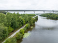
(S/E) Start from Rue du Port at the Camping du Bac. Facing the river, turn right onto the towpath. Follow it for just over 200 m, then turn right onto a path branching off the towpath.
(1) Continue straight on along the path, which leads onto a small road, and carry on until you reach the junction with the Route de la Jaille-Yvon (landmark: recycling bins on the right). Turn right onto the Route de la Jaille-Yvon and walk for about fifty metres to reach the wayside cross in the cemetery. There, a footpath branches off to the left.
(2) Turn left onto the footpath, which continues as a country lane. After 600 metres, the lane turns left. Carry on straight ahead along the path until you come out onto a small road at the hamlet of La Maison Neuve.
(3) Turn right and carry on straight ahead, passing the hamlets of La Mahottière (on the right) and then La Rochepallière (on the left) until you reach a T-junction.
(4) At the junction, turn right towards the village of Ménil.
(5) After passing the sign marking the entrance to the built-up area, turn left onto the grassy track that starts just after the large cubic house. Follow the track all the way until it joins a small road. Turn right and continue for 150 m until you reach a Y-junction (with a wayside cross on the left). Turn right again. Head towards the village, passing through the Croix des Noués housing estate to reach the junction with the Route de Château-Gontier (Stop sign).
(6) At the Stop sign, turn left, then right at the first junction (Chemin des Noués). After about 100 m, the road curves to the left; continue straight on along the path until you reach the junction with Rue Saint-Martin. Turn left, walk for about 150 m and you’ll arrive at the small Notre-Dame de Bonne Fortune Chapel.
(7) Turn right onto this road (Chemin de la Rivière) and follow it for 1.8 km until you reach a crossroads with a wayside cross on the left. Keep slightly to the right and continue for about 150 m. There, a road branches off to the right.
(8) Turn right at La Gauvenière and take this small road through the woods until you reach the junction 800 metres further on. At the junction, turn right and then carry on straight ahead to reach the river and the Bavouze Lock.
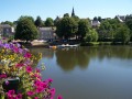
(9) At the lock, turn right onto the towpath and continue along the river for just over 2 km to reach the village of Ménil and the campsite car park (S/E).

 Tourist office


 Visorando Member
 Easy