The Peyrute Route in Port-Sainte-Foy-et-Ponchapt

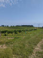
A short, gentle walk, ideal for discovering a rich and varied array of landscapes along the Dordogne and amongst the hillsides, most of which are still used for wine-growing. The route takes in the treasures of this rural commune: a diverse range of flora and fauna and a well-preserved heritage.

Details

249219
Creation:
Last update:
Last review:
  • Walking
    Activity: Walking
  • ↔
    Distance: 3.44 mi
  • ◔
    Average duration: 1h 55 
  • ▲
    Difficulty: Easy

  • ⚐
    Back to start: Yes
  • ↗
    Ascent: + 387 ft
  • ↘
    Descent: - 394 ft

  • ▲
    Highest point: 397 ft
  • ▼
    Lowest point: 33 ft

Description of the walk

Park in the Town Hall car park.

(S/E) On leaving the car park, turn left, cross the D20 and turn left to reach the riverbank.

(1) Then follow the towpath to the left until you reach Rue du Passeur.

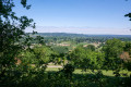
(2) Turn left to join the D20. Walk left for about ten metres, then turn right onto the path leading to the Moulin de la Ferraille, perched up there on the edge of the rocks. Once at the top, walk 50 metres to the left to enjoy the exceptional view. Continue your walk until you reach the Pasquon house by the roadside. Follow this road northwards for about 400 metres.

(3) Turn left at the junction, then go straight on along the path behind the large farm. As you emerge from the woods, you’ll come to a small road.

(4) Turn left. At the junction with the D708, take the short path on the left, then follow the road uphill for about a hundred metres. Keep left at the junction and continue for another 100 metres.

(5) Turn right onto the path known as ‘des Carrières’, which will take you back to the edge of the rocks. Go down the steep path and continue your descent to the D708 (watch out for traffic!).

(6) Carry on straight ahead along the road until you reach Rue du Moulin. Then turn left and then right into Rue des Fleurs. Carry on straight ahead at the junctions you come to and continue along Rue Notre-Dame; you’ll reach the Maison du Fleuve. Back on the riverbank, turn left along the river to reach the junction you passed on the way there.

(1) Turn left, cross the D20 and carry on straight ahead to return to your starting point (S/E).

Waypoints

  1. S/E : mi 0 - alt. 59 ft - Town Hall car park
  2. 1 : mi 0.1 - alt. 39 ft - Riverside route - Dordogne (fleuve)
  3. 2 : mi 0.53 - alt. 46 ft - On the left: Rue du Passeur
  4. 3 : mi 1.49 - alt. 394 ft - Turn left at the junction
  5. 4 : mi 1.88 - alt. 364 ft - Turn left as you leave the woods
  6. 5 : mi 2.49 - alt. 302 ft - Turn right onto the Sentier des Carrières
  7. 6 : mi 2.77 - alt. 85 ft - Straight on along the D708
  8. S/E : mi 3.44 - alt. 59 ft - Town Hall car park

Reviews and comments

4.7 / 5
Based on 2 reviews

Reliability of the description
4 / 5
Ease of following the route
5 / 5
Route interest
5 / 5
jpth8
jpth8

Overall rating : 4.7 / 5

Date of your route : Mar 08, 2021
Reliability of the description : ★★★★☆ Good
Ease of following the route : ★★★★★ Very good
Route interest : ★★★★★ Very good
Very busy route : No

A lovely walk through woods and vineyards with a beautiful view of Sainte-Foy.
Please note: following the floods, a wall has collapsed on the riverside path. It is blocked 150 m from the start.
You can reach the trail by taking the ‘road closed’ signposted road running parallel to the Dordogne on the left before the bridge. Follow it past the landslide, then take the path leading down to the right, which rejoins the walking route.

Machine-translated

raphgehren
raphgehren

Overall rating : 4.7 / 5

Date of your route : Jul 13, 2020
Reliability of the description : ★★★★☆ Good
Ease of following the route : ★★★★★ Very good
Route interest : ★★★★★ Very good
Very busy route : No

A lovely walk, best done when it’s not too hot.

But be warned: since early July, the climb up to the mill has been closed (you could be fined!) as it is considered too dangerous.

Machine-translated

Other walks in the area

For more walks, use our search engine .

The GPS track and description are the property of this route's author. Please do not copy them without permission.