La Roquille route

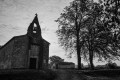
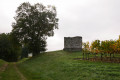
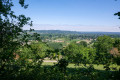
Right from the start, you’ll come across the church dating from 1730. You’ll enjoy the walk through woods, vineyards and country lanes. Don’t miss the stunning view over the Moulin du Terrier valley. On your way back to La Roquille, you’ll spot the 18th-century washhouse and fountain, whose well has been preserved since Gallo-Roman times.

Details

581156
Creation:
Last update:
Last review:
  • Walking
    Activity: Walking
  • ↔
    Distance: 5.62 mi
  • ◔
    Average duration: 2h 50 
  • ▲
    Difficulty: Moderate

  • ⚐
    Back to start: Yes
  • ↗
    Ascent: + 262 ft
  • ↘
    Descent: - 269 ft

  • ▲
    Highest point: 404 ft
  • ▼
    Lowest point: 230 ft

Photos

Description of the walk

The route starts from La Roquille school.

(S/E) Head towards the church and walk past it. Then turn left and continue straight on for 200 metres.
At the hamlet of La Croix, turn right and continue straight on, passing the cemetery. You’ll walk alongside vineyards and arrive at the hamlet of Les Jeanlins. After 500 metres, you’ll reach the hamlet of Valfontaine.

(1) At the junction, turn left and continue for 300 metres. Pass the sign marking the exit from the village of La Roquille and walk alongside woods and vineyards.
Cross the D708 and carry on straight ahead. Then head into the woods and pass by a pidgeon hunting hut.
After 300m, you’ll reach a water pump in the hamlet known as Le Châtaignier; follow the signpost straight ahead. Continue through the woods. At the top of the hill, you’ll find yourself amongst the vineyards.

(2) At the signpost, turn right through the vineyards and follow the boundary with the commune of Margueron. After 200 metres, at the signpost, continue straight ahead.
You’ll come to the tarmac road. At the signpost, head straight on.
Then, at the second signpost, turn right, continuing along the tarmac road. You are surrounded by vineyards. You are at the edge of the village of La Roquille and at the start of the village of Margueron. Head towards Montvert by turning right.

(3) At the signpost, turn right and carry on along the tarmac road. You are now at a place called Bel Air. At the signpost, carry on straight ahead for 200 metres towards the D708.

(4) At the Stop sign, cross the D708 and, at the signpost, continue along the dirt track skirting the vineyards. You are now between woodland and fields. At the signpost, carry on straight ahead through the vineyards until you reach another tarmac road.

(5) Cross it and take the dirt track opposite, at the edge of the woodland. You’ll have a lovely view of the valley on both sides. You’ll see a pond on your left. Carry on until you reach another road.

(6) Turn left onto this tarmac road, which leads through the woods. You’ll pass close to a pidgeon hunting hut.
At the next signpost, turn right onto the dirt track. You’re now between woodland and vineyards. You’ll arrive at the Moulin du Terrier, where you can enjoy a superb view of the valley.

(7) Stay on the dirt track until you reach the tarmac road. Turn right towards the hamlet of Gilet. At the second signpost, head into the woods, staying on the tarmac road to reach Gilet.

(8) Take the forest track opposite. After 300 metres, you’ll see a signpost on your right; carry on straight ahead. After 100 metres, enter the woods, go down a slope, then walk along a clearing before crossing a bridge (over the Sandaux stream) on your right. Then, carry on straight ahead to cross another bridge on your left.

(9) At the junction by the signpost, turn right onto the D141. Carry on straight ahead along the road until you reach the junction with the D708.
Turn right, continue for 50 metres, then turn right at a place called Bois d’Isaac to return to your starting point (S/E).

Waypoints

  1. S/E : mi 0 - alt. 285 ft - Car park at La Roquille school
  2. 1 : mi 0.63 - alt. 308 ft - Valfontaine crossroads
  3. 2 : mi 1.65 - alt. 384 ft - At the signpost, turn right into the vineyards
  4. 3 : mi 2.1 - alt. 387 ft - Montvert
  5. 4 : mi 2.46 - alt. 348 ft - Crossing the D708
  6. 5 : mi 2.93 - alt. 338 ft - Crossing the road
  7. 6 : mi 3.18 - alt. 322 ft - Turn left onto the road
  8. 7 : mi 3.63 - alt. 394 ft - Moulin du Terrier
  9. 8 : mi 4.48 - alt. 354 ft - At Le Gillet, go straight on
  10. 9 : mi 5.17 - alt. 240 ft - Turn right onto the D141
  11. S/E : mi 5.62 - alt. 282 ft - Car park at La Roquille school

Worth a visit

Also worth seeing: the 19th-century town hall, housed in the former Temple du Bourg.

Reviews and comments

4.2 / 5
Based on 3 reviews

Reliability of the description
4.7 / 5
Ease of following the route
4.3 / 5
Route interest
3.7 / 5
mithe.leblanc
mithe.leblanc

Overall rating : 4 / 5

Date of your route : Dec 26, 2024
Reliability of the description : ★★★★☆ Good
Ease of following the route : ★★★★☆ Good
Route interest : ★★★★☆ Good
Very busy route : No

A lovely little walk with the family, accompanied by our dogs, who had a brilliant time

Machine-translated

bx86
bx86

Overall rating : 4.3 / 5

Date of your route : Apr 21, 2019
Reliability of the description : ★★★★★ Very good
Ease of following the route : ★★★★☆ Good
Route interest : ★★★★☆ Good

Good evening

A lovely route for a leisurely drive along quiet country lanes and tracks. No problems at all.

Be careful after the ‘1’ sign and when crossing the D 670: make sure you take the path directly opposite, which is marked by a signpost. However, as it’s made of wood and has a green cap, it may be obscured by the vegetation in the area where it’s situated. Do not take the small tarmac road that branches off a few metres to the right.

Varied landscapes and lovely rolling hills.
You can already ‘sense’ the Périgord character here, with large buildings featuring dovecotes, as well as some lovely restored houses – though others are less so… 

Thanks to those who suggest these always interesting circular walks.

Kind regards

Hervé

Machine-translated

RMoute
RMoute

Overall rating : 4.3 / 5

Date of your route : Mar 05, 2018
Reliability of the description : ★★★★★ Very good
Ease of following the route : ★★★★★ Very good
Route interest : ★★★☆☆ Average

A lovely walk to enjoy with the family

Machine-translated

Other walks in the area

For more walks, use our search engine .

The GPS track and description are the property of this route's author. Please do not copy them without permission.