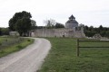
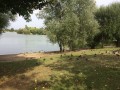
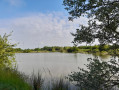
Route of three villages starting from the Garnache communal forest

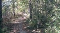
This walk is suitable in all seasons. Just one thing to bear in mind for the first four hundred metres: avoid the ruts left by farm machinery on the forest track in wet weather.

Details

26580855
Creation:
Last update:
Last review:
  • Walking
    Activity: Walking
  • ↔
    Distance: 4.42 mi
  • ◔
    Average duration: 2h 05 
  • ▲
    Difficulty: Easy

  • ⚐
    Back to start: Yes
  • ↗
    Ascent: + 39 ft
  • ↘
    Descent: - 39 ft

  • ▲
    Highest point: 157 ft
  • ▼
    Lowest point: 92 ft

Description of the walk

There is a grassy car park with space for up to three cars on the Route de Fonteclose, at the junction with the road leading to the village of La Bonnelière.

(S/E) Take the wide path that heads into the forest in the opposite direction to the road leading to the village of La Bonnelière and joins a road.

(1) Turn left and walk alongside the forest for 1 km.

(2) Turn right and follow the road, which leads to the village of Varnes after just over 1 km.

(3) Pass the first road on the right and continue for 100 m until you see, on the right, the road that winds its way between the buildings; follow this for 800 m.

(4) Turn right onto a wide gravel road which leads to a crossroads with a cross.

(5) Turn off to the right of the wayside cross onto the tarmac road signposted “Route de l’Ardoisière”, and follow it for 800 m as you pass through the village of l’Ardoisière.

(6) Turn right onto the gravel track leading to the village of La Bonnelière. On reaching La Bonnelière, the track turns left. 100 m after this bend, turn right onto the road that runs through the village. After the track on the right leading to the last house in the village, you will come within sight of the car park (S/E).

Waypoints

  1. S/E : mi 0 - alt. 131 ft - Car park on Route de Fonte Close
  2. 1 : mi 0.28 - alt. 112 ft - Exit from the forest
  3. 2 : mi 0.95 - alt. 105 ft - Tarmac road
  4. 3 : mi 1.64 - alt. 115 ft - Village of Varnes
  5. 4 : mi 2.15 - alt. 135 ft - Gravel road
  6. 5 : mi 3.02 - alt. 157 ft - Route de l’Ardoisière
  7. 6 : mi 3.53 - alt. 108 ft - Gravel road
  8. S/E : mi 4.42 - alt. 131 ft - Car park on Route de Fonte Close

Reviews and comments

4.6 / 5
Based on 3 reviews

Reliability of the description
4.7 / 5
Ease of following the route
5 / 5
Route interest
4 / 5
RAYMONDOL
RAYMONDOL

Overall rating : 4.7 / 5

Date of your route : Sep 23, 2024
Reliability of the description : ★★★★☆ Good
Ease of following the route : ★★★★★ Very good
Route interest : ★★★★★ Very good
Very busy route : No

We did the route in reverse because we couldn’t find the way on the app right at the start.

Machine-translated

Sandie7
Sandie7

Overall rating : 5 / 5

Date of your route : Oct 30, 2023
Reliability of the description : ★★★★★ Very good
Ease of following the route : ★★★★★ Very good
Route interest : ★★★★★ Very good
Very busy route : No

A very pleasant walk. The route follows paths almost exclusively, in lovely surroundings.
But we couldn’t find the car park at the starting point...

Machine-translated

Zou1911
Zou1911

Overall rating : 4 / 5

Date of your route : Sep 11, 2023
Reliability of the description : ★★★★★ Very good
Ease of following the route : ★★★★★ Very good
Route interest : ★★☆☆☆ Disappointing
Very busy route : Yes

An easy route, but not particularly interesting.

Machine-translated

Other walks in the area

For more walks, use our search engine .

The GPS track and description are the property of this route's author. Please do not copy them without permission.