La Bouteille route

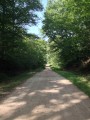
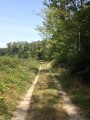
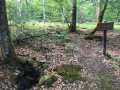
The route runs entirely through the Tronçais State Forest across relatively rugged terrain. It offers the chance to discover all stages of forestry operations.

Details

756329
Creation:
Last update:
Last review:
  • Walking
    Activity: Walking
  • ↔
    Distance: 4.27 mi
  • ◔
    Average duration: 2h 10 
  • ▲
    Difficulty: Easy

  • ⚐
    Back to start: Yes
  • ↗
    Ascent: + 197 ft
  • ↘
    Descent: - 177 ft

  • ▲
    Highest point: 1,037 ft
  • ▼
    Lowest point: 889 ft
  • ⚐ Country: France
  • ⚐ City: Le Brethon (03350)
  • ⚑
    Start/End: N 46.573996° / E 2.690213°
  • ❏
    IGN map(s): Ref. 2427SB
  • Hour-by-hour weather

Photos

Description of the walk

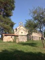
Park in the car park near Saint-Mayeul Chapel at La Bouteille.

(S/E) Head towards the Route Forestière de la Bouteille, turn left and follow the path leading to the Rond de la Bouteille.

(1) Cross the road and take the path between plots 429 and 430.

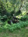
(2) At Rond des Chers Buissons, turn right, cross the road and continue along the path opposite. At the end of the path, turn left onto Route Forestière de la Bouteille and follow it for 1,200 metres. At the crossroads, turn right. Just before the end of the path, you can visit Font Bégault on the right.

(3) At Rond de la Font Bégault, turn right. At the next crossroads, turn right again.

(4) At Rond de Lasnay, turn left and continue straight on to Rond Sabotier.

(5) Take the road on the right, then, at the Rond de la Mouche junction, continue straight ahead for 800m.

(6) Turn left onto the Route Forestière de la Bouteille and continue straight on to the starting point (S/E).

Waypoints

  1. S/E : mi 0 - alt. 896 ft - La Bouteille
  2. 1 : mi 0.3 - alt. 928 ft - Rond de la Bouteille
  3. 2 : mi 0.79 - alt. 932 ft - Rond des Chers Buissons
  4. 3 : mi 2.19 - alt. 958 ft - Font Bégault circular walk
  5. 4 : mi 2.57 - alt. 968 ft - Lasnay Roundabout
  6. 5 : mi 3.21 - alt. 1,024 ft - Rond Sabotier
  7. 6 : mi 3.91 - alt. 942 ft - Turn left onto Route Forestière de la Bouteille
  8. S/E : mi 4.27 - alt. 896 ft - La Bouteille

Notes

You can visit Saint-Mayeul Chapel and Saint-Mayeul Spring, 200 metres from the car park (follow the signs).

Worth a visit

Tronçais Forest.
Saint-Mayeul Chapel.
Font Bégault.
Font Saint-Mayeul.

Reviews and comments

4.7 / 5
Based on 5 reviews

Reliability of the description
4.8 / 5
Ease of following the route
5 / 5
Route interest
4.2 / 5
lamycatherine 75@gmail.com

Overall rating : 4.7 / 5

Date of your route : Dec 23, 2024
Reliability of the description : ★★★★★ Very good
Ease of following the route : ★★★★★ Very good
Route interest : ★★★★☆ Good
Very busy route : No

An easy walk along wide paths through a beautiful oak forest, though a bit monotonous

Machine-translated

Marie Martine
Marie Martine

Overall rating : 4.3 / 5

Date of your route : Jul 11, 2022
Reliability of the description : ★★★★★ Very good
Ease of following the route : ★★★★★ Very good
Route interest : ★★★☆☆ Average
Very busy route : No

an easy, shaded walk through a beautiful forest, though a bit monotonous

Machine-translated

antcayl
antcayl

Overall rating : 5 / 5

Date of your route : Nov 13, 2021
Reliability of the description : ★★★★★ Very good
Ease of following the route : ★★★★★ Very good
Route interest : ★★★★★ Very good
Very busy route : No

What a beautiful forest!

Machine-translated

sydam18
sydam18

Overall rating : 4.7 / 5

Date of your route : Aug 30, 2020
Reliability of the description : ★★★★★ Very good
Ease of following the route : ★★★★★ Very good
Route interest : ★★★★☆ Good
Very busy route : No

A lovely short walk with very little road walking, allowing you to enjoy this magnificent forest

Machine-translated

tourniquet
tourniquet

Overall rating : 4.7 / 5

Date of your route : Oct 08, 2017
Reliability of the description : ★★★★☆ Good
Ease of following the route : ★★★★★ Very good
Route interest : ★★★★★ Very good

A lovely walk through the Tronçais Forest. It isn’t signposted, so you’ll need to follow the directions.

Machine-translated

Other walks in the area

For more walks, use our search engine .

The GPS track and description are the property of this route's author. Please do not copy them without permission.