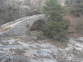
The Audibergue route starting from Pont du Loup

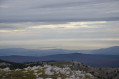
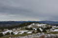
A beautiful circular walk starting from the Sources du Loup, which I’ve classified as difficult due to its length and route, taking you to the summit of the Audibergue with a 360° view of the Mercantour, the Estérel and the Massif des Maures.

Details

42651849
Creation:
Last update:
Last review:
  • Walking
    Activity: Walking
  • ↔
    Distance: 9.46 mi
  • ◔
    Average duration: 6h 20 
  • ▲
    Difficulty: Difficult

  • ⚐
    Back to start: Yes
  • ↗
    Ascent: + 2,293 ft
  • ↘
    Descent: - 2,264 ft

  • ▲
    Highest point: 5,381 ft
  • ▼
    Lowest point: 3,501 ft

Photos

Description of the walk

Head towards Andon via the D5 as far as the Pont du Loup, at the junction with the D75 which leads to Andon. Park near the sewage treatment plant and marker 151.

(S/E) Follow the path down to the right of the bridge to reach the River Loup, then wade across it: at this point it is just a small stream. Walk for about 25 metres to the signpost for the walking route.

(1) Turn right and cross the stream again. Then follow this route, which runs alongside a large field on the left and the stream on the right, to reach marker 149.

(2) Take the track on the left, heading due south, which leads to the sheepfold. Pass the sheepfold and continue straight on to the next junction.

(3) Continue left along the path which climbs through the pine forest, then joins the valley of the Gorge de Bertrand, where you’ll find another walking route marker.

(4) Turn left, towards the summit of the Audibergue. The path climbs a slightly steeper slope through the pine forest.

(5) As you emerge from the forest, from this point onwards the path becomes harder to follow. Keep a close eye out for the cairns and the yellow markings to reach marker 176a on the ridge.

(6) Follow the ridge to the right, heading west, to reach marker 176, near the top station of the Audibergue ski lifts.

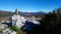
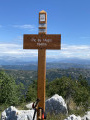
(7) Continue along the path, which descends and then climbs again, always following the ridge, to reach the orientation table at the summit of the Audibergue.

(8) After taking in the view, begin the descent, passing the top station of the Moulière chairlift. Follow the track as it winds its way down in a series of wide bends to reach the resort car park.

(9) At the bottom of the Moulière car park, take the track heading off to the right towards the east, passing marker 174, then crossing the Charbonnières ski lift and finally climbing back up towards the Audibergue resort.

(10) From this point, leave the run that descends towards the D181 and take the path heading due south on the right, until you reach marker 173.

(11) Continue downhill, taking a hairpin bend to the left, then reach the access road to the Audibergue resort (D181).

(12) Cross the road to reach marker 171, then follow the path down for 150 m to join the cross-country ski trail which starts on the right.

(13) Follow this cross-country ski trail north-eastwards, straight on to the Aven de Canen, then continue for 150 m until the trail becomes circular.

(14) Leave the trail and take the path on the right, heading east then due south, to reach a junction you’ve already passed on the way there.

(4) Turn left onto the path which descends steeply to reach another fork you’ve already passed on the way there.

(3) Continue to the left, following the route in reverse to the Pont du Loup (S/E).

Waypoints

  1. S/E : mi 0 - alt. 3,501 ft - Car park. Marker 151 on the edge of the - Loup (fleuve)
  2. 1 : mi 0.06 - alt. 3,504 ft - Junction for the A/R route. Signpost
  3. 2 : mi 0.33 - alt. 3,563 ft - Junction for the A/R route. Marker 149
  4. 3 : mi 0.64 - alt. 3,606 ft - Junction for the A/R route
  5. 4 : mi 1.06 - alt. 3,891 ft - Junction of the circular loop
  6. 5 : mi 1.92 - alt. 4,770 ft - Exit from the forest
  7. 6 : mi 2.27 - alt. 5,010 ft - Junction: turn right onto the ridge. Marker 176a
  8. 7 : mi 3.07 - alt. 5,364 ft - Top of the ski lifts. Marker 176 - L'Audibergue
  9. 8 : mi 3.78 - alt. 5,223 ft - Orientation table
  10. 9 : mi 4.95 - alt. 4,419 ft - T-junction. La Moulière car park. Near the - Aven de la Glacière (la Moulière)
  11. 10 : mi 6.13 - alt. 4,813 ft - Junction: take the path on the right
  12. 11 : mi 6.56 - alt. 4,682 ft - Marker 173
  13. 12 : mi 7.05 - alt. 4,383 ft - D181. Marker 171
  14. 13 : mi 7.14 - alt. 4,327 ft - Junction, turn right. Cross-country ski trail
  15. 14 : mi 7.91 - alt. 4,160 ft - Junction: turn right onto the circular route. After the - Aven de Canen (Audibergue-Gréolière)
  16. S/E : mi 9.46 - alt. 3,501 ft - Car park. Marker 151

Notes

The only public water point is in the toilets at the Moulière car park (9).
You can eat at the Audibergue resort (12).
Please note that the restaurant Le Chritiana chez Huguettes is often fully booked at weekends; payment is by cheque or cash (no credit cards) and it’s best to book before you go.

Worth a visit

Above the chairlift’s top station is an orientation table from which you can identify the surrounding peaks, as well as Lake Saint-Cassien and the Lérins Islands. On some days, you can catch a glimpse of Corsica.

Reviews and comments

4.8 / 5
Based on 2 reviews

Reliability of the description
5 / 5
Ease of following the route
4.5 / 5
Route interest
5 / 5
Roby06
Roby06

Thank you, Anne, for your opinion.

Machine-translated

Anne Perrin
Anne Perrin

Overall rating : 4.7 / 5

Date of your route : Jul 10, 2025
Reliability of the description : ★★★★★ Very good
Ease of following the route : ★★★★☆ Good
Route interest : ★★★★★ Very good
Very busy route : No

A lovely walk, with a superb view from the summit. Towards the end of the route, there’s a bit of a navigation challenge: after point 14, it’s not enough simply to ‘follow the path eastwards and then southwards’; you need to turn off onto a path that’s barely visible at the start, heading south.

Machine-translated

Guinot le facteur
Guinot le facteur

Overall rating : 5 / 5

Date of your route : Dec 04, 2023
Reliability of the description : ★★★★★ Very good
Ease of following the route : ★★★★★ Very good
Route interest : ★★★★★ Very good
Very busy route : No

Easy to park; the start point is well signposted. Be careful when crossing the small stream twice (not difficult). The climb is steep and tricky (small stones), as is the descent on the way back; walking poles are a great help. Reaching the summit is well worth it for the 360-degree view. The rest of the route is different as you head through the forest. It’s best to do this in sunny weather ☀️.

Machine-translated

Other walks in the area

For more walks, use our search engine .

The GPS track and description are the property of this route's author. Please do not copy them without permission.