Route from the former Abbey Church of Saint-Jean-aux-Bois to the ruins at Champlieu

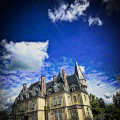
Three eras, three relics of the past, a visit to the charming town of Saint-Jean-aux-Bois with its arboretum and a walk in the Compiègne Forest.

Details

n°33705995
Creation:
Last update:
Last review:
  • Walking
    Activity: Walking
  • ↔
    Distance: 11.29 mi
  • ◔
    Average duration: 5h 25 
  • ▲
    Difficulty: Average

  • ⚐
    Back to start: Yes
  • ↗
    Ascent: + 295 ft
  • ↘
    Descent: - 295 ft

  • ▲
    Highest point: 463 ft
  • ▼
    Lowest point: 217 ft

Photos

Description of the walk

Car park and start of the walk at 3 Rue du Couvent, Saint-Jean-aux-Bois.

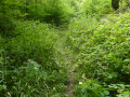
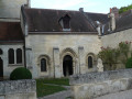
(S/E) At the far end of the car park, take the path to the arboretum to soak up the scents of the forest; ignore thefirst path on the left and, at the Fork in the road, turn right, continuing until you reach Rue du Couvent, then turn left. Walk past the former abbey church dating from 1152

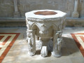
(1) Turn right to reach it, enter the church and walk around the abbey church, then retrace your steps.

(1) Continue along Rue du Couvent.

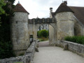
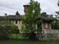
(2) On your left, an old farmhouse porch. Opposite, take the path leading to Rue des Abbesses. Pass to the right of the town hall; further on, at the bend, follow a path leading to the Fortified Gate of the Abbey Church and the Ru
des Planchettes. Retrace your steps and turn right.

(3) Turn into thefirst street on the right and, at the end, turn left onto Route du Parquet. A little further on, you’ll come across a pretty washhouse on your left. Go straight on at the next junction. Cross the Ru des Grands Monts, with a pond on your left.

(4) Immediately afterwards, turn left onto theGR®12. Go straight on at thefirst junction.

(5) Cross the D332 and, 200 metres further on, after the forest ranger’s house, turn left and continue to the Carrefour des Muses.

(6) Turn onto thefirst path on the right – a hairpin bend – known as Route de Diane. Cross the Carrefour de Diane and continue to the Carrefour des Eluas.

(7) Turn right onto the second road on the right: Les Grands Monts. At the Carrefour Callisto, go straight on and follow theGR®12, ignoring all the paths to the right and left. A lovely viewpoint, just
before reaching the Carrefour d’Acaste.''

(8) Carry on straight ahead.

(9) Pass the turn-off on the left. Carry on straight ahead to the Champlieu car park.

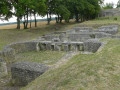
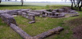
(10) Turn right onto Chaussée Brunehaut. On your left are the Gallo-Roman ruins, which you can walk around. You’ll come to a fork in the road.

(11) Turn left towards the Romanesque Chapel of Champlieu and arrive at another fork in the road. Leave the GR®11 by turning lefttwice. Return to the Champlieu car park.

(10) Continue straight on, in the opposite direction to the outward journey, until you reach a fork in the road.

(9) Turn right, continue to the Carrefour des Tournelles junction and take thesecond turning on the left, Route des Tournelles. Continue to the Carrefour des Grands Monts junction.

(12) Turn into the second lane on the right, then carry straight on at the Carrefour de l’Étoile de la Reine, the Carrefour Galatée and the Carrefour de Gilocourt. Continue to the Carrefour d’Angevilliers.

(13) After the D332, take the second track on the left, ignore a track on the right and continue to the Carrefour Girardin.

(14) At this junction, take the path on the left to reach the Landeblin junction

(15) Turn right, cross the Ru Saint-Nicolas and the second Grand Ru Saint-Nicolas

(16) Turn left and then right at the next junction, pass the sewage treatment works on your right and continue to the pylon.

(17) Turn left. Carry on to the car park (S/E).

Waypoints

  1. S/E : mi 0 - alt. 240 ft - Car park, 3 Rue du Couvent, Saint-Jean-aux-Bois
  2. 1 : mi 0.27 - alt. 233 ft - Former Abbey Church of Saint John
  3. 2 : mi 0.35 - alt. 230 ft - Farmhouse porch
  4. 3 : mi 0.52 - alt. 230 ft - Route du Parquet and wash house
  5. 4 : mi 0.96 - alt. 220 ft - GR12
  6. 5 : mi 1.6 - alt. 256 ft - D332
  7. 6 : mi 2.04 - alt. 420 ft - Route de Diane - Carrefour des Muses (Forêt de Compiègne)
  8. 7 : mi 3.09 - alt. 427 ft - GR12 - Carrefour des Éluas
  9. 8 : mi 4.93 - alt. 410 ft - GR11B – GR12 Link - Carrefour d'Acaste
  10. 9 : mi 5.33 - alt. 453 ft - Junction on Circular Loop 1 (forest)
  11. 10 : mi 5.49 - alt. 456 ft - Champlieu car park. Junction of Circular Loop 2 - Site gallo-romain de Champlieu
  12. 11 : mi 6.02 - alt. 417 ft - Chapelle Saint-Jacques (Champlieu)
  13. 12 : mi 7.89 - alt. 433 ft - Carrefour des Grands Monts
  14. 13 : mi 9.35 - alt. 433 ft - Angevilliers crossroads
  15. 14 : mi 9.91 - alt. 423 ft - Girardin crossroads
  16. 15 : mi 10.26 - alt. 256 ft - Lambledin crossroads
  17. 16 : mi 10.78 - alt. 253 ft - Grand Rue Saint-Nicolas
  18. 17 : mi 11.13 - alt. 243 ft - Wastewater treatment plant. Pylon
  19. S/E : mi 11.29 - alt. 240 ft - Car park, 3 Rue du Couvent, Saint-Jean-aux-Bois

Worth a visit

Arboretum.
Abbey church of Saint-Jean.
Old farmhouse porch.
Fortified gate of the abbey.
Washing house
Gallo-Roman ruins.
Romanesque chapel.

Always be cautious and plan ahead when you're outdoors. Visorando and the author of this route cannot be held responsible for any accidents occurring on this route.

The GR® and PR® markings are the intellectual property of the Fédération Française de Randonnée Pédestre.

Reviews and comments

4.3 / 5
Based on 2 reviews

Reliability of the description
4 / 5
Ease of following the route
4.5 / 5
Route interest
4.5 / 5
User 3281495

Overall rating : 4.3 / 5

Date of your route : Jun 08, 2025
Reliability of the description : ★★★★☆ Good
Ease of following the route : ★★★★★ Very good
Route interest : ★★★★☆ Good
Very busy route : No

No one else on the trail, beautiful paths with marked viewpoints, but untouched by humans.

Machine-translated

ovil
ovil

Overall rating : 4.3 / 5

Date of your route : Jul 04, 2023
Reliability of the description : ★★★★☆ Good
Ease of following the route : ★★★★☆ Good
Route interest : ★★★★★ Very good
Very busy route : No

A superb village with a rich heritage; it’s a shame the forest paths aren’t better maintained.
We had a few difficulties getting there; in the morning, very heavy traffic meant we started the walk later than planned, and on the way back, a very violent storm made the journey tricky.
The long stretch along the road and through the fields after visiting the Gallo-Roman ruins is of little interest.
We got lost after the Angivilliers crossroads; I didn’t spot the path on the left and we carried on straight ahead. The plot numbering helped us find our bearings again a little later.
Just so you know, the pub closes at 6 pm. We had to ask a local for some water.

Machine-translated

Other walks in the area

For more walks, use our search engine .

The GPS track and description are the property of this route's author. Please do not copy them without permission.