Country:
 City:


Park in the free car park on Rue Séverine (near Pierrefonds Castle).
(S/E) Walk up the square along Rue Jules Michelet, passing between the Town Hall and the Tourist Office. Walk alongside the lake formed by the Ru de la Berne until you reach a junction.
(1) Turn left onto Rue du Beaudon, then turn right onto the Sentier du Point de Vue: you can see Jonval Castle on your left, behind the bushes. Pass a few houses, then take the Chemin de la Forêt on the right, cross the Sentier du Diable and enter the woodland. You’ll reach a crossroads.
(2) Carry on straight ahead along the GR®12 between plots 5312 and 5212. Continue to the Carrefour du Trou Fondu.
(3) Take a sharp right-hand bend and head for the Carrefour de la Fontaine aux Porchers, situated on the D85.
(4) Ignore the road and turn right. Head downhill, cross the Ru de la Fontaine and go back up the opposite side. Carry on straight ahead until the GR® turns sharply left at a 90° angle.
(5) Carry on straight ahead, passing the Carrefour de la Bécasse by cutting across the Route des Étangs and then a cycle path. Continue to the Carrefour Marsaux.
(6) Turn right. Carry on straight ahead at the Carrefour de la Croix Aguet and reach the Carrefour du Grand Veneur.
(7) Carry on straight ahead again. Cross the D973 with care, head straight across and then cross a cycle path via the GR®12A. You’ll reach the Carrefour des Prés de la Ville.
(8) Carry on straight ahead to reach the Maison Forestière des Étangs de Saint-Pierre.
(9) Go round the small pond on the right, cross the D547 and continue straight ahead: there is a picnic table nearby. Reach the Carrefour de la Gorge du Han.
(10) Turn right into the Parc de Loisirs, rejoin the D547 and follow it in the same direction for about a hundred metres.
(11) Turn left, then right at the first junction. Pass between plots 5383 and 5384 and arrive at a junction situated a few dozen metres from a small road on the right.
(12) Turn left, pass the Carrefour du Rond de Sapin and come out onto the D335, facing vast fields.
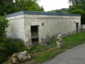
(13) Cross carefully, head right for about fifty metres, then turn left. Leave the access road to the building behind you quickly and turn right onto the path through the fields, which joins the GR®12 further on. Turn right, head into the woodland and arrive at the wash house.
(14) Take the path on the left, cross the D85 with care and continue straight ahead. Once at the junction, head to the right and you’ll reach the D973.
(15) Carry on for about twenty metres, cross at the pedestrian crossing and turn right. Then turn left onto Rue Notre-Dame, walk past Pierrefonds Castle and then turn left onto Rue Viollet le Duc. Finally, turn right and follow Rue Napoléon, which leads straight back to the car park (S/E).
 Visorando Member

 Easy

 Difficult