Country:

 City:


From Nice, take the M6202 to the village of Plan-du-Var, then turn right onto the M2565 towards Saint-Martin-Vésubie. A few kilometres after the village of Lantosque, turn right onto the M70 towards La Bollène-Vésubie and the Col de Turini. After passing through the village, continue along the road for about 3 km, passing the Chapelle Saint-Honorat on your right, followed by the car park providing access to the Clue du Vallon Sainte-Élisabeth (marker 200). Carry on to the car park at the Chapelle Sainte-Élisabeth (marker 198), the starting point of the walk.
(S/E) From the car park, carefully walk along the M70 towards the Col de Turini for about 600 m. After the first hairpin bend, head for marker 197, which marks the actual start of the walk.
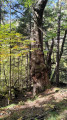
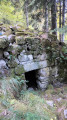
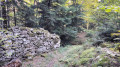
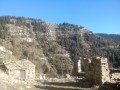
(1) Follow this poorly marked path as it climbs eastwards. It passes beneath an old ruin currently being renovated (in 2026), and successively reaches the bottom of the Arpiha ravine and then that of the Issarts. The route then passes through an area characterised by old terraced fields and ruins, in the heart of a beautiful forest featuring, in particular, numerous chestnut trees. Throughout the walk, the path overlooks the Riou de la Bollène, which can be seen below. Continue along this path until you reach the Pra d’Alart forest track.
(2) Take the track heading east and cross the Riou de la Bollène valley. The track then climbs gradually towards the south-west through the forest before reaching marker 196, the GR®52A and the Piste de Tardei.
(3) From this marker, continue straight on along the Piste de Tardei heading north-west. Ignore the Baisse de Suei path on the left (marker 191) and carry on to the next junction. Then turn right onto a track that descends for about ten metres. A white marker indicates the start of the GR®52A leading to the Sainte-Élisabeth Chapel.
(4) Follow the path, which descends quite steeply northwards before turning westwards. After a sustained descent through the forest, it joins the lower section of the Piste de Tardei at marker 190.
(5) From this marker, continue along the Piste de Tardei heading south-west for approximately 550 m until you reach marker 189.
(6) Leave the GR®52A by turning right onto the yellow-marked path which descends towards the Sainte-Élisabeth Chapel. The path passes close to some ruins, then crosses the Sueil valley. Ignore the path that descends into the valley and carry on straight ahead. The route climbs slightly at the Serre de l’Abrigth, before descending again towards the Riou de la Bollène. It then climbs back up to the car park at the Sainte-Élisabeth Chapel, where the walk ends (S/E).
 Visorando Member


 Easy
 Difficult


 Very difficult