On the trail of the wolf in Mosnay

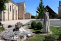
During the summer of 1878, a rabid wolf spread terror in Mosnay, claiming several human victims and causing the loss of livestock. Today, this walking trail and several wolf statues recount this story.

Details

3245098
Creation:
Last update:
Last review:
  • Walking
    Activity: Walking
  • ↔
    Distance: 6.96 mi
  • ◔
    Average duration: 3h 20 
  • ▲
    Difficulty: Moderate

  • ⚐
    Back to start: Yes
  • ↗
    Ascent: + 154 ft
  • ↘
    Descent: - 171 ft

  • ▲
    Highest point: 597 ft
  • ▼
    Lowest point: 489 ft
  • ⚐ Country: France
  • ⚐ City: Mosnay (36200)
  • ⚑
    Start/End: N 46.622227° / E 1.629984°
  • ❏
    IGN map(s): Ref. 2126SB
  • Hour-by-hour weather

Photos

Description of the walk

The start point is at the church car park. The route is mainly signposted in yellow and is a shorter version of the FFRandonnée route.

(S/E) With your back to the church, follow the D40 to the left to reach the junction. Turn right and follow the D30a for 300 m until you reach the post office.

(1) Just past the post office, turn right onto Rue des Écoles. This turns into a footpath. Cross the Ruisseau de l’Étang des Nielloux via a footbridge and continue until you reach a junction with a wide track.

(2) Follow this track to the right. Turn left to join the D40 carefully for 200 m, then take the first track on the right. Turn right again at the next junction to reach a small road.

(3) Cross over and carry on straight ahead to rejoin the D40 at a cross: head for the junction 50 m further down, just before a bend.

(4) Take the road on the left as far as La Garderie, then turn onto a track on the right. Cross the Bois du Pied Ferré and continue to the right along the edge of the woodland. After a left-hand bend, you’ll reach a junction just before the road.

(5) Turn onto the path on the left and, after a 90° bend to the left, follow it to a small road.

(6) Cross it and carry on straight ahead, then turn onto the path on the right. At Les Sallés, turn left. Pass a path on the right and carry on straight ahead at the next junction until you reach the Domaine de la Touche.

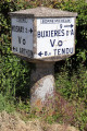
(7) Continue along the street, then straight on along the Route de Riau to reach the Thomasses crossroads (former Michelin milestone). Carry on straight ahead towards Tendu.

(8) At the Abbaye crossroads, take the small path on the left, heading due south until you reach the road. Turn right and follow the road for about 1.5 km to rejoin the path you took on the way there.

(3) Take the path on the left again, then rejoin the D40.

(4) At the crossroads, proceed with care straight ahead towards Mosnay, cross the bridge, then take the track on the left before the cemetery. Continue straight on along a farm track which climbs and joins the D30a.

(9) Then turn right onto the D30a and go straight on. Pass a well and a cross, and reach the village centre via Rue des Adenets. At the end of the street, turn right to return to the church car park (S/E).

Waypoints

  1. S/E : mi 0 - alt. 561 ft - Church car park
  2. 1 : mi 0.14 - alt. 548 ft - La Poste
  3. 2 : mi 0.47 - alt. 525 ft - Crossroads – Road suitable for vehicles
  4. 3 : mi 1.15 - alt. 545 ft - Junction with the A/R route – Small road
  5. 4 : mi 1.33 - alt. 522 ft - Junction for the outward and return journeys
  6. 5 : mi 2.71 - alt. 594 ft - Crossroads before the road
  7. 6 : mi 3.33 - alt. 584 ft - Route des Sallés
  8. 7 : mi 4.44 - alt. 535 ft - La Touche
  9. 8 : mi 5.03 - alt. 505 ft - The Abbey
  10. 9 : mi 6.72 - alt. 561 ft - D30a
  11. S/E : mi 6.96 - alt. 561 ft - Church car park

Notes

Make sure you wear waterproof walking shoes as some sections may be damp.

Worth a visit

Notes:
In (5), take a look at the Étang des Nielloux on the other side of the road.
Signpost 1 of the ‘History of the Wolf’ trail is located on a truncated section of the yellow route, at Le Terreau (see the ‘Balade mosnacienne’ walk, no. 4533894).

Mosnay:

Argenton/Creuse:
https://www.berryprovince.com/mon-sejour...

Basilica of Saint-Étienne in Neuvy-Saint-Sépulchre:
https://www.berryprovince.com/patrimoine...

Reviews and comments

4.5 / 5
Based on 2 reviews

Reliability of the description
5 / 5
Ease of following the route
4.5 / 5
Route interest
4 / 5
User 12593799

Overall rating : 4.7 / 5

Date of your route : Jun 09, 2025
Reliability of the description : ★★★★★ Very good
Ease of following the route : ★★★★★ Very good
Route interest : ★★★★☆ Good
Very busy route : No

The hike was well marked, with lots of shaded areas, which was nice because it was hot.

Machine-translated

martinelqe
martinelqe
• Edited:

Overall rating : 4.3 / 5

Date of your route : Oct 12, 2023
Reliability of the description : ★★★★★ Very good
Ease of following the route : ★★★★☆ Good
Route interest : ★★★★☆ Good
Very busy route : No

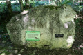
A lovely walk that tells the story of a wolf’s disastrous passage through this region. Two beautiful sculptures on large boulders are well worth a stop. This route is not very busy, so absolute peace and quiet is guaranteed for much of the way.

Machine-translated

Other walks in the area

For more walks, use our search engine .

The GPS track and description are the property of this route's author. Please do not copy them without permission.