Country:

 City:
City:


Park 500 m below the summit of the Col de l’Épine.
(S/E) Turn right onto the Pré Puisat Forest Track.
(1) Take the Chemin de Noire Combe; it leads to a man-made pond designed to support biodiversity. Follow the path, then continue to the right onto the Route Forestière de Pré Puisat.
(2) Pass a picnic area and continue along the track.
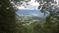
(3) There is a viewpoint on the right. Carry on along the track.
(4) At the sign for “Piste du Contrat”, head uphill towards the Chemin des Crêtes. This is a slightly steep path that passes by the Fontaine de la Rouge and leads to the ridge.
(5) Turn left towards the Croix du Signal, which is 1.3 km away.
(6) After stopping at the cross, rejoin the main path on the left, continuing to the Pierre Gravée crossroads.
(7) Leave the path to the right; further on, at another junction, follow the sign for “Château Richard via les échelles”.
(8) After stopping at the viewpoint, retrace your steps and, this time, head downhill to the right. After a few fairly steep bends, you’ll reach another junction.
(9) Carry on straight ahead, then turn right, walking alongside the Table des Princes.
(10) Head downhill to the left to rejoin the Route de Belledigue, at the paragliding take-off area. Follow this road to the left.
(11) At the start of a bend, head downhill; the path alternates between stony sections and easier-going stretches. Marked on the ground with yellow markings, it leads to the Cantine picnic area.
(12) Continue on the other side of the road until you reach a junction.
(13) Take a return trip to the Reposoir viewpoint.
(14) Retrace your steps.
(13) Take the path on the right.
(15) Leave the main path and head up to the left. In places, the path winds its way between small rocky outcrops, then descends towards the Route du Col de l’Épine.
(16) Before reaching the road, turn left and head back to the car park (S/E).
 Visorando Member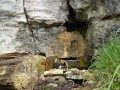


 Difficult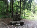
 Easy
Easy