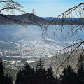
Circular route starting from Zimmerbach via the Obschel

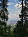
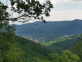
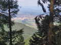
A pleasant walk through a deciduous forest with scenic views.

Details

n°36011865
Creation:
Last update:
Last review:
  • Walking
    Activity: Walking
  • ↔
    Distance: 6.61 mi
  • ◔
    Average duration: 4h 35 
  • ▲
    Difficulty: Moderate

  • ⚐
    Back to start: Yes
  • ↗
    Ascent: + 1,726 ft
  • ↘
    Descent: - 1,699 ft

  • ▲
    Highest point: 2,543 ft
  • ▼
    Lowest point: 1,030 ft

Photos

Description of the walk

Park at the car park by the Hohnack community hall on Rue Hohnack.

(S/E) With your back to the car park, walk down Rue de Hohnack to the right, then turn into the first street on the right and walk past the primary school. After the school, follow the street to the right, which climbs gently and leads further on to the Eselweg; follow this to the right until you reach a junction.

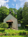
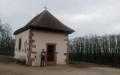
(1) Follow the path branching off to the left (marked with a Yellow Saltire) which leads to the bend before the Bruderhauskapelle, which you’ll be able to see on the way back.

(2) Before this bend, carry on to the left (marked with a Blue Cross). After crossing a wider path, continue uphill (marked with a Blue Cross) to a junction with a wider forest track.

(3) Carry on straight ahead and follow the path which winds upwards in several bends to the Auberge Obschel, where you can enjoy a bite to eat and/or a drink.

(4) After a stop (for those who wish) at the inn, return via the same path and continue to the left (marked with a Green Triangle). Navigate the bend to the right, then follow the path which descends to the left (still marked with a Green Triangle) and joins a wider track further on.

(5) Continue to the right (Yellow Saltire sign) then, at the second bend, follow the path leading straight ahead downhill (still marked with Yellow Saltire signs) to rejoin a wider track near the Engelhof.

(6) Follow the path branching off to the right (Green Ring and Yellow Saltire), which crosses a forest track twice and leads to the Bruderhauskapelle, right next to the (2). Follow the path on the left towards Zimmerbach (marked with a Green Ring and Blue Cross).

(7) At the entrance to Zimmerbach, follow Rue du Hohnack to the right to reach the car park at the start of the route further down (S/E).


Waypoints

  1. S/E : mi 0 - alt. 1,047 ft - Car park at the Hohnack community hall – Rue H
  2. 1 : mi 0.48 - alt. 1,178 ft - Crossroads
  3. 2 : mi 1.31 - alt. 1,385 ft - Bruderhauskapelle
  4. 3 : mi 1.94 - alt. 1,814 ft - Junction with a wider path
  5. 4 : mi 2.99 - alt. 2,543 ft - Auberge Obschel
  6. 5 : mi 4.24 - alt. 1,604 ft - Forest track
  7. 6 : mi 4.88 - alt. 1,591 ft - Engelhof
  8. 7 : mi 6.49 - alt. 1,106 ft - Zimmerbach
  9. S/E : mi 6.61 - alt. 1,047 ft - Car park at the Hohnack multi-purpose hall – Rue H

Notes

Refreshments available at the Auberge Obschel (4).
Picnic tables and benches at the Bruderhauskapelle and after the Auberge Obschel.

Reviews and comments

4.2 / 5
Based on 2 reviews

Reliability of the description
4.5 / 5
Ease of following the route
4 / 5
Route interest
4 / 5
Thecla
Thecla

I’m sorry you didn’t enjoy the walk. Personally, I don’t always need scenic views; simply being out in nature is more than enough for me.

Machine-translated

Sylvie  Éliane
Sylvie Éliane

Overall rating : 3.3 / 5

Date of your route : Aug 22, 2026
Reliability of the description : ★★★★☆ Good
Ease of following the route : ★★★☆☆ Average
Route interest : ★★★☆☆ Average
Very busy route : No

A lovely walk in the shade, but there isn’t much to see. A few panoramic views would have been nice.
We had a few minor difficulties with the route, but thanks to the map we quickly found our way.

Machine-translated

Daniel67
Daniel67

Overall rating : 5 / 5

Date of your route : Feb 17, 2025
Reliability of the description : ★★★★★ Very good
Ease of following the route : ★★★★★ Very good
Route interest : ★★★★★ Very good
Very busy route : No

A lovely walk with a coffee break at the summit, at the Obschel inn. (It’s best to book in advance if you’re having a meal.)

Machine-translated

Other walks in the area

For more walks, use our search engine .

The GPS track and description are the property of this route's author. Please do not copy them without permission.