Country:

 City:
City:


Park in the Mélezet gondola lift car park in La Norma: Maison de la Norma car park.
(S/E) Head towards the lake and the resort’s lake.
(1) Walk past the lake and head up to the left of the lake. Continue to the guardrail after the “bike park”, then head up the path on the left. Follow the yellow ONF signposts. Walk alongside the “La Forêt” ski run for about fifty metres, then continue along the path through the forest. Caution: the path is narrow and often littered with scree due to landslides.
You’ll reach a wider track.
(2) Cross it and follow the markings along a fairly wide track (suitable for 4x4s) towards the ONF chalet.
(3) Head towards the cable car via a small path. Walk alongside the “Stade” ski run and rejoin a 4x4-type track. On the right, you may be able to see the cable car’s top station about a hundred metres away (possible alternative route), with the mountain restaurant “L’Eterlou” behind it, open during the resort’s operating season (school summer holidays).
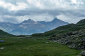
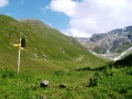
Head towards the Saint-Antoine stream on the right along the 4x4-style track (opposite the restaurant and the cable car top station), then climb up a small path on the left, marked with ONF signposts, towards the “Plan” chalet. You’ll come to a large meadow with plenty of marmots and, at times, flocks of sheep (depending on the season).
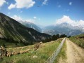
Then head off to the left towards the cable car top station along a 4x4 track until you reach the junction with the “Carrelet” ski run. Once on this run, turn right towards the Pointe de La Norma along the 4x4 track.
(4) Continue along this track until you pass under the 4-seater chairlift at Norma 2 and under the 3-seater chairlift at Carrelet.
Then, once at the top of the “Marmottes” ski run, turn right towards the top station of the Carrelet chairlift. Caution watch out for sheepdogs, as there is a sheep farm situated nearby. Once you have passed the top station, take the 4x4 track on the left and head uphill until you reach the junction with another 4x4 track, which is the “Crêtes” ski run.
(5) Head back down this track for about fifty metres, then turn right to reach the Pointe de La Norma, or continue straight on to bypass it. If you’ve taken the track to the right towards the peak, you’ll pass a stockpile of gas cylinders used to activate the Gazex devices in winter to trigger avalanches. Continue climbing along this path until you reach the “Perdrix” ski run, then take the 4x4 track on the left and follow it uphill to the top station of the Norma 2 chairlift.
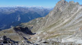
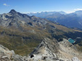
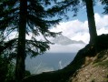
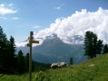
To reach the summit of La Norma: Caution very rocky path (wear a good pair of boots), marked on the ground by white markings on the stones. Once at the top, there is a magnificent panoramic view of the Maurienne Valley, with a view of Mont Blanc in excellent weather. You’ll pass close to two Gazex devices during both the ascent and descent.
(6) Head back down the same route as on the way up to the ‘Crêtes’ path.
(5) Turn right onto the “Crêtes” path, which leads downhill. Cross the Saint-Joseph stream and continue down the same path, crossing the “Clot” track towards the top station of the “l’Arlette” 3-seater chairlift.
(7) Once there, head down to the left towards the lower station of the “Clot” 3-seater chairlift, pass underneath it and descend along the “Arlette” ski run (4x4 type). Follow this wide run until you reach the junction with the ‘Myrtilles’ run, where you can see the ski lift arriving at the top of the run. Turn left onto a path that winds through the trees and emerges onto the “Granges” run; cross this towards the ski lift and continue along a 4x4-type track towards the La Repose chairlift.
(8) Pass close to the chairlift and head down towards the Saint-Joseph chairlift. Pass underneath it towards the mountain restaurant “Le Grizzli” and pass underneath it (open during the resort’s operating season, which coincides with the main school holidays).
Finally, head back down via the Sainte-Anne road (Caution this road is quite busy with traffic): go under the Myrtilles ski lift, pass close to the Myrtilles ski lift’s lower station, and walk past the Sainte-Anne Chapel.
(9) Head towards the resort rather than the main road: leave the tarmac road and take a 4x4-type dirt track. Follow this down to the resort: pass above the ‘Chalets des Hollandais’ and continue down towards the Maison de La Norma (S/E)

 Visorando Member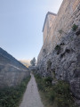
 Moderate
 Tourism professional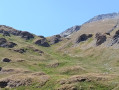
 Difficult