Country:

 City:
City:



Park near the Church of the Holy Trinity at Cros d’Utelle
The signposting begins in front of the church at Cros d’Utelle. Follow signs for Utelle.
White and red markings
(S/E) Walk round the church; the path starts directly behind the building.
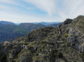
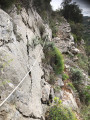
(1) At marker 4, carry on straight ahead towards Utelle. Follow the path clinging to the cliff face, overlooking the Gorges de la Vésubie.
(2) Saint-Antoine Chapel with its glazed roof. The interior is simply decorated, and a wood-burning stove welcomes walkers. Outside, an open area offers a view of the Alps.
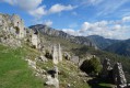
(3) At marker 5, turn right towards Le Colombier. The path is narrower here. A few ruins remind us that this area was once inhabited. The wooded area is very pleasant, and in autumn you can find a few chestnuts.
Start of yellow markings
(4) At marker 5a, follow the path towards Le Colombier. A long, wooded slope leads down towards Utelle. You’ll come out onto a small road; follow it to the left for about thirty metres. Watch out for traffic.
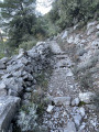
(5) At marker 8b, continue left along the ancient paved slanting street towards Utelle.
(6) Cross the M32 road and continue straight ahead. At the next M32 road, follow it to the left for about 20 metres, then climb the steps on the right, just past the fire hydrant.
At the top of the steps, follow the yellow markings to the left as far as the Church of Saint-Véran in Utelle, which is open to the public
.
(7) Turn left twice and follow Rue Emile Passeroni.
The white and red markings (GR®5) resume
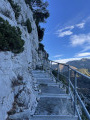
(8) At marker 7 (chapel), head towards Cros d’Utelle. The path begins with a flight of steps leading down, then continues along a section that has been beautifully paved for over 700 years.
(9) At marker 6, turn right towards the Col d’Ambellarte. The path passes through a wooded area, where there are numerous terraces. Reach the Col d’Ambellarte.
The yellow markings resume.__
(10) At the first marker (118), turn left towards the Col de la Moutète (note: there are two markers numbered 118; the second is about twenty metres further on). You’ll reach a grassy area as you emerge from the forest.
(11) At the junction (marker 105), go straight on towards Cros d’Utelle. The stony path descends to the finish. You can see the village of Cros d’Utelle below
(12) At marker 104, turn left (the marker’s position on the map is incorrect). The path is a bit rutted, so take care. Follow the signposting, which is very helpful in the marl area.
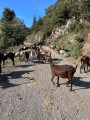
(13) At the hamlet of Collet des Moutons, follow the tarmac road. At the end of the road, continue between the houses to rejoin the path.
(14) At the junction of tarmac roads, turn left. At the end of the road, continue up a concrete ramp. Pass between the houses and follow the path, which climbs slightly.
(1) At the junction you passed at the start of the walk (marker 4), turn sharply right to return to the church at Cros d’Utelle (S/E).


 Visorando Member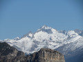
 Difficult
 Moderate