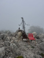
Cime de Rastel from Peillon

This beautiful circular starting from Peillon will take you to the summit of Le Rastel, offering you some beautiful views of the Alps during the ascent and, at the summit, a panorama stretching as far as Théoule.

This route can also be done in the opposite direction.

Details

6426430
Creation:
Last update:
Last review:
  • Walking
    Activity: Walking
  • ↔
    Distance: 4.04 mi
  • ◔
    Average duration: 3h 05 
  • ▲
    Difficulty: Moderate

  • ⚐
    Back to start: Yes
  • ↗
    Ascent: + 1,430 ft
  • ↘
    Descent: - 1,430 ft

  • ▲
    Highest point: 2,635 ft
  • ▼
    Lowest point: 1,204 ft

Photos

Description of the walk

Park in the car park of the old village of Peillon, near the Chapelle des Pénitents Blancs.

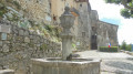
(S/E) Head towards the village and climb the wide staircase on the left behind the fountain (marker 586). Leave the village just after the calvary where marker 585 is located. Stay on the left-hand path to reach marker 580.

(1) Turn left onto the paved slanting street: signposted "Peille par le Farquin". Shortly afterwards, turn right at marker 579 (same signpost "Peille par le Farquin"). Continue along the winding, uphill path. Further on, the terrain becomes flat and non-stony again.

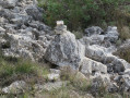
(2) At the top of the path, there are two cairns on the right. Leave the Peille path and turn right between the two cairns (no signpost). Continue gently uphill through the pine and deciduous forest. When you pass a rocky area with natural holes in the stones, the barely visible path is on your right. At a beautiful path intersection marked by a cairn, turn left (the path on the right leads to the climbing routes).

(3) As you approach the summit, take a path on the left (look out for the double cairns that mark the start of this path to the summit, which is not shown on the map). Climb up to the Cime de Rastel, with several cairns marking the path.

(4) Descend via the same path.

(3) Turn left (north-northeast) and continue downhill. You will come to a track, pass some antennas and reach the Col de Saint-Pancrace (toilets and water point).

(5) Follow the D53 road to the right towards La Turbie. Be careful, as the road is dangerous. You will reach marker 564 with a sign for "Peillon village".

(6) Leave the road. Turn right onto a short path that continues along the road. Continue downhill on Chemin de Buampin and continue on the Peillon path at the end of the tarmac.

(8) Just after the Roman bridge, turn right at the crossroads, following the sign for "Peillon village".
Continue along the path that runs alongside the Launa stream until you reach marker 580.

(1) Turn left to reach the village of Peillon and the car park (S/E).

Waypoints

  1. S/E : mi 0 - alt. 1,204 ft - Car park in the old village. - Chapelle des Pénitents Blancs (Peillon)
  2. 1 : mi 0.15 - alt. 1,283 ft - Marker 580 - Crossroads of the circular
  3. 2 : mi 0.62 - alt. 1,739 ft - Cairn - Crossroads of trails
  4. 3 : mi 1.49 - alt. 2,464 ft - Cairn - Access to the summit
  5. 4 : mi 1.57 - alt. 2,635 ft - Cime de Rastel (803m)
  6. 5 : mi 2.05 - alt. 2,208 ft - Marker 558 - Col de Saint-Pancrace (672m)
  7. 6 : mi 2.28 - alt. 2,175 ft - Marker 564 - Trailhead
  8. 7 : mi 2.85 - alt. 1,834 ft - Intersection
  9. S/E : mi 4.04 - alt. 1,204 ft - Car park in the old village. - Chapelle des Pénitents Blancs (Peillon)

Notes

Wear sturdy shoes.

Water point, toilets and picnic area at Col de Saint-Pancrace.

Worth a visit

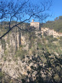
End this walk with a visit to the magnificent hilltop village of Peillon.

Its winding streets with wide staircases and, at the top, the church square with benches under the trees, ideal for resting.

An orientation table is located just above.

Reviews and comments

4.3 / 5
Based on 14 reviews

Reliability of the description
4.5 / 5
Ease of following the route
4 / 5
Route interest
4.4 / 5
bernard bb
bernard bb

Thanks fxgdel for this review – that says it all
Best wishes, Rando, B.

Machine-translated

fxgdel
fxgdel

Overall rating : 4.3 / 5

Date of your route : Apr 05, 2026
Reliability of the description : ★★★★☆ Good
Ease of following the route : ★★★★☆ Good
Route interest : ★★★★★ Very good
Very busy route : No

A very pleasant circular walk, and best of all, not too far from Nice. You need to keep a close eye out for changes in the path, particularly around the hollow stones (keep to the right of them) and the path leading up to the summit.
The return path is reminiscent of a Roman road...
Be aware that the car park fills up very quickly and there are no other parking spaces available in the very pretty village of Peillon. (Don’t forget to have a stroll around the village after the hike.)

Machine-translated

bernard bb
bernard bb

Thank you, Isabelle, for your review.
A lovely area
Best wishes, B.

Machine-translated

Isabelle54
Isabelle54

Overall rating : 5 / 5

Date of your route : Mar 24, 2026
Reliability of the description : ★★★★★ Very good
Ease of following the route : ★★★★★ Very good
Route interest : ★★★★★ Very good
Very busy route : No

A magnificent hike near Nice, starting from the charming village of Peillon, perched atop a rocky peak.

Machine-translated

bernard bb
bernard bb

Thank you, User 28549527, for this clear and concise review.
Best regards, B.

Machine-translated

User 28549527

Overall rating : 4.7 / 5

Date of your route : Feb 22, 2026
Reliability of the description : ★★★★★ Very good
Ease of following the route : ★★★★☆ Good
Route interest : ★★★★★ Very good
Very busy route : No

An interesting hike, the description is accurate, the cairns are clearly visible and useful for finding your way. The direction of this hike is more interesting as described. The return trail from the Saint Pancrace pass is pleasant, a beautiful rustic paved path that runs alongside a stream with two pretty stone bridges and a beautiful rock face before arriving at the village. The only slight downside, which has nothing to do with the hike, is finding parking in Peillon.

Machine-translated

bernard bb
bernard bb
• Edited:

Thank you, Yosylda, for this comprehensive review.
Best regards, B.

Machine-translated

Yosylda
Yosylda

Overall rating : 4.3 / 5

Date of your route : Nov 03, 2024
Reliability of the description : ★★★★☆ Good
Ease of following the route : ★★★★☆ Good
Route interest : ★★★★★ Very good
Very busy route : No

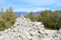
A lovely little autumn hike, with sunshine to boot. The summit itself isn't necessarily breathtakingly beautiful, just a pile of rocks forming a slight circle, but the view is!
The hike itself is quite peaceful, passing through scrubland, forest and greenery, with a return route featuring small bridges, moss, beautiful cliff faces and a lovely arrival at the village as the sun was setting.
Be sure to pay attention to the cairn markings!

Machine-translated

bernard bb
bernard bb

Thank you, intrepid hikers, for this review.
Best regards, B

Machine-translated

randonneurintrépide
randonneurintrépide

Overall rating : 4.3 / 5

Date of your route : Oct 29, 2024
Reliability of the description : ★★★★★ Very good
Ease of following the route : ★★★☆☆ Average
Route interest : ★★★★★ Very good
Very busy route : No

To reach the summit, the two cairns are well before point no. 3. From there, everything is fine. However, we climbed from point 3; it is difficult, rocky and steep, so it is best to avoid it.

Machine-translated

traunero
traunero

Thank you.
This will make the summit accessible.

Machine-translated

bernard bb
bernard bb

Sorry, Traunero
When I get the chance, I'll put some cairns back
Best regards, B

Machine-translated

traunero
traunero

Overall rating : 3.3 / 5

Date of your route : Apr 15, 2024
Reliability of the description : ★★★☆☆ Average
Ease of following the route : ★★★☆☆ Average
Route interest : ★★★★☆ Good
Very busy route : No

Hello,
It's a shame we couldn't reach the summit of Rastel and enjoy the view because we couldn't find the two cairns mentioned in the description, even though we looked carefully... and we didn't really see a path leading up to the summit.

Machine-translated

bernard bb
bernard bb

Thank you JPJ for your feedback.
Have a good weekend, B.

Machine-translated

jpg13490
jpg13490

Overall rating : 4.3 / 5

Date of your route : Jan 02, 2024
Reliability of the description : ★★★★★ Very good
Ease of following the route : ★★★★☆ Good
Route interest : ★★★★☆ Good
Very busy route : No

A lovely, easy hike starting from the village of Peillon, which is definitely worth a visit.
However, I found that the landscape was often obscured by the forest canopy, particularly in the valley on the way back.
The route is not difficult, but the GPS track attached to the description seems to be incorrect for access to the summit of Rastel: it is much easier to take the path clearly marked by a cairn that branches off to the left about a hundred metres before the location indicated on the GPS track.

Machine-translated

Other walks in the area

For more walks, use our search engine .

The GPS track and description are the property of this route's author. Please do not copy them without permission.