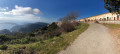
From Châteauvieux to Saint-Martin-de-Peille, returning via Spraès

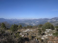
A hike with a very varied route, offering views over the Peillon valley and the village.

Details

n°27859179
Creation:
Last update:
–
Last review:
  • Walking
    Activity: Walking
  • ↔
    Distance: 8.07 mi
  • ◔
    Average duration: 5h 20 
  • ▲
    Difficulty: Moderate

  • ⚐
    Back to start: Yes
  • ↗
    Ascent: + 1,824 ft
  • ↘
    Descent: - 1,818 ft

  • ▲
    Highest point: 1,811 ft
  • ▼
    Lowest point: 453 ft

Description of the walk

Park in the car park by the Châteauvieux bus stop.

(S/E) Take the road leading uphill to the right of the signpost. Immediately take the steps on the right, cross the road and take the steps opposite to reach the wayside shrine.

(1) Set off along the path opposite the EDF post, heading towards Sainte-Thècle. Continue along the path running alongside the railway line. Go under the railway bridge and you’ll come out onto the road. Turn right and walk 100 metres to the bus stop.

(2) Take the stairs just past the bus stop. After crossing the railway line, reach the road and head up it. Turn into thefirst road on the right (with little traffic) until you reach marker 591.

(3) Turn left onto the downhill road, then take the path on the right after the gate until you reach marker 592.

(4) Head right, towards Peillon village, until you reach marker 584.

(5) Turn sharply right, towards Saint-Martin-de-Peille. Walk up this mule track. At the next junction, do not follow the path on the right marked with a yellow sign, but continue along the wire fence on the left until you reach the road.

(6) Follow it to the right to join the Route de la Gorra. Walk down this long cul-de-sac. At the ‘Passage du Gaïan’ sign, enter the Domaine des Trois Sources. At the fire hydrant, turn right, following theGR®653A–GR®51, still on the Route de la Gorra.

(7) At the end of the cul-de-sac, continue along theGR® to the left of the gate until you reach marker 622.

(8) Turn right towards Spraès, now on theGR®51. At the track junction, turn left, staying on the GR®. At the marker, in front of the house, turn right until you reach the next marker.

(9) Take theGR® and follow it to another fork at marker 624.

(10) Leave theGR® and turn right towards Peille. After 100 m, at the junction, turn left (do not follow the signs for Peille) and you will reach the forest track.

(11) Follow this track to the left and go through a gate. After 500 m, follow a path to the right which rejoins the forest track. Continue for 300 m and take the path on the right (signpost). Back on the forest track, turn right. At the gate, take the path on the left which leads uphill. When you reach a quarry, walk along its left-hand side to rejoin the path and follow it to a small stone wall. Turn right, then immediately left, until you reach the Châteauvieux road.

(1) Once past the wayside shrine at the start, carry on straight ahead along the road. Take the steps on the right after the rubbish bins and head for the car park by the bus stop (S/E).


Waypoints

  1. S/E : mi 0 - alt. 453 ft - Châteauvieux Road
  2. 1 : mi 0.23 - alt. 636 ft - Shrine
  3. 2 : mi 0.82 - alt. 528 ft - Bus stop
  4. 3 : mi 1.6 - alt. 728 ft - Le PueÏ
  5. 4 : mi 1.77 - alt. 682 ft - Marker 592
  6. 5 : mi 2.42 - alt. 1,152 ft - Marker 584
  7. 6 : mi 3.67 - alt. 1,808 ft - Marker 583
  8. 7 : mi 4.84 - alt. 1,401 ft - GR. Gate, on the left
  9. 8 : mi 5.26 - alt. 1,352 ft - Path junction – track
  10. 9 : mi 5.72 - alt. 1,460 ft - The hamlet of Spraès.
  11. 10 : mi 6.24 - alt. 1,522 ft - Leave the GR
  12. 11 : mi 6.44 - alt. 1,453 ft - Forest track
  13. S/E : mi 8.07 - alt. 453 ft - Châteauvieux Road

Worth a visit

Oil mill at Borghéas.

Always be cautious and plan ahead when you're outdoors. Visorando and the author of this route cannot be held responsible for any accidents occurring on this route.

The GR® and PR® markings are the intellectual property of the Fédération Française de Randonnée Pédestre.

Reviews and comments

4.2 / 5
Based on 2 reviews

Reliability of the description
4 / 5
Ease of following the route
4 / 5
Route interest
4.5 / 5
Cromagnon
Cromagnon

Overall rating : 5 / 5

Date of your route : Mar 28, 2025
Reliability of the description : ★★★★★ Very good
Ease of following the route : ★★★★★ Very good
Route interest : ★★★★★ Very good
Very busy route : Yes

A lovely walk lasting just under 3 hours. Varied scenery. Even the tarmac sections are pleasant as there isn’t much traffic. A few sections that really get your heart rate up.

Machine-translated

millepat06
millepat06

Hello Espedaillac,
Thank you for these additional comments, which will be useful for the next issue of Visorandonneur.
Millepat06

Machine-translated

Espedaillac
Espedaillac
• Edited:

Overall rating : 3.3 / 5

Date of your route : Mar 16, 2023
Reliability of the description : ★★★☆☆ Average
Ease of following the route : ★★★☆☆ Average
Route interest : ★★★★☆ Good
Very busy route : No

Hello,

A few comments on the accuracy of the route description. Despite using GPS, it took us a while to find the steps, as we were relying on the details in the description provided, to which I must make a small correction.

From the car park (S/E) behind the bus stop, cross the D21 and take the road leading uphill opposite (Route de Chateauvieux). Take the steps on the LEFT straight away – keep your eyes peeled – not the ones on the right, as those lead down into the valley. Another clarification at the point (11): this is not a quarry but a former riding arena.

See you soon on the trails

Machine-translated

Other walks in the area

For more walks, use our search engine .

The GPS track and description are the property of this route's author. Please do not copy them without permission.