Chemin du Fusté

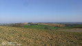
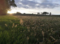
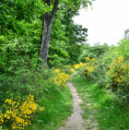
A lovely little circular walk starting from the church in the village of Pujaudran. The route winds through valleys and over hillsides.

Details

20369586
Creation:
Last update:
Last review:
  • Walking
    Activity: Walking
  • ↔
    Distance: 4.65 mi
  • ◔
    Average duration: 2h 40 
  • ▲
    Difficulty: Easy

  • ⚐
    Back to start: Yes
  • ↗
    Ascent: + 581 ft
  • ↘
    Descent: - 604 ft

  • ▲
    Highest point: 1,001 ft
  • ▼
    Lowest point: 689 ft
  • ⚐ Country: France
  • ⚐ City: Pujaudran (32600)
  • ⚑
    Start/End: N 43.590625° / E 1.150059°
  • ❏
    IGN map(s): Ref. 2043ET, 2043O
  • Hour-by-hour weather

Photos

Description of the walk

Park in the designated spaces on Avenue Victor Capoul.

(S/E) Head towards Saint-Brice Church and carry on straight along the Chemin de Saint-Jacques. At the bottom of the hill, continue along the small road until you reach the hamlet of Cornac.

(1) Turn left just after the oak tree. After a few metres, do not enter the woods but turn right and follow the path that climbs along the edge of the woods.

(2) Turn left to continue along the edge of the woods. Follow the path, pass under the mobile phone mast and go down the small tarmac road.

(3) Take the small path on the left. Follow the edge of the small road to the left, going round the lay-by on the A-road. At a place called Lamarque, take the small path on the right and you’ll come out above the A124: views of the Pyrenees in good weather.

(4) Turn left, then immediately right (at the barrier) along the wire fence. Walk alongside the main road for a short while (there’s little noise when the autan wind is blowing). You can see that the road’s foundations are made of tyres. Emerge onto Impasse du Fusté and continue straight on. You’ll reach the Ronald Nichols memorial.

(5) Turn left for about 50 metres, then leave the road and take the small path on the left. At the end of this path, turn right and rejoin the small road you left earlier.

(6) Turn left and follow it on the right-hand side (cycle path). After 100 metres (cross), turn right. A little further on, at the junction with three large pine trees, take the Chemin du Midi on the left.

(7) Head left onto the small path (steps) which passes above the sports ground (tennis courts). At the end of the path, turn right, walk up the street to the bend and take the steps opposite. A pleasant little walk under the magnolias (toilets and drinking water next to the community hall on the right). Go round the small garden, then turn left to reach the car park (S/E).

Waypoints

  1. S/E : mi 0 - alt. 984 ft - Avenue Victor Capoul - Église Saint-Brice (Pujaudran)
  2. 1 : mi 1.13 - alt. 807 ft - Cornac
  3. 2 : mi 1.58 - alt. 883 ft - T-junction
  4. 3 : mi 2.2 - alt. 922 ft - Path on the left
  5. 4 : mi 2.64 - alt. 922 ft - Crossroads
  6. 5 : mi 3.75 - alt. 981 ft - Ronald Nichols memorial
  7. 6 : mi 4.03 - alt. 984 ft - Road junction
  8. 7 : mi 4.49 - alt. 919 ft - Path – Tennis courts
  9. S/E : mi 4.65 - alt. 984 ft - Avenue Victor Capoul

Notes

A highly renowned gourmet restaurant in Pujaudran.
Bar, tobacconist’s and newsagent’s on the high street
Bar and restaurant in the “Roulage” business park

Worth a visit

The Ronald Nichols memorial: on 12 August 1944, whilst on a reconnaissance mission to prepare for the bombing of Toulouse-Blagnac Airport and Francazal Airfield, a Mosquito aircraft (the pride of the military air force at the time) piloted by Ronald Nichols was shot down by an American fighter pilot who mistook it for a German aircraft.
The ‘Mosquito’ crashed in the Fusté woods, not far from the memorial. Only the navigator, Helbert Harris, managed to eject from the falling aircraft.
Harris was taken in and hidden by a family in Lias (in the hamlet of Laroudet), entrusted to the Roger resistance group and, later, was able to return to England.
The memorial was unveiled on 12 August 1944, exactly 60 years after the day of the crash, in the presence of Lt Harris’s family.

Reviews and comments

3.9 / 5
Based on 3 reviews

Reliability of the description
4.5 / 5
Ease of following the route
4 / 5
Route interest
3.3 / 5
catherinelanglais
catherinelanglais
• Edited:

Overall rating : 3.7 / 5

Date of your route : Jun 27, 2025
Reliability of the description : ★★★★☆ Good
Ease of following the route : ★★★★☆ Good
Route interest : ★★★☆☆ Average
Very busy route : No

This hike isn't very interesting because it takes you around several cultivated fields where it's not always easy to find a way through, and the section along the four-lane road is particularly challenging!
There are a few nice views, though!

Machine-translated

FreeP.
FreeP.

Overall rating : 4.7 / 5

Date of your route : May 05, 2024
Reliability of the description : ★★★★★ Very good
Ease of following the route : ★★★★☆ Good
Route interest : ★★★★★ Very good
Very busy route : No

A lovely route that starts on a stretch of road (with little traffic) and continues along field-side paths from point 1 (be careful not to miss the fork to the left just past the private road).
Stunning 360° panoramic views of the GERS!
Between points 2 and 3, the field has been ploughed and we were forced to walk along the first row of crops… so the path no longer really exists on that particular plot
A lovely series of paths follows, and the return route to Pujaudran is very well signposted.
There’s proper signposting at the start (a general sign for the Pujaudran trails) and consistent signposting throughout.
The GPS app is useful for checking directions.
Thank you for this walk

Machine-translated

jeanetmaryse
jeanetmaryse

Watch out for private roads

Machine-translated

JLBRICE
JLBRICE

The return journey along the motorway will only be of interest to civil engineers!
I suggest heading to the viewpoint overlooking the Pyrenees and returning to the radio station. From there, head back about 500 metres and, at the first corner at the bottom of the field you went round on the way up, head into the woods along a narrow path that zigzags down towards a stream. Follow the stream down, alternating between the right and left banks. You’ll reach the Saint-Antoine stream. Then turn right (marked blue and yellow) and follow it upstream on its left bank. Reach and cross a footbridge, then turn left (marked yellow CR No. 7). The path follows another tributary upstream and then climbs directly up to Pujaudran.
This adds a little to the distance and the total ascent is around 300 metres.
An otherwise picturesque route, but perhaps best avoided in muddy conditions …

Machine-translated

Henry32
Henry32

Overall rating : 2 / 5

Date of your route : Apr 16, 2022
Reliability of the description : Not used / Not applicable
Ease of following the route : Not used / Not applicable
Route interest : ★★☆☆☆ Disappointing
Very busy route : No

A fairly pleasant start, but on a tarmac road, followed by a lovely stretch through the countryside, and that’s it. The rest of the route is very tedious, with the A-road just a few metres from the path

Machine-translated

Other walks in the area

For more walks, use our search engine .

The GPS track and description are the property of this route's author. Please do not copy them without permission.