Chemin du Pont de Saint-Antoine

A fairly short walk with a lovely stretch through woodland alongside the little Ruisseau de Saint-Antoine

Details

n°21658041
Creation:
Last update:
Last review:
  • Walking
    Activity: Walking
  • ↔
    Distance: 2.69 mi
  • ◔
    Average duration: 1h 30 
  • ▲
    Difficulty: Easy

  • ⚐
    Back to start: Yes
  • ↗
    Ascent: + 338 ft
  • ↘
    Descent: - 341 ft

  • ▲
    Highest point: 991 ft
  • ▼
    Lowest point: 689 ft
  • ⚐ Country: France
  • ⚐ City: Pujaudran (32600)
  • ⚑
    Start/End: N 43.590894° / E 1.149284°
  • ❏
    IGN map(s): Ref. 2043ET, 2043O
  • Hour-by-hour weather

Photos

Description of the walk

Park in the car park by the church in Pujaudran.

(S/E) With your back to the church, turn right onto the Chemin de Saint-Jacques. Follow this small road until you reach a cross. Stay on the path to reach the bridge over the Ruisseau de Saint-Antoine.

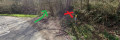
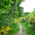
(1) Cross the bridge, then turn left onto the path that follows the stream. Continue through the woods, ignoring the small paths branching off to the right. You’ll reach a small wooden bridge.

(2) Cross this bridge and head left. Climb up through the woods to reach the hamlet of La Gravette.

(3) Carry on straight ahead, ignoring the path branching off to the right. You’ll reach the D572 road. Turn left onto it and follow it for a good hundred metres. Turn right off it onto the Chemin de l’Aiguilleron. Continue along this path until you reach the junction with the Chemin de Midi, marked by two large pine trees.

(4) Turn left onto this path and you’ll reach a playground and some tennis courts.

(5) Turn left, taking the small wooden steps to reach a beautiful avenue of magnolias. Walk straight up to reach a small cobbled road. Turn left and you’ll come back to the church car park (S/E).

Waypoints

  1. S/E : mi 0 - alt. 991 ft - Car park - Église Saint-Brice (Pujaudran)
  2. 1 : mi 0.73 - alt. 689 ft - Saint-Antoine stream
  3. 2 : mi 1.32 - alt. 764 ft - Bridge
  4. 3 : mi 1.8 - alt. 971 ft - La Gravette
  5. 4 : mi 2.34 - alt. 971 ft - Grand Pins crossroads
  6. 5 : mi 2.48 - alt. 919 ft - Playground
  7. S/E : mi 2.69 - alt. 991 ft - Car park - Église Saint-Brice (Pujaudran)

Notes

Bar, tobacconist and newsagent in the village.
There is a bar in the ‘Roulage’ industrial estate (at the bottom of the village, towards Toulouse).

Worth a visit

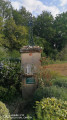
(1) The cross marks the spot where, in days gone by, there was a hospital caring for pilgrims on their way to Santiago de Compostela.

Reviews and comments

4.2 / 5
Based on 2 reviews

Reliability of the description
4.5 / 5
Ease of following the route
4 / 5
Route interest
4 / 5
HULOTTE14
HULOTTE14

Overall rating : 4.3 / 5

Date of your route : Aug 21, 2024
Reliability of the description : ★★★★★ Very good
Ease of following the route : ★★★★☆ Good
Route interest : ★★★★☆ Good
Very busy route : No

Despite the first 10 minutes on the road, and a bit of trouble finding our way at the bottom of the descent, it was a very pleasant walk, with plenty of woodland; the river is lovely, even if it had dried up in August.
I’d recommend this short walk – it’s advertised as taking 1½ hours, but it took us 2 hours, though my daughter took lots of photos… so we took our time.
It’s a lovely walk to do with a dog.

To avoid getting lost:. At the start of the walk, at the bottom of the slope on the road, head towards the big bend at the bottom – you’ll see the GR7 and GR6 signposts there. Follow the little path to the left; don’t go right or straight up the hill. We did end up wandering around a bit… but after that, the signposting is spot on.

Machine-translated

Hugouvieux
Hugouvieux

Overall rating : 4 / 5

Date of your route : Apr 29, 2024
Reliability of the description : ★★★★☆ Good
Ease of following the route : ★★★★☆ Good
Route interest : ★★★★☆ Good
Very busy route : No

A short, pleasant walk through the woods (apart from a few sections along the road).
Be careful after the first bridge – which is actually the road – as there are two paths a few metres apart; you need to take the first one, which runs alongside the little stream and is flat. We didn’t spot it at first glance, probably because the signposts are located by another path that starts by going uphill.
So don’t make the same mistake we did – we ended up going round in circles before turning back and realising our error.
On the right path, the signposts are very clear.

Machine-translated

Other walks in the area

For more walks, use our search engine .

The GPS track and description are the property of this route's author. Please do not copy them without permission.