Country:

 City:
City:


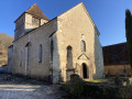

The walk starts at the car park opposite the market hall near the church, at the foot of the hiking information board. There is ample parking available.
Follow the yellow signposts.
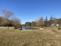
(S/E) Take the path at the wooden gate, running alongside the stream which will be on your right. 100 m before the pond, turn right, cross the wooden bridge, then cross the town hall car park and turn left as you leave it, then continue for 50 m.
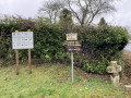
(1) At the wayside cross, turn right. Follow this uphill road for 1 km, pass through the pretty hamlet of ‘Le Mas’, and continue until you reach the entrance to the footpath at the horse paddock.
(2) Enter the forest path and walk alongside the horse paddock. Turn left after 100 metres and follow the fence until it ends. At a gate on the left, turn right and follow the path to the Route des Archets. (The final 100 m provide access to neighbouring properties and are called Impasse des Orchidées).
(3) Turn right and follow this road for 1 km until you reach the next junction.
(4) Take the DFCI JULCR 04 track on the left into the forest for about 1 km.
At the edge of the forest, on your left, a sign indicates that you should turn off to take this path. Due to the vegetation, this sign can be difficult to spot.
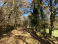
Follow this path, which takes you along a lovely avenue lined with plane trees to a metal gate.
(5) At the gate, turn left onto the forest track, which veers left 50 metres further on. At the end of this track, you’ll find yourself walking alongside some houses.
(6) At the end of the wire fence, turn left and join the road.
(7) At Route des Archets, turn left and walk uphill to No. 723, which is on the left.
(3) Turn right opposite this house number into Impasse des Orchidées. Now follow the path back along the same route you took on the way there, eventually reaching the car park (S/E).

 Visorando Member

 Moderate