Country:

 City:
City:


The route starts at the Place de la Mairie in Saint-Sauveur, at the foot of the hiking information board.
Car parking is available there.
Please follow the route markers carefully, as they may be of different colours.
(S/E) Go down the steps at the foot of the hiking information board, then turn left into Rue Traversière. 50 metres further on, on the D 21, turn right and continue along this road, ignoring a dead-end on the right.
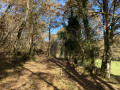
(1) Opposite the fire hydrant, turn right onto the forest track. You will be passing through private property: do not stray from the track. Continue straight on until you reach the Route de Gaffan.
(2) At the road, turn left and, after 50 m, turn left into Impasse de la Capelotte, which leads, via a path, to the Route de Sainte-Alvère (D 32).
(3) Cross this road with care, continue for 80 m and turn right in front of the fire hydrant. Carry on straight ahead, crossing a road. Continue straight ahead along the path and, when you reach thesecond road, turn left. At the hamlet of La Jolivie, take the path on the right (marked green and pink) and follow it to the next hamlet, La Barabie, at the next road.
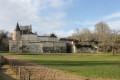
(4) Turn left and, following this small tarmac road which bends right after 500 metres and then left, head down to the fish farms. On the left, you can see Bellegarde Castle on the hill.
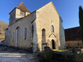
(5) After the pond, take the road on the left after the bridge and head towards the town centre. Pass in front of the Church of Notre-Dame and continue to the Route de Vergt (D21). Cross this busy road with extreme caution and continue straight on towards the Château de Lamonzie-Montastruc.
(6) At the foot of the château, turn left towards La Martigne. Follow the road to a Fork in the road, where you should take the left-hand branch to reach a wayside cross.
(7) Turn left to head down into the hamlet along the road which bends first to the right and then to the left. Pass between the houses, turning left at the start of the bend, and head down the grassy path. At the property with the swimming pool, turn right and rejoin the original road. Continue for 600 metres, cross the stone bridge and carry on to the Route de Vergt (D 32), 150 metres further on.
(8) Cross with care and take the path leading up into the woods opposite, slightly to the right.
At the wooden gate, follow the path on the left for 700 m to reach the five-way junction at a DFCI track.
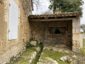
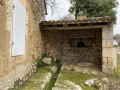
(9) Turn right immediately at this junction and continue along the track. Pass in front of a property with numerous animals (donkeys, sheep, horses, etc.) to reach a chapel known locally as ‘le Reposoir’. Continue to the Grateloup road
(10) Cross the road and take the path through the woodland opposite (DFCI SAUVE 2) for 700 m. Leave the track, turn left onto the path and continue to the Route de Sainte-Alvère (D 32).
(11) Cross the road with care. Walk past the Creysse village water reservoir and, after 50 m, turn onto the path on the left marked by the Yellow Cross. This route avoids the road and takes you through the countryside. Turn right after 1 km, walk alongside the power lines and turn left before the private fence. Follow the path through the forest and walk alongside the vineyards until you reach the road.
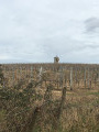
(12) Turn left following the yellow markings, passing the livestock farm. Pass a tower amongst the vineyards. At the wayside cross, Impasse du Térondel, turn right and, after 150 m, take the marked path on the left, across the field. Pass a remarkable oak tree (over a hundred years old). Follow this path to the road.
(13) At the Route de la Grande Dairy Farm, turn left and head down to the village of Saint-Sauveur, arriving at the town hall car park (S/E).


 Visorando Member
 Easy
Easy