Country:

 City:
City:


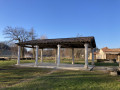
The meeting point is opposite the town hall, situated on the D21, by the hiking information board: parking is readily available.
Follow the pink (poorly maintained) and yellow markings.
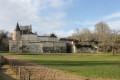
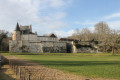
(S/E) Head in the opposite direction to the village, walking along the left-hand side of the D21 for about 200 metres. Turn left onto the Route de la Jolivie at the foot of Bellegarde Castle. At the next junction, turn right onto a forest track to reach the hamlet of La Croix Vieille.
(1) From here, take the Impasse de la Croix Vieille, walk past the Versannes neighbourhood and then, before reaching the D32, turn left onto the Chemin des Versannes. Cross the road and take the footpath opposite. When you reach another road, follow it to the left to reach the hamlet of La Jolivie.
(2) Opposite No. 1130, turn right onto the track to reach the hamlet of La Barabie further on. Turn 90° to the right onto Route des Femmes. Continue straight on until you reach a Stop sign at the junction with the D32.
(3) Cross the departmental road with care and continue straight ahead along Impasse du Lac de Lacroix, then follow the forest track to the left after the last detached house until you reach a track. Turn right and follow this track for a few hundred metres until you reach a yellow and pink marker.
(4) Turn left and follow the track. At the next Fork in the road, keep left and head for the crossroads at a place called Bouyssonnat.
(5) Turn left, keep going straight on and join the D32.
(6) Cross it again with care and continue straight on to the hamlet of Le Cluzel. At the top of the hill, after house number 575, carry on along the track to the left of the stone pillar (the appearance is misleading; it looks as though you’re entering private property). Shortly afterwards, the path descends to the right, into the valley. Turn right at the next junction, take the path, pass through a poplar grove and cross the river Louyre. After the river, take the rough path that climbs to the right.
(7) Once at the top, turn left and shortly afterwards right to pass through the hamlet of Lartigue. Walk past a house to join the signposted path, which becomes visible to the right of the shed. Continue until you reach the tarmac road known as the Voie Romaine.
(8) Turn right onto it, passing in front of the Château de l’Escot. Continue along a track here, following the ridge overlooking the Louyre valley. After a short climb, you’ll reach the Eyssal crossroads. Please take care here: make sure you spot the sign for Eyssal on a signpost on the left, as it is positioned facing away from the direction of travel (there are letterboxes on the right).
(9) Turn left and head towards the hamlet of Eyssal. Cross the hamlet following the track and join the D21, the road to Vergt.
(10) Turn left onto it for about a hundred metres, then cross the road with care. At the next junction, turn right, then right again to reach the hamlet of Monsacou.
(11) At No. 1075, turn slightly right onto the forest track. Enter the woods, continue straight on and head for the livestock farm. Walk past the cattle pen and reach the shed on the right.
(12) Turn right immediately after the shed, continue for about a hundred metres, then turn left onto the path between the meadows to reach the Monsacou road at the top of the hill.
(13) Carry on straight ahead along the grassy path towards the yellow marker (no sign at the road). At the edge of the woodland, follow the path on the right until you reach the Route du Penlet.
(14) Carry on straight ahead, passing the Caisses d’Envol de chasseurs (2 sites), and continue to the next junction.
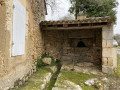
(15) Turn right and carry on for about a hundred metres. Be careful not to miss the next junction. Turn left onto the path leading downhill (hint: just at the entrance, 10 metres to your right, you’ll find a spring shelter). Continue to the Route de Maillol and cross with care. Carry on straight ahead, pass through the hamlet of Mareyssal, then reach the hamlet of La Nauze.
(16) Turn left in the centre of the hamlet and head down Route de la Crabouille. Turn right into Impasse de Fonrouge (the second right). Continue along the path that follows it, running alongside the fence of the large estate, until you reach a Y-junction.
(17) Take the path on the left and walk up the hill to the hamlet of La Martigne.
(18) Carry on straight ahead towards the Prieuré’s carriage entrance, then follow the road past an old bread oven. After the two tobacco sheds, turn right and head back down the road (take a moment here to enjoy the view of Bellegarde Castle on your right, 400 m away), until you reach Montastruc Castle.
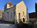
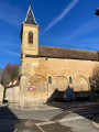
(19) Turn right onto Route de Maillol towards the D32, cross the road with care and head for the church. Turn right and return to the town hall car park (S/E).


 Visorando Member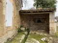
 Easy
Easy