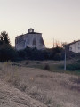
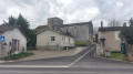
The Né Valley starting from Pont à Brac

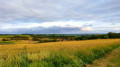
A route with significant elevation changes and beautiful views over the Né valley.
Blue-marked route.

Details

n°6282038
Creation:
Last update:
Last review:
  • Walking
    Activity: Walking
  • ↔
    Distance: 6.09 mi
  • ◔
    Average duration: 3h 20 
  • ▲
    Difficulty: Moderate

  • ⚐
    Back to start: Yes
  • ↗
    Ascent: + 659 ft
  • ↘
    Descent: - 653 ft

  • ▲
    Highest point: 463 ft
  • ▼
    Lowest point: 157 ft
  • ⚐ Country: France
  • ⚐ City: Nonaville (16120)
  • ⚑
    Start/End: N 45.526182° / W 0.093139°
  • ❏
    IGN map(s): Ref. 1632SB
  • Hour-by-hour weather

Photos

Description of the walk

Park at the Place de la Mairie in Pont à Brac.

(S/E) Head towards the D151 in the direction of Viville. After the last house, take the cul-de-sac ‘Voie sans Issue’ on the right. Walk up to the road, turn right then left, continue for about 100 metres and turn right to walk alongside the woodland. At the road, turn left.

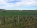
(1) Take care on the bend; go straight on, passing the house at the hamlet of La Font Nicot. At the fountain, take the dirt track opposite which leads up through the vineyards.

(2) When you reach Chez Perot, turn right, follow the hedge and then turn right. Before thefirst house in Le Vignaud, take the dirt track on your left to join the lower road to Nonaville. Turn left and walk through the village.

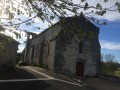
(3) Head towards the old coaching inn, which has been renovated. Then, at the bend, carry straight on along the dirt track to reach the orientation table.

(4) Take the road on the right and, opposite the road leading down into the village, turn onto the path on the left through the vineyards. When you reach a road, turn right.

(5) At the large crossroads, take the path on your right towards a walnut tree and head downhill to a pond. About a hundred metres further on, take the path on the right to reach the village of Chez Delhuile, then that of Balzac

(6) At the road, turn left and carry on straight ahead, passing along the vineyard and following the road.

(7) On leaving the village of Chez Cerclet, turn right at the bend, head down through the woodland and turn left to join the old RN 10. Turn right to reach the car park at the Place de la Mairie in Pont à Brac (S/E) via the motorhome site.

Waypoints

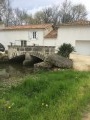
  1. S/E : mi 0 - alt. 164 ft - Car park at Place de la Mairie Near the - Né (rivière)
  2. 1 : mi 1.35 - alt. 377 ft - Chez Nicot
  3. 2 : mi 1.95 - alt. 430 ft - Chez Perot
  4. 3 : mi 2.83 - alt. 282 ft - Nonaville Church
  5. 4 : mi 3.2 - alt. 463 ft - Orientation board
  6. 5 : mi 3.62 - alt. 430 ft - Major crossroads
  7. 6 : mi 4.49 - alt. 413 ft - Balzac
  8. 7 : mi 5.22 - alt. 259 ft - Le Cerclet
  9. S/E : mi 6.09 - alt. 164 ft - Car park at Place de la Mairie in Pont à Brac

Worth a visit

Church. Numerous viewpoints – undulating route – orientation board.

Reviews and comments

4.2 / 5
Based on 2 reviews

Reliability of the description
4 / 5
Ease of following the route
4.5 / 5
Route interest
4 / 5
Pierrot680
Pierrot680

Overall rating : 3.7 / 5

Date of your route : Sep 01, 2025
Reliability of the description : ★★★★☆ Good
Ease of following the route : ★★★★☆ Good
Route interest : ★★★☆☆ Average
Very busy route : No

Hike undertaken to gain some elevation

Machine-translated

BELLEVIGNE
BELLEVIGNE

I’m glad you enjoyed the beautiful views along this route

Machine-translated

petitgillou
petitgillou

Overall rating : 4.7 / 5

Date of your route : Jun 07, 2025
Reliability of the description : ★★★★☆ Good
Ease of following the route : ★★★★★ Very good
Route interest : ★★★★★ Very good
Very busy route : No

Hello, walker – this route is surprisingly easy; you can do it at a leisurely pace in 2 hours 30 minutes. At this time of year, much of the route is grassy, with the grass mostly cut short, making for a very comfortable walk. The panoramic views are stunning, and the undulating terrain offers a wide variety of scenery and sights to take in. Why not consider doing it the other way round? Looking for a bit more of a challenge? Well, I think we have to agree that the proximity of the RN10 will make it a bit more strenuous and take us further away from the Né. Don’t worry, there are some lovely surprises to enjoy along the way.
Enjoy the walk!

Machine-translated

Other walks in the area

For more walks, use our search engine .

The GPS track and description are the property of this route's author. Please do not copy them without permission.