Country:
 City:
City:


Head to Monferran Plaves Town Hall. Park in the car park opposite, next to the old telephone box, or in front of the church.
(S/E) Take the main road, heading east, and after 50 m:
- take the path on the right, towards Gimbelon,
- walk past the Gimbelon farm.
(1) Continue straight on until, 400 m further on, you reach a Fork in the road.
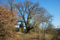
(2) Carry on straight ahead, skirting the meadow; the track enters the woodland and becomes a footpath.
Follow the path straight ahead under the trees. Just before the path ends and opens out into a field, you’ll come to another crossroads.
(3) Turn left, go down a small slope and follow the track through the woodland. You’ll come to a meadow; head down the meadow to the right, diagonally. The path resumes at the bottom, on the left. Head back up into the meadow, following the edge, and pass a wooden cross. The path resumes just after this and enters the woodland; follow it to the road.
(4) Take the road on the right until you reach the next crossroads. On the left, a sheepfold houses some alpacas.
(5) Turn right onto Chemin de Bel Air and head uphill to the place known as La Hourcade.
(6) Take the road on the right and, immediately after the building, turn left. Follow the path downhill until you reach the road; take it to the left and head towards the Ruisseau de Cantroubat.
(7) Cross the stream, then turn right onto the path and follow the stream for about 400 metres until you reach a bridge.
(8) Turn right onto it and you’ll come out onto a road in the hamlet of En Picardie.
(9) Turn right onto this road and continue up to the Monferran Plaves cemetery.
(10) Turn left and head for the car park at Monferran Plaves Town Hall (S/E).

 Visorando Member

 Association / Club / Walk leader
 Moderate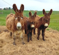
 Tourism professional
 Tourist office