


Refine your search for walks in Chapelle Saint-Wandrille (Labaroche)
Chapelle Saint-Wandrille (Labaroche) walks


 Orbey circular via Labaroche
 Visorando Member
 5.86 mi
 +994 ft
 -994 ft
 3h 35
3h 35
 Moderate
 Departure from Orbey (Haut-Rhin)
Breathtaking view of the Vosges peaks and the Tour du Faudé.
Le Petit and Le Grand Hohnack from Labaroche
 8.00 mi
+1,352 ft
-1,358 ft
4h 50
Moderate
Departure from Labaroche (Haut-Rhin)
8.00 mi
+1,352 ft
-1,358 ft
4h 50
Moderate
Departure from Labaroche (Haut-Rhin)
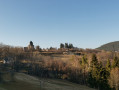
A beautiful hike alternating between forest, meadows and the neighbourhoods of Labaroche, with beautiful views.
The Labaroche rollercoaster
 5.30 mi
+971 ft
-984 ft
3h 15
5.30 mi
+971 ft
-984 ft
3h 15
 Easy
Departure from Labaroche (Haut-Rhin)
Easy
Departure from Labaroche (Haut-Rhin)
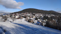
This route is structured around four main routes, four atmospheres, four ways of experiencing the landscape. Panoramic at times, through woodland at others, or deep in the forest, with a rhythm of ascents and descents. They cross or skirt the village, opening up views to the east or west, sometimes wide-open, sometimes more secluded. The route begins with a gentle climb, ideal for warming up, as it crosses through the village. We tackle the hill via a very pleasant forest path. Upon reaching the end of the route, after visiting the ‘Le Gestion’ site, we head south again along a wider path, offering breathtaking views to the west. The grand finale: a mix of trails and wide paths, with a breathtaking view of the Alsace plain.
Walks near Chapelle Saint-Wandrille (Labaroche)
Col de Bagenelles – Schupferen
 10.77 mi
+2,694 ft
-1,847 ft
7h 20
Moderate
Departure from Le Bonhomme (Haut-Rhin)
10.77 mi
+2,694 ft
-1,847 ft
7h 20
Moderate
Departure from Le Bonhomme (Haut-Rhin)
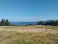
This third day follows the Sentier des Crêtes for the most part, passing through the burnt-out fields with beautiful panoramic views. A walk of moderate difficulty with several opportunities to stop and enjoy a blueberry tart
Schupferen – Hahnenbrunnen
 12.27 mi
+1,798 ft
-1,762 ft
7h 15
Moderate
Departure from Stosswihr (Haut-Rhin)
12.27 mi
+1,798 ft
-1,762 ft
7h 15
Moderate
Departure from Stosswihr (Haut-Rhin)
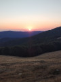
A stage of around twenty kilometres that begins in the shade of the forest, then runs alongside the Hirschsteine and Spitzenfels rocks, with a few sections secured by metal steps and fixed handrails, before continuing along the ridges after the Col de la Schlucht and passing beneath thethird-highest peak in the Vosges, the Hohneck.
Ribeauvillé–Hunawihr via the vineyards
1.75 mi
+299 ft
-220 ft
1h 05
Easy
Departure from Ribeauvillé (Haut-Rhin) (Haut-Rhin)
A lovely little walk that follows the edge of the woodland alongside the vineyards. Superb views of the surrounding villages.
Ribeauvillé - Le Bonhomme
 Tourism professional
 17.75 mi
+3,858 ft
-2,444 ft
11h 30
17.75 mi
+3,858 ft
-2,444 ft
11h 30
 Very difficult
Departure from Ribeauvillé (Haut-Rhin) (Haut-Rhin)
Very difficult
Departure from Ribeauvillé (Haut-Rhin) (Haut-Rhin)
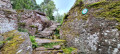
Stage thirteen, from Ribeauvillé to Le Bonhomme, is very long and involves a significant climb. It marks the hiker’s entry into the Hautes-Vosges and its first major peaks: Hirzberg and Brézouard, via the Lapoutroie valley. With a mountain atmosphere and superb views in store.
Schelmenkopf – Col des Bagenelles
 10.60 mi
+1,818 ft
-1,289 ft
6h 25
Moderate
Departure from Ribeauvillé (Haut-Rhin) (Haut-Rhin)
10.60 mi
+1,818 ft
-1,289 ft
6h 25
Moderate
Departure from Ribeauvillé (Haut-Rhin) (Haut-Rhin)
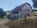
A leisurely second stage, apart perhaps from the total distance. It takes place mainly in the shade on mostly flat paths. You’ll pass beneath the Petit Brézouard and give the Grand Brézouard a wide berth – as it is a wildlife sanctuary – before heading directly to Le Haïcot and then on to the Col des Bagenelles.
Col de la Schlucht – Le Grand Ballon: the Sentier des Crêtes
 16.57 mi
+3,238 ft
-2,556 ft
8 hrs
Very difficult
Departure from Le Valtin (Vosges)
16.57 mi
+3,238 ft
-2,556 ft
8 hrs
Very difficult
Departure from Le Valtin (Vosges)
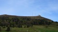
A very beautiful hike, taking in some remarkable sights: the Martinswand rocks, the summit of the Hohneck, the summit of the Kastelberg and the Grand Ballon (with the ‘Boule’ at the summit).
Petit Ballon - Sengern
 5.91 mi
+604 ft
-2,608 ft
3h 15
Moderate
Departure from Luttenbach-près-Munster (Haut-Rhin)
5.91 mi
+604 ft
-2,608 ft
3h 15
Moderate
Departure from Luttenbach-près-Munster (Haut-Rhin)
The route begins in alpine pastureland, then passes through very shady forests.
Charlemagne car park - Schiessrothried Lake
 5.84 mi
+728 ft
-1,683 ft
3h 20
Moderate
Departure from Xonrupt-Longemer (Vosges)
5.84 mi
+728 ft
-1,683 ft
3h 20
Moderate
Departure from Xonrupt-Longemer (Vosges)
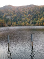
day1: hike around Hohneck, snowfield route and descent to Schiessrothried Lake.
Schiessrothried Lake - Charlemagne car park
 5.08 mi
+2,352 ft
-1,398 ft
4h 25
Moderate
Departure from Metzeral (Haut-Rhin)
5.08 mi
+2,352 ft
-1,398 ft
4h 25
Moderate
Departure from Metzeral (Haut-Rhin)
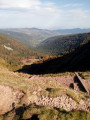
From Schiessrothried, tour of Petit Hohneck, Dagobert's cave, Frankenthal and Col de Falimont.
This route is not accessible in winter. The route is closed between (3), (4), (5) and (6) from 1 November to 30 April 2022 (Prefectural Order of 18 May 2022).
From Lake Longemer to Lake Blanchemer
 11.03 mi
+2,979 ft
-2,169 ft
7h 40
11.03 mi
+2,979 ft
-2,169 ft
7h 40
 Difficult
Departure from Xonrupt-Longemer (Vosges)
Difficult
Departure from Xonrupt-Longemer (Vosges)
The first stage of a two-day bivouac hike with an overnight stay at Lac de Blanchemer, passing by Lac du Lispach, which is reminiscent of a Canadian landscape, and the Machais peat bog.
Difficulty and beautiful views sum up this first stage.