


Refine your search for walks in Chapelle Saint-André de Liar (Canaveilles)
Chapelle Saint-André de Liar (Canaveilles) walks


 Visorando Member
Walks near Chapelle Saint-André de Liar (Canaveilles)
 Thués-Entre-Valls – Fillols Route
 34.29 mi
 +14,088 ft
 -14,383 ft
 5 days
 Moderate
 Departure from Thuès-Entre-Valls (Pyrénées-Orientales)
A 5-day route in the Catalan Pyrenees, offering the chance to explore the stunning Carença Gorges before finishing with an ascent of the Catalan giant: the Canigou.
Thués-Entre-Valls - Carança refuge
5.40 mi
+3,832 ft
-653 ft
5h 50
Moderate
Departure from Thuès-Entre-Valls (Pyrénées-Orientales)
This is the first stage of the Thués - Fillols loop, which takes you up the Carença Gorge to the refuge of the same name.
Chemin Vauban: from Olette to Sauto
10.54 mi
+4,596 ft
-1,398 ft
8h 50
 Difficult
Departure from Olette (Pyrénées-Orientales)
This section of the Chemin Vauban links Olette to Sauto via a route that is much better signposted than the previous one. The route remains, however, long and challenging, with some steep ascents and descents, but in return offers sumptuous and varied scenery. In particular, it takes you through the villages of Canaveilles and Llar, before gaining altitude towards the Serre de Clavera, then beginning the final descent towards Sauto.⚠️ Warning: the route runs alongside and crosses a military firing range between (10) and (11). Before setting out on this route, it is essential to check the days and times of firing exercises to ensure that passage is permitted.
Chemin Vauban: From Sauto to Formiguères
14.63 mi
+1,112 ft
-1,401 ft
7h 40
Difficult
Departure from Sauto (Pyrénées-Orientales)
This section of the Chemin Vauban links Sauto and Formiguères, passing through La Llagonne, the Col de la Quillane, Lake Matemale and the village of Matemale. The route, which is generally easy and accessible to all, alternates between balcony paths, woodland trails and sections along the shores of Lake Matemale, offering beautiful panoramic views of the surrounding peaks and providing an opportunity to explore the Tour de Creu.Please note that the route passes through the La Quillane ski resort, which means it is impassable whilst the resort is open for the winter season. The final section between Lake Matemale and Formiguères, which mainly follows a forest track, offers little shade and should therefore be avoided in very hot weather.
Refuge de la Carença - Mantet
7.47 mi
+2,881 ft
-3,720 ft
5h 55
Moderate
Departure from Fontpédrouse (Pyrénées-Orientales)
Deuxième étape du circuit catalan pour rejoindre le village de Mantet.
From Planès to Coll del Torn
 11.53 mi
+2,608 ft
-1,467 ft
7h 35
Moderate
Departure from Pyrénées-Orientales
First stage of the Capcir route.
Village in the valley and at higher altitudes, high plateaus, a major centre for solar energy, finishing in a peaceful setting.
Chemin Vauban from Mont-Louis to La Llagonne
2.00 mi
+344 ft
-72 ft
1h 15
 Easy
Departure from La Cabanasse (Pyrénées-Orientales)
This section of the Chemin Vauban links Mont-Louis to La Llagonne via an easy and pleasant route. After skirting the ramparts of the fortified town of Mont-Louis, the route crosses the River Têt before reaching the village of La Llagonne. One-way walk: leave a car at La Llagonne (car park near the post office) to return to Mont-Louis.
From Coll del Torn to Esposolla (Espousouille)
 13.99 mi
+1,706 ft
-2,848 ft
7h 55
Difficult
Departure from Matemale (Pyrénées-Orientales)
Second stage of the Capcir route.
A long day, with no real difficulties.
Views of the Matemale and Puyvalador lakes.
Crossing the Puyvalador dam.
Arrival at Espousouille, in the Galba Valley.
The Balcons de la Têt and the Yellow Train
 6.59 mi
+873 ft
-2,398 ft
3h 45
Moderate
Departure from La Cabanasse (Pyrénées-Orientales)
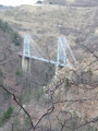
A climb on the Train Jaune from Fontpédrouse to La Cabanasse, followed by a beautiful, tree-lined descent along the River Têt.A lovely walk, partly through the forest; this is a different route from La Cabanasse to Planès suggested by PO Express, with the chance to find a few porcini mushrooms depending on the season, and to pass under the Gisclard Bridge, a true engineering marvel for its time.
From Mantet to Estany Negre via the Carança Valley
10.36 mi
+5,781 ft
-2,654 ft
8 hrs
 Very difficult
Departure from Mantet (Pyrénées-Orientales)
Stage1 of this Mantet-Carança circular walk. From valley to valley, with a wide variety of landscapes and panoramic views.
Suitable only for experienced walkers. However, this stage can be split: spend the night at the Ulldeter mountain hut.