


Refine your search for walks in Chalet de la Vénitier
Chalet de la Vénitier walks

No walk here yet
There are no hikes starting from or close to “Chalet de la Vénitier”
Walks near Chalet de la Vénitier
 Alpine pastures and waterfalls of Valmorel
 Visorando Member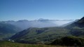
 5.83 mi
 +1,253 ft
 -1,532 ft
 3h 45
3h 45
 Moderate
 Departure from Les Avanchers-Valmorel (Savoie)
A short hike with moderate elevation gain, suitable for a family outing with young children. The route takes you through working mountain pastures, offering beautiful views of the surrounding mountains, and passes by the foot of three stunning waterfalls.
Lac de la Grande Léchère mountain hut – Montartier Lakes
10.81 mi
+4,577 ft
-3,084 ft
8h 55
 Difficult
Departure from Montgellafrey (Savoie)
Difficult
Departure from Montgellafrey (Savoie)
A lovely climb through the upper pastures where the cows that produce the milk for Beaufort cheese graze, with views of the Vanoise, the Thabor Massif, the Aiguilles d’Arves and the foothills of the Écrins. Then the route changes direction, offering views of Belledonne, the Chartreuse and the Bauges, before setting up camp at the Montartier Lakes.
Nant Fourchu stream car park – Chalets de l’Eau Froide
8.13 mi
+4,140 ft
-2,103 ft
7h 20
 Very difficult
Departure from École (Savoie)
Very difficult
Departure from École (Savoie)
First day of a two-day route around the Pointe d’Arcalod, the highest point in the Bauges, crossing wild areas, valleys and rivers. The proposed route mainly follows the eastern section of the GR® de Pays Tour de l’Arcalod, marked in yellow and red. Spectacular views of the mountains and Lake Annecy. This wild and little-used route is situated mainly within a sensitive, regulated area.The terrain is good and presents no particular difficulties.
From Albertville station to the Refuge du Soplat des Streams
 7.03 mi
+4,177 ft
-604 ft
6h 50
Difficult
Departure from Albertville (Savoie)
7.03 mi
+4,177 ft
-604 ft
6h 50
Difficult
Departure from Albertville (Savoie)
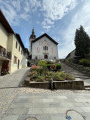
A lovely climb starting from Albertville, passing through the medieval town of Conflans and pretty mountain hamlets with views of the Tarentaise Valley, before reaching the Refuge du Soplat des Stream. The refuge is ideally located near the Tour du Beaufortain with a beautiful view of Albertville and the Olympic Park. Hike to be done from May to November: avalanche risk in winter above 1,100 metres.
Valbuche – Montpascal
5.98 mi
+2,096 ft
-4,669 ft
5 hrs
Very difficult
Departure from Saint-Jean-de-Belleville (Savoie)
The second day of a two-day hike in the Maurienne region, including a bivouac.
Montpascal – Valbuche
 8.10 mi
+4,413 ft
-1,834 ft
5 hrs
Very difficult
Departure from Pontamafrey-Montpascal (Savoie)
8.10 mi
+4,413 ft
-1,834 ft
5 hrs
Very difficult
Departure from Pontamafrey-Montpascal (Savoie)
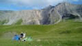
First day of a two-day hike in the Maurienne with a bivouac.
Hike completed in 2016 with a break at the Col de la Baisse, another above the Chalet des Brunes and a final one at the Chalet du Tovet.
Note: The route shown is based on my GPS watch, which I never paused, which explains the circular patterns in certain places.