


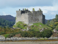
The walk starts from the small car park (free of charge for once) near the ruins of Tioram Castle.
After about 1 km, the route leaves Loch Moidart to follow and ascend the course of a stream fed by a small loch that has been artificially raised to collect water for the few houses below.
Once you reach this first small loch, the path becomes wetter, much like the high-altitude Scottish trails that cross marshy areas fed by a multitude of streams rushing down from the surrounding hills.
Beyond the 3 km mark, the path descends quite steeply towards Loch Moidart, merging in places with the stream it follows.
The ‘coastal’ section of the return journey follows part of the Silver Walk; it is less damp but more challenging: a succession of ascents and descents, rocky outcrops, tree roots, fallen trees and a brief, sheer section that is very uncomfortable for anyone with a fear of heights.
In short, whilst the walk isn’t long, it isn’t necessarily easy, especially if it’s raining or has rained recently.
Castle Tioram and the Silver Walk


Tioram Castle is situated on the island of the same name, accessible on foot via the sandbank that emerges at low tide. Anyone tempted to go and see it up close should be wary not only of the rising tide but also of the condition of the ruins, where the occasional falling stone cannot be ruled out.
Details
Creation:
Last update:
Last review:
–
–
-
 Activity: Walking
 -
 Distance: 3.57 mi
 -
 Average duration: 2h 15
 -
 Difficulty: Easy
 -
-
 Back to start: Yes
 -
 Ascent: + 712 ft
 -
 Descent: - 715 ft
 -
-
 Highest point: 502 ft
 -
 Lowest point: 10 ft
-
 Country:
United Kingdom
Country:
United Kingdom
-
 City:
Highland
City:
Highland -
 Start/End: N 56.781071° / W 5.825039°
 -


 Hour-by-hour weather
Photos
Description of the walk
Waypoints
- S/E : mi 0 - alt. 30 ft - Tioram car park
- 1 : mi 1.03 - alt. 430 ft - Reservoir
- 2 : mi 2.39 - alt. 30 ft - Silver Walk
- 3 : mi 3.37 - alt. 23 ft - Tioram Castle
- S/E : mi 3.57 - alt. 30 ft - Tioram car park
Other walks in the area
Strontian Lead Mines via Ariundle Oakwoods
 Visorando Member
 6.43 mi
+843 ft
-837 ft
3h 40
6.43 mi
+843 ft
-837 ft
3h 40
 Average
 Departure from Highland
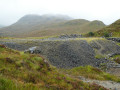
The magnificent Ariundle Nature Reserve offers the chance to explore a forest of centuries-old oak trees. Information boards indicate that this forest was already mentioned in the very first recorded censuses, probably dating back to the15th century. The two sections through the Strontian River valley are also a feast for the eyes.
Loch Teacuis
 4.05 mi
+318 ft
-259 ft
2h 10
Average
Departure from Highland
4.05 mi
+318 ft
-259 ft
2h 10
Average
Departure from Highland
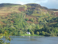
The walk starts in the middle of nowhere. It is advisable to park at the quarry. The proposed walk is deliberately limited to a “good”, motorable forest track and offers lovely views of the loch, the opposite shore and, towards the end, the junction with the central part of Loch Sunart.The end point is a slipway for forestry vehicles.Please note: the route is not circular … you’ll need to allow for at least double the distance to get back to your car.
Auliston Point
 2.97 mi
+456 ft
-449 ft
1h 45
Average
Departure from Highland
2.97 mi
+456 ft
-449 ft
1h 45
Average
Departure from Highland
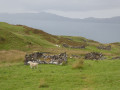
Auliston Point, the north-westernmost point of the Morvern Peninsula, where the Sound of Mull meets Loch Sunart, is a prime spot for spotting marine life.There’s no guarantee you’ll spot any, of course, but it’s not uncommon to see seals and dolphins, in particular. Binoculars are essential if you want to identify them accurately, as they’re usually quite far out to sea near the navigation buoys.
Tobermory Lighthouse, Isle of Mull
 Tourism professional
 3.60 mi
+423 ft
-413 ft
2h 00
Easy
Departure from Argyll and Bute
3.60 mi
+423 ft
-413 ft
2h 00
Easy
Departure from Argyll and Bute
A circular walk starting at Tobermory Distillery and heading along a good path to the lighthouse. The return takes you onto higher ground and along the edge of the golf course for fantastic views down into Tobermory.
Aros Park Waterfalls & Lochan Trail, Isle of Mull
 1.92 mi
+210 ft
-210 ft
1h 05
Average
Departure from Argyll and Bute
1.92 mi
+210 ft
-210 ft
1h 05
Average
Departure from Argyll and Bute
This route combines the Waterfalls Trail and Lochan Trail within Aros Park. You will pass both the Upper and Lower Falls on Aros Burn then walk around the east side of peaceful Lochan Gharrabain.
Old Ardtornish Castle
 4.23 mi
+154 ft
-118 ft
2h 05
Average
Departure from Highland
4.23 mi
+154 ft
-118 ft
2h 05
Average
Departure from Highland
A charming starting point with a lovely free car park, a souvenir shop and a shop selling local produce from the surrounding farms.And then a walk where you’re likely to encounter nothing but nature and the ferries on the Sound of Mull!
Loch Tearnait
 6.73 mi
+535 ft
-531 ft
3h 35
Average
Departure from Highland
6.73 mi
+535 ft
-531 ft
3h 35
Average
Departure from Highland
The first objective of the walk is Loch Tearnait, a lovely mountain loch. The second objective is to stay on a wide, dry path… essential after several days of incessant rain in this part of Scotland. Thethird objective is to explore the slopes to the south of the local summit.
Rubha Beach & Point of Sleat
5.47 mi
+617 ft
-617 ft
3h 05
Average
Departure from Highland
The route of this hike leads to the tip of Sleat, a quiet and splendid place. Before reaching the tip, the path passes by a superb beach in Camas Daraich Bay, with white sand and turquoise sea, depending on the weather! This beach alone can be the goal of this hike if you decide to return by the same route.
For more walks, use our search engine .
The GPS track and description are the property of this route's author. Please do not copy them without permission.

