Auliston Point

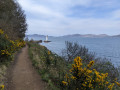
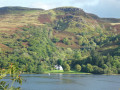
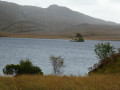
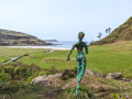
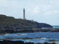
Auliston Point, the north-westernmost point of the Morvern Peninsula, where the Sound of Mull meets Loch Sunart, is a prime spot for spotting marine life.
There’s no guarantee you’ll spot any, of course, but it’s not uncommon to see seals and dolphins, in particular. Binoculars are essential if you want to identify them accurately, as they’re usually quite far out to sea near the navigation buoys.

Details

103598921
Creation:
Last update:
Last review:
  • Walking
    Activity: Walking
  • ↔
    Distance: 2.97 mi
  • ◔
    Average duration: 1h 45 
  • ▲
    Difficulty: Moderate

  • ⚐
    Back to start: No
  • ↗
    Ascent: + 456 ft
  • ↘
    Descent: - 449 ft

  • ▲
    Highest point: 466 ft
  • ▼
    Lowest point: 10 ft

Photos

Description of the walk

Please be careful at the starting point (S) not to obstruct long vehicles turning round or the makeshift jetty for the seasonal ferry.
The route climbs the hill along a wide track for over 3 km, passing a brand-new artisan distillery (Nc’nean gin and whisky) (2) before branching left onto a mule track (3) (well, in this case, cows and sheep) heading towards the ocean.
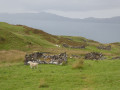
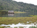
The track disappears near the ruins of the former hamlet of Auliston (E), which was abandoned in the 19th century following a change of landowner who decided to reclaim the land for livestock farming. Some of the locals emigrated to the Oronsay peninsula, whilst others joined one of the many waves of immigrants heading for the New World, like so many other Scots.
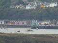
Of particular note during the climb are the beautiful views of the Isle of Mull, especially the harbour and the colourful houses of Tobermory (somewhat reminiscent of those in Portree harbour on the Isle of Skye).
In fine weather, there’s a beautiful sunset over the Isle of Mull.

Please note: the suggested route is a one-way trip!
Return via the same route taken on the way out or, for the more adventurous, across open country (no path) for about 2 km along the coastal foothills to the northern edge of Drimnin.

Waypoints

  1. S : mi 0 - alt. 10 ft - Drimnin Harbour
  2. 1 : mi 0.16 - alt. 72 ft - Drimnin
  3. 2 : mi 0.93 - alt. 279 ft - Nc'nean distillery
  4. 3 : mi 2.03 - alt. 463 ft - Leave the path
  5. E : mi 2.97 - alt. 16 ft - Near Auliston Point

Notes

At (3), it is possible to continue along the path to the former hamlet of Dorlin or Doirlinn, 7.6 km further on, directly opposite the south-eastern tip of Oronsay.

As the map shows, the route reaches the former hamlet of Auliston but not actually Pointe d’Auliston itself. To reach Pointe d’Auliston itself, it is best to continue along the path shown at (3) for about 500 metres and then take another path that branches off to the right and winds its way downhill to Pointe d’Auliston.

Other walks in the area

For more walks, use our search engine .

The GPS track and description are the property of this route's author. Please do not copy them without permission.