Gerlette Waterfall

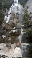
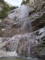
A beautiful waterfall in the heart of a wild, natural cirque.

Details

43567653
Creation:
Last update:
Last review:
  • Walking
    Activity: Walking
  • ↔
    Distance: 2.53 mi
  • ◔
    Average duration: 2h 00 
  • ▲
    Difficulty: Moderate

  • ⚐
    Back to start: Yes
  • ↗
    Ascent: + 948 ft
  • ↘
    Descent: - 968 ft

  • ▲
    Highest point: 3,114 ft
  • ▼
    Lowest point: 2,592 ft

Photos

Description of the walk

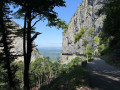
The best way to reach the village of Malleval-en-Vercors is via the dizzying Gorges du Nan road. The car park at the start of the walk is by the church.

(S/E) Follow the start of the track, then the path signposted ‘Waterfall de la Gerlette’, heading north-east.

(1) The path soon descends gently through the woodland and joins an old track at the Tessonnière signpost.

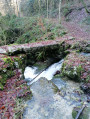
(2) The path turns into an old mule track. Note: a small, unremarkable cave can be seen on the right. You’ll reach a pretty crossroads with a small stone bridge.

(3) Continue to the right, uphill, towards the waterfall.

(4) Ford the torrent several times and continue climbing. Follow the yellow and green markings carefully through the undergrowth, amongst moss-covered trees and over a jumble of rocks. Take care, as it can be slippery. You’ll reach the Gerlette Waterfall fairly quickly.

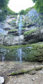
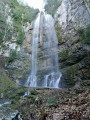
(5) Enjoy the view of the waterfall, which plunges more than 50 metres into its wild cirque.
The return journey follows the same route back to the Tessonnière signpost.

(2) Don’t forget to take the path on the left that leads uphill to reach the church at Malleval-en-Vercors (S/E).

Waypoints

  1. S/E : mi 0 - alt. 3,064 ft - Church of Malleval-en-Vercors
  2. 1 : mi 0.19 - alt. 2,966 ft - Slightly downhill path
  3. 2 : mi 0.47 - alt. 2,792 ft - Junction, Tessonnière
  4. 3 : mi 0.78 - alt. 2,595 ft - Bridge over the Gerlette
  5. 4 : mi 1.09 - alt. 2,877 ft - Ford
  6. 5 : mi 1.26 - alt. 3,074 ft - Cascade de Gerlette
  7. S/E : mi 2.53 - alt. 3,064 ft - Church of Malleval-en-Vercors

Notes

Make sure you wear good, high-top, waterproof shoes if possible.
The path leading to the waterfall is quite damp and slippery with leaves.

Worth a visit

The village of Malleval-en-Vercors.

Reviews and comments

4.3 / 5
Based on 2 reviews

Reliability of the description
4.5 / 5
Ease of following the route
4.5 / 5
Route interest
4 / 5
lea26
lea26

Overall rating : 4 / 5

Date of your route : May 05, 2025
Reliability of the description : ★★★★☆ Good
Ease of following the route : ★★★★☆ Good
Route interest : ★★★★☆ Good
Very busy route : Yes

We went on this walk in the afternoon. It’s well signposted. You follow the stream down a lovely slope which leads to the first small waterfall, No. 4.
After that, to get to the Gerlette waterfall, you have to cross the stream several times, but it’s very slippery on the stones.
We came across some people who’d slipped into the water, and they warned us.
This walk is not recommended if it has rained, or if you’re with children or older people like us. Although we’re keen walkers, we slipped a few times too.

Machine-translated

CFou
CFou

Overall rating : 4.7 / 5

Date of your route : Jul 28, 2024
Reliability of the description : ★★★★★ Very good
Ease of following the route : ★★★★★ Very good
Route interest : ★★★★☆ Good
Very busy route : No

A return walk, not particularly difficult and shaded throughout. The final section isn’t signposted, but there’s only one path, so you can’t go wrong. The estimated time is generous (I did it in 1 hour 45 minutes without rushing too much).
The approach to Malleval is spectacular (the Nan Gorges), but you need to bear in mind the return journey (you’ll often have to reverse on the narrow road to give way to oncoming traffic).

Machine-translated

Other walks in the area

For more walks, use our search engine .

The GPS track and description are the property of this route's author. Please do not copy them without permission.