Cap de la Hague

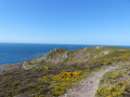
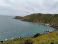
Easy walk: no significant elevation gain, just enough to enjoy some lovely views.

⚠️ 10 July 2026: The walk has been modified to avoid the pebble bank between the Goury blockhouse and the Croix du Vendémiaire, which is a sensitive area and strongly discouraged from April to July.

Details

117936
Creation:
Last update:
Last review:
  • Walking
    Activity: Walking
  • ↔
    Distance: 7.40 mi
  • ◔
    Average duration: 3h 40 
  • ▲
    Difficulty: Easy

  • ⚐
    Back to start: Yes
  • ↗
    Ascent: + 331 ft
  • ↘
    Descent: - 315 ft

  • ▲
    Highest point: 259 ft
  • ▼
    Lowest point: 10 ft

Photos

Description of the walk

After parking your car in the designated car park, to the right of the road leading to Port de Goury, walk down the D901 to the Tourist Office.

(S) Head south along Rue du Perret, which bends left, towards the east, and climbs towards the few houses in La Valette.

(1) At the end of Rue du Perret, you’ll come out onto the D401; take this road by turning left at the hairpin bend; you’re now on Route de la Roche, which takes you to the centre of Auderville.

(2) Turn left into Rue de l’Eglise, then, after 40 metres, turn right into Rue du Grand Doué or the D45. Without changing roads, leave Auderville and enter the commune of Saint-Germain-des-Vaux via Rue du Haut. Pass by a wash house and continue along the D45. Rue du Haut becomes Rue de la Cavée. Pass another wash house on the right. Carry on and leave the D45 by turning right before the church.

(3) After 50 metres, turn left at the Fork in the road heading south-east. The road descends towards the pumping station. As you pass, you’ll see the Church of Notre-Dame on your left.

(4) At the pumping station, turn right onto the Route de Jobourg. After 80 metres, turn left towards the Jacques Prévert Garden.

(5) Follow the path which runs alongside the Jacques Prévert Garden at the far end of the Val des Moulins. After the garden entrance, continue to the right along the path which leads past a few houses.

(6) You’ll come back onto the tarmac road, which leads to the D45 running along the coast.

(7) Facing the sea, turn left onto the D45 or Route de Port Racine. The road climbs slightly, passes the Hôtel l’Ergillère on the right and, shortly afterwards, you’ll go down a few steps on the right to join the coastal path, which combines theGR®®223and theGR®® de Pays Tour de la Hague. From this point onwards, stay on the coastal path until you reach Goury.

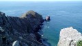
(8) Pass close to Fort Saint-Martin, where a chapel is visible on private property to the right. Continue along the path to enter the La Hague protected nature reserve. Cross the D202, then the Route de Bombec. You’ll need to climb over low walls several times. Fortunately, small steps have been built to make the crossing easier.

(9) About 1,200 metres after the Route de Bombec, you’ll cross the D402 and, a little further on, a road leading to the Bergerie des Etennevaux.

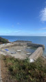
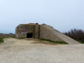
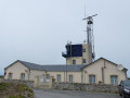
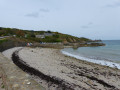
(10) After about 700m, you’ll pass the La Hague signal station and then a blockhouse. Take the coastal path (GR® 223) situated just above the beach ridge, then head towards the Croix du Vendémiaire and the lighthouse via the path, without walking on the pebbles.

(11) Finish the walk by passing close to the Croix du Vendémiaire and return to the starting point at the Tourist Office, or head straight back to your cars.

Waypoints

  1. S/E : mi 0 - alt. 16 ft - Goury Tourist Office
  2. 1 : mi 0.47 - alt. 115 ft - La Valette
  3. 2 : mi 0.86 - alt. 194 ft - Turn left, then right, onto Rue du Grand Doué
  4. 3 : mi 1.63 - alt. 226 ft - Turn right off the D45
  5. 4 : mi 2.17 - alt. 197 ft - Route de Jobourg on the right
  6. 5 : mi 2.28 - alt. 187 ft - Turn left towards the Jacques Prévert Garden
  7. 6 : mi 2.83 - alt. 66 ft - La Vallée
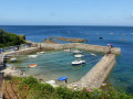
  8. 7 : mi 3.01 - alt. 23 ft - Arrival near Port Racine
  9. 8 : mi 3.4 - alt. 46 ft - Near Fort Saint-Martin
  10. 9 : mi 5.07 - alt. 20 ft - Junction with the D402
  11. 10 : mi 5.8 - alt. 23 ft - Semaphore - Sémaphore de la Hague
  12. 11 : mi 7.1 - alt. 16 ft - Croix du Vendémiaire - Phare du Cap de La Hague
  13. S/E : mi 7.4 - alt. 16 ft - Goury Tourist Office

Always be cautious and plan ahead when you're outdoors. Visorando and the author of this route cannot be held responsible for any accidents occurring on this route.

The GR® and PR® markings are the intellectual property of the Fédération Française de Randonnée Pédestre.

Reviews and comments

4.7 / 5
Based on 78 reviews

Reliability of the description
4.7 / 5
Ease of following the route
4.7 / 5
Route interest
4.7 / 5
lntess
lntess

Overall rating : 5 / 5

Date of your route : Sep 09, 2025
Reliability of the description : ★★★★★ Very good
Ease of following the route : ★★★★★ Very good
Route interest : ★★★★★ Very good
Very busy route : No

Magnificent landscapes, paths that are very quiet at this time of year. A very beautiful hike

Machine-translated

Stclair
Stclair

Overall rating : 4.7 / 5

Date of your route : Sep 13, 2025
Reliability of the description : ★★★★☆ Good
Ease of following the route : ★★★★★ Very good
Route interest : ★★★★★ Very good
Very busy route : No

Great, beautiful region that is still unspoilt; the coastline is not urbanised like in many other regions.
We will gladly return

Machine-translated

Stclair
Stclair

Overall rating : 4.7 / 5

Date of your route : Sep 13, 2025
Reliability of the description : ★★★★☆ Good
Ease of following the route : ★★★★★ Very good
Route interest : ★★★★★ Very good
Very busy route : No

Great, beautiful region that is still unspoilt; the coastline is not urbanised like in many other regions.
We will gladly return

Machine-translated

Dispo
Dispo

Overall rating : 5 / 5

Date of your route : Aug 11, 2025
Reliability of the description : ★★★★★ Very good
Ease of following the route : ★★★★★ Very good
Route interest : ★★★★★ Very good
Very busy route : Yes

A very beautiful walk, especially between Port Racine and Goury along the cliffs. We started our hike from the Port Racine car park, which allowed us to enjoy fish and chips for lunch in Goury.

Machine-translated

PierreSmi
PierreSmi
• Edited:

Overall rating : 4.7 / 5

Date of your route : Aug 10, 2025
Reliability of the description : ★★★★★ Very good
Ease of following the route : ★★★★★ Very good
Route interest : ★★★★☆ Good
Very busy route : Yes

Very nice ride.
A few busy sections and quite a lot of tarmac in the back country, but the ride is very pleasant.

Machine-translated

Lukowiak Michel
Lukowiak Michel

Overall rating : 5 / 5

Date of your route : Jun 22, 2025
Reliability of the description : ★★★★★ Very good
Ease of following the route : ★★★★★ Very good
Route interest : ★★★★★ Very good
Very busy route : No

A must-do. Please note that the end of the route does not correspond to the description. However, it is easy to find your way back to the starting point.

Machine-translated

User 11989188

Overall rating : 4.7 / 5

Date of your route : Jun 07, 2025
Reliability of the description : ★★★★★ Very good
Ease of following the route : ★★★★★ Very good
Route interest : ★★★★☆ Good
Very busy route : No

very interesting journey

Machine-translated

Claude R
Claude R

Overall rating : 4.7 / 5

Date of your route : Jun 12, 2025
Reliability of the description : ★★★★☆ Good
Ease of following the route : ★★★★★ Very good
Route interest : ★★★★★ Very good
Very busy route : No

Caution! Between points 9 and 10 of the hike, the trail has collapsed. There are a few difficult sections.

Machine-translated

User 20073096

Overall rating : 4.3 / 5

Date of your route : Jun 03, 2025
Reliability of the description : ★★★★☆ Good
Ease of following the route : ★★★★☆ Good
Route interest : ★★★★★ Very good
Very busy route : No

Lovely views of the coast and pretty villages Difficult to start with but well worth the diversions

Machine-translated

User 12257802

Overall rating : 5 / 5

Date of your route : May 26, 2025
Reliability of the description : ★★★★★ Very good
Ease of following the route : ★★★★★ Very good
Route interest : ★★★★★ Very good
Very busy route : Yes

Superb walk with magnificent scenery

Machine-translated

Mlaure-Thierry
Mlaure-Thierry

Overall rating : 4.3 / 5

Date of your route : May 01, 2025
Reliability of the description : ★★★★★ Very good
Ease of following the route : ★★★★☆ Good
Route interest : ★★★★☆ Good
Very busy route : No

A pleasant walk through the various villages, with a visit to Jacques Prevert's garden along the way. Please note, however, that you cannot pay by credit card. The little Port Racine is still very pretty, and the return journey along the coastal path to Port Goury is top-notch!

Machine-translated

Jean-Marc42
Jean-Marc42

Overall rating : 4 / 5

Date of your route : Aug 15, 2024
Reliability of the description : Not used / Not applicable
Ease of following the route : ★★★★☆ Good
Route interest : ★★★★☆ Good
Very busy route : No

Thanks to the author of this route, we parked before the indicated point but that was no problem, the little port Racine is very surprising. The return from Port Racine is a bit too much on the road for my liking, but it's still a nice walk.

Machine-translated

michel tout court
michel tout court

Overall rating : 4.7 / 5

Date of your route : Jul 24, 2024
Reliability of the description : ★★★★★ Very good
Ease of following the route : ★★★★★ Very good
Route interest : ★★★★☆ Good
Very busy route : No

We did this route in reverse, leaving from Port Racine and doing the tarmac section first.
Very pleasant coastal path. Narrow path at times as the sea and vegetation gain ground.

Machine-translated

Jairaison
Jairaison

Overall rating : 5 / 5

Date of your route : Jun 29, 2024
Reliability of the description : ★★★★★ Very good
Ease of following the route : ★★★★★ Very good
Route interest : ★★★★★ Very good
Very busy route : Yes

The most accessible parts of this route are popular. For lovers of gardens (and Prévert), don't miss the visit to the Jardin en hommage à Prévert. Check the days and times of the visit to ensure they coincide with your itinerary.
Before arriving at the Semaphore de la Hague, it was difficult to find the GR because access was blocked at one point. Keep to the right to go towards the semaphore.
After the blockhouse, also take care as several paths are signposted. Make sure you take the pebble dike near the sea.

Machine-translated

benoitrando
benoitrando

Overall rating : 5 / 5

Date of your route : Apr 22, 2024
Reliability of the description : ★★★★★ Very good
Ease of following the route : ★★★★★ Very good
Route interest : ★★★★★ Very good
Very busy route : Yes

Very nice trace

Machine-translated

Other walks in the area

For more walks, use our search engine .

The GPS track and description are the property of this route's author. Please do not copy them without permission.