


Refine your search for walks in Canal de Craponne
Canal de Craponne walks


 Chambremont
 Visorando Member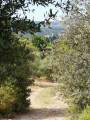
 3.71 mi
 +118 ft
 -118 ft
 1h 50
1h 50
 Easy
Easy
 Departure from Mouriès (Bouches-du-Rhône)
A short walk along the Craponne Canal (Arles branch), then through the Chambremont heath.
Around La Roque d'Anthéron
 5.61 mi
+85 ft
-85 ft
2h 40
Easy
Departure from La Roque-d'Anthéron (Bouches-du-Rhône)
5.61 mi
+85 ft
-85 ft
2h 40
Easy
Departure from La Roque-d'Anthéron (Bouches-du-Rhône)
From the Cistercian Abbey of Silvacane to the village, following the Durance. An easy walk combining history and nature.Moderator’s note: this walk description is quite old – please check the comments at the bottom of this page
Mur des Abeilles, the ridges of the Défens d’Eyguières and the Calès Caves
 7.10 mi
+1,125 ft
-1,125 ft
4h 15
7.10 mi
+1,125 ft
-1,125 ft
4h 15
 Moderate
Departure from Lamanon (Bouches-du-Rhône)
Moderate
Departure from Lamanon (Bouches-du-Rhône)
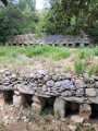
This route, which presents no particular difficulties, is designed to appeal to both walkers seeking beautiful views and history enthusiasts. It offers a pleasant way to discover a corner of Provence between the Durance and the Alpilles whilst appreciating the harmony with nature that people have been able to achieve over the centuries.
Notes: as there are numerous paths in this area, the use of a GPS is strongly recommended. The suggested routes, which largely avoid forest tracks, can be viewed on OSM and OSM Rando maps. Although largely shaded, the route is exposed to the sun during the climb up the Défens.
 From Salon-de-Provence to Grans via small paths
 Walks near Canal de Craponne
From Mérindol to Cucuron
 18.44 mi
+3,422 ft
-2,858 ft
11h 25
18.44 mi
+3,422 ft
-2,858 ft
11h 25
 Difficult
Departure from Mérindol (Vaucluse)
Difficult
Departure from Mérindol (Vaucluse)
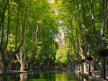
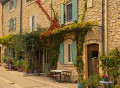
This second stage of the Tour du Luberon takes place on the sunny side of the Durance valley, through the wooded valleys of the Luberon Nature Park. From Mérindol, the route follows the valleyfloor and, after passing Les Borrys, climbs towards the Pic de l’Aigle before descending into the Vallon du Gros Ubac, which it follows to reach the Combe de Recaute. It climbs its slope then crosses over to the Combe du Sautadou, which it descends before climbing up the Vallon des Séyes and reaching the Cap de Serre. Via the Vallon du Bon Dieu, it reaches Lourmarin and, skirting the foot of the Grand Luberon, heads to Cucuron.
From Cucuron to Vitrolles-en-Lubéron
 15.61 mi
+3,950 ft
-3,337 ft
10h 35
Difficult
Departure from Cucuron (Vaucluse)
15.61 mi
+3,950 ft
-3,337 ft
10h 35
Difficult
Departure from Cucuron (Vaucluse)
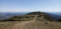
This third stage takes you through the forests on the southern slopes of the Grand Lubéron. From Cucuron, the route climbs gently northwards across fields, then rises steeply up the wooded flank of the Montagne du Grand Lubéron and, following various valleys, reaches the bare ridge at the small pass of Basse Cabrière, east of the Mourre Nègre, the highest point of the massif. It winds along the ridge and, at its end, drops down the northern slope, then, skirting Mont La Grand Colle, returns south via the Vallat de la Combe d’Apt, before reaching Vitrolles-en-Lubéron.
From Sivergues to Vitrolles via the Luberon ridges
 13.06 mi
+2,159 ft
-2,703 ft
7h 55
Difficult
Departure from Sivergues (Vaucluse)
13.06 mi
+2,159 ft
-2,703 ft
7h 55
Difficult
Departure from Sivergues (Vaucluse)
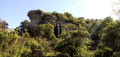
This second stage is both long and superb! First, you climb the highest point of the Luberon, the Mourre Nègre, alternating between steep paths and gently sloping tracks. Then, you follow the ridges from west to east, always on open terrain with sweeping panoramic views. The (long) descent to Vitrolles is shaded.
From Apt to Sivergues via the Rocher des Druides
 6.27 mi
+2,106 ft
-630 ft
4h 45
Moderate
Departure from Apt (Vaucluse)
6.27 mi
+2,106 ft
-630 ft
4h 45
Moderate
Departure from Apt (Vaucluse)
This first stage is mainly uphill, leading to the foot of the western part of the Grand Luberon ridges. Halfway through, there is a descent to pass by the foot of the Rocher des Druides and the hamlet of Roscalière, followed by a climb back up. It is possible to avoid this detour and thus shorten the stage.