Around La Roque d'Anthéron

From the Cistercian abbey of Silvacane to the village along the Durance. An easy walk combining history and nature.
Moderator's note: this is a fairly old hiking guide; please refer to the comments at the bottom of this page

Details

17259
Creation:
Last update:
Last review:
  • Walking
    Activity: Walking
  • ↔
    Distance: 5.61 mi
  • ◔
    Average duration: 2h 40 
  • ▲
    Difficulty: Easy

  • ⚐
    Back to start: Yes
  • ↗
    Ascent: + 85 ft
  • ↘
    Descent: - 85 ft

  • ▲
    Highest point: 554 ft
  • ▼
    Lowest point: 469 ft

Photos

Description of the walk

Departure: Silvacane Abbey car park (S/E).

Head east along the marked trail that runs alongside the D561a road, then descend towards the EDF canal.

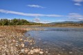
(1) Cross it. Continue left on the marked trail heading west (the canal embankment is closed to traffic). The trail winds between the canal and the Durance. There are numerous paths providing access to the banks of the Durance.

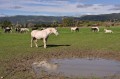
(2) Return and stay on the north bank of the canal. The path then crosses "Les Iscles", an agricultural area with alternating fields of artichokes, vines and horses.
Still following the canal, the path moves away from the Durance. Tunnels allow you to pass under the canal.

(3) Take the second one to head towards the village.
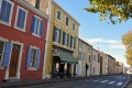
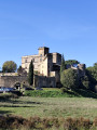
Take a quick tour of the village (the Mail, the castle, the church).

(4) Head back down along the park (where the famous piano festival takes place) via Avenue du Parc.
At the junction with the D23, turn right and continue for just over a kilometre.

(5) Pay attention to the signposts: the path turns right and crosses a cultivated area before climbing back up to the abbey car park (S/E).

Waypoints

  1. S/E : mi 0 - alt. 551 ft - Silvacane Abbey car park - Canal de Marseille
  2. 1 : mi 0.82 - alt. 525 ft - EDF canal
  3. 2 : mi 1.71 - alt. 482 ft - Bank of the - La Durance
  4. 3 : mi 3.39 - alt. 469 ft - 2nd tunnel - Canal de Craponne
  5. 4 : mi 4.27 - alt. 472 ft - Parc de la Roque
  6. 5 : mi 5.06 - alt. 482 ft - Crossroads on the return trail
  7. S/E : mi 5.61 - alt. 551 ft - Silvacane Abbey car park

Notes

Some parts of the route are on roads.

Access to the banks of the Durance is not signposted.

Worth a visit

Reviews and comments

3.5 / 5
Based on 31 reviews

Reliability of the description
3.8 / 5
Ease of following the route
3.8 / 5
Route interest
3 / 5
pilou457
pilou457

Overall rating : 3 / 5

Date of your route : Jan 01, 2025
Reliability of the description : ★★★★☆ Good
Ease of following the route : ★★★☆☆ Average
Route interest : ★★☆☆☆ Disappointing
Very busy route : No

Hike taken the day after New Year's Eve, so ideal for getting back into shape. The view of the canal hill is uninteresting. As I said, "good for the day after a party".

Machine-translated

LIONEL13118
LIONEL13118

Overall rating : 4 / 5

Date of your route : Oct 01, 2024
Reliability of the description : Not used / Not applicable
Ease of following the route : Not used / Not applicable
Route interest : ★★★★☆ Good
Very busy route : No

Thank you for sharing.

Machine-translated

jean-louis pin
jean-louis pin

Overall rating : 5 / 5

Date of your route : Dec 03, 2022
Reliability of the description : ★★★★★ Very good
Ease of following the route : ★★★★★ Very good
Route interest : ★★★★★ Very good
Very busy route : No

This route starting from Silvacane is very good... nothing to complain about except for the number of the tank, No. 162, which does not correspond, but that does not change anything! The distance is almost 12 km. A route to be recommended...

Machine-translated

vrchris
vrchris

Overall rating : 1 / 5

Date of your route : Sep 21, 2021
Reliability of the description : ★☆☆☆☆ Very disappointing
Ease of following the route : Not used / Not applicable
Route interest : ★☆☆☆☆ Very disappointing
Very busy route : No

Why didn't I read the comments before going on this walk, which is definitely not a hike...
No interest whatsoever, a long stretch of busy road to get to the start, tarmac, no view as it's below the canal, everything is ugly. It's okay for taking kids for a quiet bike ride, but it's no feast for the eyes!
Is this the only kind of route around the abbey?

Machine-translated

Centuriona
Centuriona

Overall rating : 1.7 / 5

Date of your route : Sep 26, 2020
Reliability of the description : ★★☆☆☆ Disappointing
Ease of following the route : ★★☆☆☆ Disappointing
Route interest : ★☆☆☆☆ Very disappointing
Very busy route : No

A hiking route to be avoided at all costs: completely uninteresting, we were trapped between the EDF Canal and the Durance, which was inaccessible due to overgrown vegetation. The route along the Durance is not feasible. There are no viewpoints, the hike is not interesting, so we cut it short by taking the first tunnel.
HIKE NOT RECOMMENDED in your files.
The only interesting visit is Silvacane Abbey, which can be organised as a tourist attraction rather than a hiking destination.

Machine-translated

cyclotrain
cyclotrain

Overall rating : 2.7 / 5

Date of your route : Jun 15, 2020
Reliability of the description : ★★★★☆ Good
Ease of following the route : ★☆☆☆☆ Very disappointing
Route interest : ★★★☆☆ Average
Very busy route : No

Any route with a fanciful route in the area near the bed of the Durance river

Machine-translated

muriel2006
muriel2006

Overall rating : 3.3 / 5

Date of your route : Mar 16, 2020
Reliability of the description : ★★★★☆ Good
Ease of following the route : ★★★☆☆ Average
Route interest : ★★★☆☆ Average

It appears that part of the path no longer exists, most likely due to flooding. Description to be reviewed.

Machine-translated

Eliane ROS HUGON
Eliane ROS HUGON

Overall rating : 4 / 5

Date of your route : Mar 02, 2020
Reliability of the description : ★★★★☆ Good
Ease of following the route : ★★★☆☆ Average
Route interest : ★★★★★ Very good

It's a shame, but the mileage is different from what is indicated; it only shows 4 km???

Machine-translated

henri57
henri57 ★

Hello,

Thank you for taking the time to give your opinion.

For your information, "Map route" refers to assessing the accuracy of the route as it appears on the map in relation to the actual terrain.

See you soon!

Machine-translated

Qalinka
Qalinka

Overall rating : 2.7 / 5

Date of your route : Feb 09, 2020
Reliability of the description : ★★★☆☆ Average
Ease of following the route : ★★★☆☆ Average
Route interest : ★★☆☆☆ Disappointing

Quite a long stretch near the road... then the path between the canal and the Durance river looked like a rubbish tip, so we climbed up to the canal to walk alongside it, which was much more pleasant and... sunny!
Then the passage through the village was pointless, as the part we crossed only showed us council flats...
I think we'll have to revisit this route!
The only interesting thing was the visit to Silvacane Abbey

Machine-translated

Gindrier Thierry
Gindrier Thierry

Overall rating : 4 / 5

Date of your route : Jan 16, 2020
Reliability of the description : ★★★★☆ Good
Ease of following the route : ★★★★★ Very good
Route interest : ★★★☆☆ Average

Why this walk is interesting:
+: allows you to discover both a village and its surroundings.
+: hiking time and distance are neither too long nor too short.
+ Starts and ends at the Cistercian abbey, which is open to visitors.
-- very difficult to reach the banks of the Drac if it has rained recently (very muddy)
-: Drac side: moderately interesting, a little monotonous and lacking in variety, although the view of the Luberon is beautiful.

- reliability of the description: OK everywhere except point 2, which is difficult to access if it has rained beforehand and the direction is not clearly indicated.

Machine-translated

Netra
Netra ★

Hello jookline, and thank you for your additional comments.

Perhaps the author has something to add?

Machine-translated

Jookline
Jookline

Hello Étienne,

Right from the start, the route does not follow the path exactly, and between points 1 and 2, where you are supposed to turn onto a trail, the trail does not exist. We wanted to persevere, but you have to cross through bushes and a ditch, and in any case, you can't continue after that because the vegetation has taken over and the path no longer exists. You end up wading through a kind of marsh... We had to turn back. We tried to do the walk in the other direction, but it wasn't very interesting, just more tarmac...

Machine-translated

Netra
Netra ★

Hello Jookline, thank you for your comments.

I'm sorry to hear about your disappointment... across the board. I'll make a note of the problems with the tarmac and access... The author may be able to provide some clarification on this.

In what way is the description "disappointing"? Does it not provide sufficient guidance on site?

Machine-translated

Jookline
Jookline

Overall rating : 1.7 / 5

Date of your route : Jan 05, 2020
Reliability of the description : ★★☆☆☆ Disappointing
Ease of following the route : ★★☆☆☆ Disappointing
Route interest : ★☆☆☆☆ Very disappointing

The route is more than approximate. Lots of road. Trail open to vehicles and used as a rubbish tip. Impossible to complete the walk, as point 2 is inaccessible in winter. Not worth it. Angry that I drove 45 minutes to get here.

Machine-translated

Other walks in the area

For more walks, use our search engine .

The GPS track and description are the property of this route's author. Please do not copy them without permission.