


Refine your search for walks in Campile
Campile walks


 Monte Castellare loop
 Visorando Member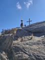
 3.64 mi
 +1,401 ft
 -1,401 ft
 2h 55
2h 55
 Moderate
 Departure from Campile (Haute-Corse)
This magnificent loop on the slopes of Monte Castellare offers breathtaking views of the neighbouring valleys, the plain of Bastia, Elba Island and, on a clear day, even the Italian coast.
It alternates between wooded and open sections until you reach the summit at 1,000 metres, where a magnificent oak tree provides welcome shade for a picnic or a siesta.
The descent takes you through the charming hamlet of Costa.
Mont Sant'Angelo from Carogne
 5.32 mi
+1,926 ft
-1,926 ft
4h 05
5.32 mi
+1,926 ft
-1,926 ft
4h 05
 Difficult
Departure from Monte (Haute-Corse)
Difficult
Departure from Monte (Haute-Corse)
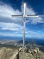
This circular route will take you through pleasant woodland at 1,200 metres above sea level, on Mont Sant'Angelo, which overlooks the Biguglia plain and the sea. Unlike the traditional trail that starts from Silvareccio, the departure from Carogne or Monte will take you off the beaten track on old, abandoned paths and trails and has the advantage of being circular.
(!) Old description, some paths seem to have disappeared, see reviews.
Sant'Angelo from Silvarecciu
 4.23 mi
+1,801 ft
-1,795 ft
3h 30
Moderate
Departure from Silvareccio (Haute-Corse)
4.23 mi
+1,801 ft
-1,795 ft
3h 30
Moderate
Departure from Silvareccio (Haute-Corse)
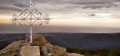
Sant Angelo (1,200 m) is a peak located between Casinca and Castaniccia. At its summit, you can enjoy a 360° view of the sea, the Biguglia lagoon and the surrounding villages and valleys.
The hike takes place in the undergrowth, mostly under the protection of chestnut trees.
Double circular route between Vescovato and Olmu
 7.50 mi
+1,969 ft
-1,972 ft
5h 10
Moderate
Departure from Haute-Corse
7.50 mi
+1,969 ft
-1,972 ft
5h 10
Moderate
Departure from Haute-Corse
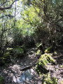
This walk forms a circular route linking the villages of Vescovato and Olmu. It starts in Vescovato, where the architectural heritage is well worth exploring for the curious, and passes through the village of Olmu, which will delight lovers of the ‘old stone’ architecture found in island villages. The landscapes you pass through are varied, ranging from woodland to oak groves and open, exposed areas such as the ridges. Thus, as you move from one slope to another, from one bank to the other, you will have the opportunity to enjoy views of both the sea and the islands bordering Corsica, as well as views of the mountains, which are sometimes snow-capped depending on the season.
Monte San Petrone from Bocca di u Pratu
 7.95 mi
+2,543 ft
-2,520 ft
5h 50
Moderate
Departure from Quercitello (Haute-Corse)
7.95 mi
+2,543 ft
-2,520 ft
5h 50
Moderate
Departure from Quercitello (Haute-Corse)
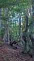
Starting from Col du Pratu (Bocca di u Pratu), this hike takes you to the summit of Castagniccia: Monte San Petrone. There is a magnificent beech forest along the entire route and a superb panorama at the summit.
Mount Sant'Anghjulu and the Lento Refuge as seen from the Col de Bigorno
 Association / Club / Walk leader
 7.66 mi
+1,959 ft
-1,962 ft
5h 15
Moderate
Departure from Bigorno (Haute-Corse)
7.66 mi
+1,959 ft
-1,962 ft
5h 15
Moderate
Departure from Bigorno (Haute-Corse)
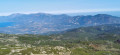
A beautiful mid-mountain route which, from the Col de Bigorno at an altitude of 885 m, takes walkers to the summit of Sant’Anghjulu at 1,389 m. On a clear day, the 360° panorama offers views of some of the highest peaks in Southern Corsica. Nearby, the Lento Refuge is situated on the western side of the I Compuli rocks. It is made available by the local council; the key is hung near the window to the right of the entrance. The only refuge in the Tenda range, this peaceful spot overlooks the Manghjatoghju valley, where animals gather around ‘pozzine’* fed by the numerous springs. A magnificent view opens up over the peaks of Asco and Cortenais. The return journey follows the same route, with the Nebbiu plain, the Gulf of Saint-Florent and Cap Corse to the north. To the south, from the Col de Bocca Forca, the Golo valley and its hilltop villages come into view.
This route is strongly advised against from 15 July to 31 October 2026
See practical information
The Porri Cave
 2.42 mi
+958 ft
-971 ft
1h 55
Moderate
Departure from Porri (Haute-Corse)
2.42 mi
+958 ft
-971 ft
1h 55
Moderate
Departure from Porri (Haute-Corse)
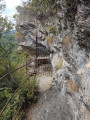
In Haute-Corse, the village of Porri was one of the strongholds of the island's resistance movement. Near the village, a refuge cave known as the "Grotte des Maquisards" (Maquis Cave), which served as the Resistance's headquarters, recalls the contribution of Porri and the Casinca region to the liberation of Corsica. It is well guarded by the Vincetti, Vittori, Bébé Arrighi, Antoine Battesti, Noël Agostini and many others.
Source: France 3 Corse ViaStella
Hamlets and old paths between Castineta and Morosaglia
 2.46 mi
+627 ft
-719 ft
1h 40
2.46 mi
+627 ft
-719 ft
1h 40
 Easy
Departure from Castineta (Haute-Corse)
Easy
Departure from Castineta (Haute-Corse)
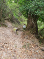
A beautiful little circular walk from the outskirts of Castineta (well worth a visit!). Discover old hamlets and paths between Castineta and Morosaglia. These paths were widely used before the road to Castineta was built.
Circular walk along the Penta di Casinca heritage trail
 0.74 mi
+89 ft
-85 ft
0h 25
Easy
Departure from Penta-di-Casinca (Haute-Corse)
0.74 mi
+89 ft
-85 ft
0h 25
Easy
Departure from Penta-di-Casinca (Haute-Corse)
A walk through the listed hilltop village of Penta di Casinca, with its narrow streets and panoramic viewpoints.
Circular Penta Di Casinca via Palustrico and Castello
 4.73 mi
+1,234 ft
-1,257 ft
3h 15
Moderate
Departure from Penta-di-Casinca (Haute-Corse)
4.73 mi
+1,234 ft
-1,257 ft
3h 15
Moderate
Departure from Penta-di-Casinca (Haute-Corse)
Circular in the Penta Di Casinca valley among the cork oaks and scrubland.
Ridge path to Monte Torriccella above Rutali
6.43 mi
+1,522 ft
-1,496 ft
4h 15
Moderate
Departure from Rutali (Haute-Corse)
This hike will allow you to admire the views of both seas.
The Memory Trail: path at Rutali - Trà aghje è Pagliaghji
 4.21 mi
+335 ft
-338 ft
2h 15
Easy
Departure from Rutali (Haute-Corse)
4.21 mi
+335 ft
-338 ft
2h 15
Easy
Departure from Rutali (Haute-Corse)
This is a route with little elevation gain in the mountains above Rutali, ideal for a family walk. In the middle of the scrubland, there are arbutus trees, oaks and a few chestnut trees. You quickly find yourself isolated in wild nature at an altitude of 600 metres with views of the sea to the east and west. We are facing the base of Cap Corse.
A story of stones and water in Murato
 4.17 mi
+771 ft
-768 ft
2h 35
Easy
Departure from Murato (Haute-Corse)
4.17 mi
+771 ft
-768 ft
2h 35
Easy
Departure from Murato (Haute-Corse)
The village of Murato invites you to discover a trail called Histoire de pierres et d'eau (History of Stones and Water). It is a tourist circuit between village and nature where you can discover Murato Supranu (upper part of the village) and Murato Sottanu. You will pass through narrow streets, old houses, churches, chapels, fountains, pagliaghji (straw huts), wash houses and bread ovens.
This route is not intended to be a long hike, but it has the merit of allowing you to discover the past and can be enjoyed by the whole family.
Circular walks from Murato via San Michele and Teppa di Lucciana
6.22 mi
+955 ft
-961 ft
3h 40
Moderate
Departure from Murato (Haute-Corse)
Here is a new route starting from the Church of Saint Michael in Murato, which quickly takes the walker to discover the ‘Queen’s Rock – Teppa di Luciana’. The archaeological excavations of this ‘enormous rocky chaos’ are described in the ‘Places to See’ section.
On the descent towards the coastal river Bevinco, traces of the area’s agricultural and pastoral past can be seen. In and around the village, there are magnificent historic buildings , including the 12th-century Pisan church , other churches and chapels, as well as restored old structures such as ovens, wash houses and fountains. On the southern outskirts, heading towards the Col de Bigorno, renovated Genoese bridges allow you to cross the Bevinco. An old ice house can be seen beside the Strada di Bigorno, which you’ll take on the return journey. Just before crossing the Pont Neuf, there is a picnic area for walkers. Finally, on arrival, you can visit the Church of San Michele, a12th-century Romanesque building in the Pisan style.
Murato loop, nature and heritage
6.46 mi
+928 ft
-925 ft
3h 45
Moderate
Departure from Murato (Haute-Corse)
This is a lovely family walk around an exceptional village. Not only because of the natural areas you pass through and the scenery they offer, but also because of the history of the place and the preservation of its heritage.
Or quite simply because of the quality of life that Muratu, in the Corsican language, offers its residents, whether they are permanent residents or just passing through. This impression is confirmed by the condition of the buildings – from the renovated old ones to the most recent – as well as by the variety and quality of the shops.
Along the route, walkers will discover, to the south, the plateaus with their rich agro-pastoral history and the ruins of the San Frusulu chapel, which has recently been restored. After a short stretch over the heights of the village of Piève , followed by a descent through the maquis, you reach the banks of the small coastal river ‘the Bevincu’, spanned by its Genoese bridges.
The village centre offers a chance to appreciate Murato’s significant vernacular heritage.
This route is strongly discouraged from 15 July to 31 October 2026
See practical information
Circular Piazzole route via San Damianu and San Bertuli
 9.07 mi
+2,799 ft
-2,785 ft
6h 35
Difficult
Departure from Piazzole (Haute-Corse)
9.07 mi
+2,799 ft
-2,785 ft
6h 35
Difficult
Departure from Piazzole (Haute-Corse)
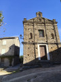
This circular walk in Castagniccia offers the chance to discover both the natural and built heritage of our island. The walk passes through the villages of Piazzole, Bonifaziu, San Damianu and Mont d’Olmu – jewels of the region – and also takes you past the Chapel of San Bertuli. During the summer months, you can also stop there for a welcome and a bite to eat before heading back down to Piazzole. Alongside the built heritage, the route offers natural beauty, with a section through the woodland that provides cool respite in summer, as well as sections along the ridges offering unrivalled views of Castagniccia.
Circular route via the Chiesa Nera
 3.59 mi
+945 ft
-945 ft
2h 30
Easy
Departure from Piève (Haute-Corse)
3.59 mi
+945 ft
-945 ft
2h 30
Easy
Departure from Piève (Haute-Corse)
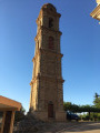
Pleasant circular walk passing the ruins of a 13th-century chapel, with lovely views of Cap Corse, the Gulf of Saint Florent and the Tenda Mountains.
Piève–Sorio circular loop
 3.83 mi
+1,322 ft
-1,329 ft
2h 55
Moderate
Departure from Piève (Haute-Corse)
3.83 mi
+1,322 ft
-1,329 ft
2h 55
Moderate
Departure from Piève (Haute-Corse)
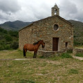
Second circular route of the route: ‘Between the Secular and the Sacred’, created on the initiative of the municipalities of Rapale, Pieve and Sorio, using the old footpaths that once linked the three villages. This route is every bit as good as the previous one when it comes to exploring the local heritage: menhir statues, wash houses, fountains, cobbled alleyways and village paths lined with walls – that’s the secular side.The sacred heritage is equally remarkable, featuring the churches of San Quilico in Pieve, San Filippu Neri in Sorio and the chapels.The return journey from Sorio to Pieve, offering a panoramic view over the Nebbiu plain and the Gulf of Saint Florent, is ideal for taking photographs.
This route is strongly advised against from 15 July to 31 October 2026
See practical information
Croce Niolo and Monte Taglio ridges via Fiuminale
 9.53 mi
+2,756 ft
-2,746 ft
6h 45
Difficult
Departure from Pero-Casevecchie (Haute-Corse)
9.53 mi
+2,756 ft
-2,746 ft
6h 45
Difficult
Departure from Pero-Casevecchie (Haute-Corse)
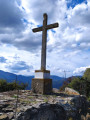
This circular hike, which is not difficult but does require a certain level of fitness, will take you through varied and unspoilt vegetation. Along the way, you will discover the two hamlets of Fiuminale and forests of hundred-year-old chestnut trees. From the summit of Croce Niolo at an altitude of 995 m, you will have a 360° panorama. To the west, you can see Monte San Petrone, the highest peak in Castagniccia. To the east, the Tuscan archipelago: Elba and Monte Cristo. To the north, Casinca and the Bastia region. Unspoilt by mass tourism, you will have the opportunity to visit three traditional villages in the upper Costa Verde region.