Country:
 City:
City:


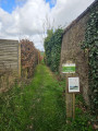
Start: at the end of Rue des Chanterelles in Genappe.
GPS: Rue des Chanterelles 21 - 1470 Genappe.
Parking: you can park near No. 21 or further down the street (which is a cul-de-sac).
(S/E) Take Chemin de Pontaille, which continues from Rue des Chanterelles.
(1) At the end of the path, at the crossroads, turn right onto Rue de l'Égalité, which continues as Drève des Rossignols.
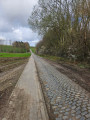
(2) At the first fork, continue straight ahead. The Drève des Rossignols continues as the Chemin (No. 9) de la Bruyère des Censes (an old paved path partly covered with earth). Cross the Ry d'Hez for the first time a few hundred metres further on. About 500 metres after the Ry d'Hez, the Chemin de la Bruyère des Censes turns left and then splits into two (hard surface).
(3) Continue to the left. 250 metres further on, near a farmhouse (on the left), the hard surface gives way to a small dirt track running alongside a copse (on the right). Continue straight ahead.
(4) About 500 metres further on, after house no. 2, take a wide path on the left which joins Chemin Taillis-Locquet (according to Google Maps) or Rue de la Taille Loquet (according to OpenStreetMap).
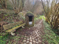
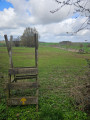
(5) 400 metres further on, take the Sentier des Échaliers on the left (see photo). Pass the two échaliers (wooden steps allowing you to cross over fences) and follow the yellow-painted wooden arrows to Chemin n°1 du Marais des Chiens.
(6) Turn left onto Chemin du Marais des Chiens. Cross over the Ry d'Hez then continue straight on to the “Borne de Ways” crossroads.
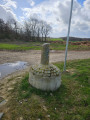
(7) You can shorten the walk by turning left onto Path No. 51 across the fields. However, this 2-kilometre path is less charming than the rest of the walk and is very exposed to the wind and sun. Otherwise, continue straight on. After about 500 metres, the path runs alongside the Bois de Saint-Jean (on the left) and crosses over the Ri du Marais des Chien. Continue for another 500 metres to the crossroads.
(8) Take Rue du Buisson Collinet on the left.
(9) After 400 metres, at the fork, take the path branching off to the left to return to the crossroads from the outward journey.
(1) Head straight ahead to return to the car park (S/E).
 Visorando Member
 Moderate