Countryside, ocean and woodland around Saint-Martin-de-Ré

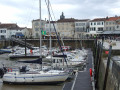
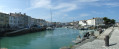
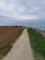
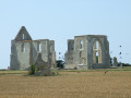
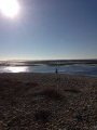
An easy walk offering a variety of scenery: the town of Saint-Martin-de-Ré and Vauban’s fortifications, oyster farmers on the banks of the Pertuis Breton, some marshland and vineyards, the wide beaches on the ocean side (Pertuis d’Antioche), and pleasant pine and cedar woods.

Details

47560315
Creation:
Last update:
Last review:
  • Walking
    Activity: Walking
  • ↔
    Distance: 9.25 mi
  • ◔
    Average duration: 4h 20 
  • ▲
    Difficulty: Moderate

  • ⚐
    Back to start: Yes
  • ↗
    Ascent: + 105 ft
  • ↘
    Descent: - 98 ft

  • ▲
    Highest point: 49 ft
  • ▼
    Lowest point: 3 ft

Description of the walk

Saint-Martin bus station (Cognacq-Jay). Free shuttle bus to the town centre. Regular buses from La Rochelle. Parking along Avenue de la Plage or at La Cible Beach.

(S/E) Join the cycle path heading towards the clearly visible Porte Thoiras, the entrance to the town fortified by Vauban. Pass under this gate. Cross the road (Cours Vauban) at a pedestrian crossing and cut diagonally across a triangular, grassy square (Place du123e RI et de la Liberté).

(1) Opposite, take Rue de l’Hôpital, which slopes gently upwards, and follow it to Place de la République.

(2) Cross this square diagonally. Continue along Rue Carnot, then Rue Aristide Briand, and pass
under the Porte des Campani.

(3) Cross the road to join the cycle path on the left, then turn right onto the Chemin de la Galère. The path joins the coastal track; follow it for several kilometres, passing a few oyster farmers’ houses. At the hamlet of La Moulinatte, pass the sign reading ‘No entry except for cycles’.

(4) At the end of the hamlet of La Moulinatte, before the marshes, take a dirt track to the left. Ride between the vineyards and the marshes. Cross the D735 with care, and follow it to the right for 200 metres.

(5) Leave the road by going round an old brick kiln (leaving it on your left). At the end of this track, turn left, then right until you reach a road.

(6) The hamlet of Les Marattes (imposing old gate). Follow the road to the left, then take the first path on the right towards a cycle path, which you should follow to the right for 50 metres.

(7) Turn left onto a track running alongside a copse of ash trees. Cross the D201 with care and continue straight ahead for 150 m.

(8) Turn left to pass between the two sections of a pony club (ignore the ‘Parking’ sign to the right). Walk through the woodland, cross a track (Route de la Couarde) and continue for 100 m.

(9) Take the path on the left (discreet ‘Plage’ sign) towards a sandy clearing, then turn right once you reach it.

(10) At the top of the dune, take the authorised path on the left. Visit the “Batterie Herta”, a complex of German blockhouses from the Second World War with information panels. Continue along the dune path parallel to the beach.

(11) At “Bidon V” Beach, take the wooden footbridge, situated slightly higher up, to the Gollandières car park, then continue along the beach (there is no dune path at this point).

(12) From Pas des Bœufs Beach, the dune path is accessible again.

(13) Pas des Gouillauds Beach car park: You must take the dune path, which runs parallel to the coast (you cannot reach it via the beach). 150 m past this car park, take a sandy path on the left, at a right angle, which passes in front of a turquoise-blue hut, and enter the woodland. You will come to a crossroads of tracks.

(14) Turn right onto a semi-tarmac track. 50 m further on, take the track branching off to the left at a right angle (Chemin des Éridolles). Cross the D201 with care (very busy). Continue along the path, straight ahead, until you reach the corner of the tennis court in a block of prefabricated buildings.

(15) Turn left at a right angle. 200 m further on, the track passes in front of the pretty Évières plain and its stud farm. Continue for 200 m.

(16) Head diagonally to the right onto a path that crosses a clearing. At the road (Chemin des Évières), turn left and then, immediately, right onto a path that becomes a track through the woodland and leads out into a clearing.

(17) Turn right onto a faintly marked path. Continue to the end of the path, where you’ll reach a hut.

(18) Turn left, then right, and cross a track (Chemin du Gros Moulu). Opposite, take the track running parallel to the power line, at the foot of an elevated transformer.

(19) At the junction of sandy tracks, carry on straight ahead, between a field on the left and a fence on the right, until you reach a crossroads of tracks.

(20) Head straight ahead into the woodland to avoid the recycling centre, and you’ll reach a tarmac road (Route de la White Cross). Turn right to pass in front of the entrance to a substation.

(21) Turn left at a right angle (opposite the ‘Déchèterie’ sign). 150 metres further on, turn right, then left. Head towards the white buildings. Cross the Route des Morissières and continue straight ahead. At the buildings, first turn left then right onto Rue de l’Ancien Four à Chaux.

(22) Cross Avenue du Général de Gaulle, heading towards the Biocoop shop. Turn right, then, at number 23 (the bakery), turn left onto a path which joins Route de la Flotte (D735).

(23) Cross it carefully at the pedestrian crossing set back to the right and turn left onto the cycle path to return to the starting point (S/E).

Waypoints

  1. S/E : mi 0 - alt. 36 ft - Bus stop (Cognacq-Jay), Porte Thoiras
  2. 1 : mi 0.24 - alt. 39 ft - Rue de l’Hôpital
  3. 2 : mi 0.5 - alt. 49 ft - Place de la République
  4. 3 : mi 0.72 - alt. 46 ft - Porte des Campani
  5. 4 : mi 2.42 - alt. 7 ft - La Moulinatte hamlet
  6. 5 : mi 2.76 - alt. 10 ft - Former brickworks
  7. 6 : mi 3.17 - alt. 10 ft - Les Marattes
  8. 7 : mi 3.37 - alt. 7 ft - Ash woodland
  9. 8 : mi 3.79 - alt. 7 ft - Pony Club
  10. 9 : mi 3.98 - alt. 16 ft - Sign for ‘Beach’
  11. 10 : mi 4.04 - alt. 43 ft - Dune path, Herta battery
  12. 11 : mi 4.97 - alt. 36 ft - Water bottle V, wooden footbridge
  13. 12 : mi 5.7 - alt. 33 ft - Dune Trail
  14. 13 : mi 6.41 - alt. 36 ft - Pas des Gouillauds car park
  15. 14 : mi 6.64 - alt. 13 ft - Chemin de la Pierre qui Vire
  16. 15 : mi 7.25 - alt. 33 ft - Tennis
  17. 16 : mi 7.55 - alt. 39 ft - Path through a clearing
  18. 17 : mi 7.82 - alt. 39 ft - Clearing
  19. 18 : mi 7.93 - alt. 43 ft - Hut
  20. 19 : mi 8.12 - alt. 43 ft - Junction of sandy tracks
  21. 20 : mi 8.27 - alt. 43 ft - Crossroads of trails
  22. 21 : mi 8.52 - alt. 43 ft - Substation
  23. 22 : mi 9.07 - alt. 36 ft - Avenue du Général de Gaulle
  24. 23 : mi 9.17 - alt. 39 ft - Route de la Flotte (D735)
  25. S/E : mi 9.25 - alt. 36 ft - Bus stop (Cognacq-Jay)

Notes

Shops in Saint-Martin.

Oyster tasting by the cycle path.

Toilets and drinking fountains at the various beach car parks between (10) and (13). Restaurants at Plage des Gollandières, Pas des Bœufs and Gros-Jonc. Grocery shop open in season at Gros-Jonc Beach.

From (8) to (10) and from (13) to (21), there are pleasant woodland sections. The rest of the walk is in open country.

From point (10), bicycles, mountain bikes, pushchairs and wheelchairs will struggle (sand).

Worth a visit

Visiting Saint-Martin: starting from (S/E), take Rue de la Plage to La Cible Beach. Turn left onto the footpath running parallel to the coast. A footbridge crosses over the citadel’s moats. You’ll pass between the citadel/prison (on the left) and its private harbour. Continue along the ramparts to the port of Saint-Martin (restaurants, shops). Wind your way up through the narrow streets to the Porte des Campani. See also the guide‘Exploring Saint-Martin-de-Ré’.

Between (10) and Gollandières Beach (end of the footbridge (11)), and between Pas des Bœufs and Pas des Gouillauds (13), you can choose between the dune path (suggested route) and walking along the beach. Between Gollandières Beach and Pas des Bœufs Beach, walking through the dunes is prohibited. At the Pas des Gouillauds car park (13), you must take the dune path (it is not possible to reach the destination via the beach).

Reviews and comments

4.3 / 5
Based on 3 reviews

Reliability of the description
4.7 / 5
Ease of following the route
4 / 5
Route interest
4.3 / 5
User 11373037

Overall rating : 5 / 5

Date of your route : Feb 23, 2026
Reliability of the description : ★★★★★ Very good
Ease of following the route : ★★★★★ Very good
Route interest : ★★★★★ Very good
Very busy route : Yes

A very pleasant route connecting Saint Martin to Bois Plage with breathtaking views of the coastline on one side of the island and then the other. Worth doing again and again depending on the season and the tides on the Bois side. The paths through the woods are pleasant, with only one fallen tree at the end of the route requiring caution when going around it. Close to the trail, it is easy to find your way after the detour.

Machine-translated

Luc70
Luc70

Overall rating : 4.3 / 5

Date of your route : Feb 09, 2026
Reliability of the description : ★★★★★ Very good
Ease of following the route : ★★★★☆ Good
Route interest : ★★★★☆ Good
Very busy route : No

An interesting route starting at the ramparts, then along the coast, through vineyards and dunes, and back through the forest.
Reasonable length at 15 km.
Lost GPS signal near the pony club, minor navigation error but easy to get back on track.
Very happy.

Machine-translated

totolitoto
totolitoto

Overall rating : 3.7 / 5

Date of your route : Apr 29, 2025
Reliability of the description : ★★★★☆ Good
Ease of following the route : ★★★☆☆ Average
Route interest : ★★★★☆ Good
Very busy route : No

A lovely circular route. We set off from Blois Plage for a picnic in St Martin. The circular route covered just over 19 km. There were lots of bikes on the cycle paths (as you’d expect…), so you had to be quite careful not to get run over. There were some really good “clouds of re” in the market halls at St Martin.

Machine-translated

Other walks in the area

For more walks, use our search engine .

The GPS track and description are the property of this route's author. Please do not copy them without permission.