The path from Sant Vicenç to Port de Pollença

A pleasant way to get back from Sant Vicenç to Port de Pollença. An easy walk.

Details

1229944
Creation:
Last update:
Last review:
  • Walking
    Activity: Walking
  • ↔
    Distance: 2.62 mi
  • ◔
    Average duration: 1h 25 
  • ▲
    Difficulty: Easy

  • ⚐
    Back to start: No
  • ↗
    Ascent: + 240 ft
  • ↘
    Descent: - 253 ft

  • ▲
    Highest point: 269 ft
  • ▼
    Lowest point: 7 ft
  • ⚐ Country: Spain
  • ⚐ City: Pollença 
  • ⚑
    Start: N 39.919581° / E 3.057357°
  • ⚑
    End: N 39.909245° / E 3.079566°
  • Hour-by-hour weather

Photos

Description of the walk

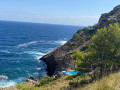
(S) The path starts at Cala Molins, in Sant Vicenç (when facing the sea, it’s the first cove after the central rocky ridge). There’s a wooden signpost.
Follow the small road that runs along the coast towards the north-east. The sea is on your left.

(1) Ignore a path branching off to the left, running along the coast, and head up to the right towards the interior. You’ll come to a roundabout; take the second path from the left (the first leads to a house). The fairly steep climb levels out.

(2) You reach the Coll de Siller. The wide stony track gives way to a path that winds its way down through the heath. After a while, you join a track leading to the house visible from the pass on your right. Take the track on the left. At a Fork in the road, turn left again.

(3) You come to a gate closed by a chain. The chain is loose, allowing you to squeeze through. Personally, I would have turned back. A local told me to go through, saying this is the normal route. This has since been confirmed to me. You walk up a straight path.
When you reach a small road, turn left. It curves round to the right of its own accord. Pass two narrow streets on your left. Then turn left.

(4) You’ll come out onto the ring road/Route de Formentor. Head left to reach the bus station. (E)

Waypoints

  1. S : mi 0 - alt. 30 ft - Cala Molins in Sant Vicenç
  2. 1 : mi 0.68 - alt. 210 ft - Road on the left
  3. 2 : mi 1.26 - alt. 246 ft - Coll de Siller
  4. 3 : mi 1.75 - alt. 30 ft - Iron gate
  5. 4 : mi 2.31 - alt. 16 ft - Formentor Road
  6. E : mi 2.62 - alt. 16 ft - Port de Pollença bus station

Notes

You can get to Sant Vicenç by bus from Port de Pollença. The journey takes a quarter of an hour. Buses leave from the station, which is the end point of the walk.

Sant Vicenç is a very built-up area. You’ll have no trouble finding somewhere to eat or drink.

Worth a visit

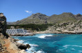
The lovely Cala Carbo.

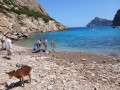
The heath with its goats.

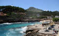
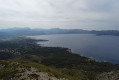
From Coll de Siller, there’s a lovely view of the bay of Port de Pollença.

Reviews and comments

4.3 / 5
Based on 3 reviews

Reliability of the description
4.3 / 5
Ease of following the route
4.3 / 5
Route interest
4.3 / 5
nfaure33
nfaure33

Overall rating : 4 / 5

Date of your route : Jul 16, 2025
Reliability of the description : ★★★★☆ Good
Ease of following the route : ★★★★☆ Good
Route interest : ★★★★☆ Good
Very busy route : No

Hike done with the family and a 13-year-old child, in the blazing sun. Even though it's not long, make sure you take enough water to stay hydrated.

The trail passes by two beaches: Cala Molins and Cala Carbo.

Start by walking along the sea on the left. Be careful with children and don't get too close as there are no safety barriers.

The hike is marked with signs in some places.

Pass through the Col de Siller with beautiful views of the port of Pollença.

Discover the market on Wednesdays until 1pm, then visit the port

Arrival at the bus station to return by bus with the 321 to Pollença then Cala Sant Vicenç.

Machine-translated

Sudouestguy
Sudouestguy

Overall rating : 4 / 5

Date of your route : Jul 05, 2019
Reliability of the description : ★★★★☆ Good
Ease of following the route : ★★★★☆ Good
Route interest : ★★★★☆ Good

A lovely little walk. It’s more road than footpath, but it’s still a nice little walk...
The various coves at Sant Vicenç are magnificent; there’s a lovely view of Port de Pollença from the pass.

Machine-translated

Chicagoboy
Chicagoboy

Overall rating : 5 / 5

Date of your route : Jan 28, 2019
Reliability of the description : ★★★★★ Very good
Ease of following the route : ★★★★★ Very good
Route interest : ★★★★★ Very good

:We are a Franco-Dutch couple of walkers who are always amazed by the quality of the routes on Visiorando, and in particular the accuracy of the directions. This time, whilst out walking in Mallorca, we discovered online this magnificent route from the coast to the inland via a pass, offering superb views of Porto Pollensa and the coves. Easy and straightforward.Two comments: the hunters we met were very friendly, but we were appalled by the housing estates that have already been built and those currently under construction. Thank you – we’ll suggest some routes in the Netherlands if you’d like.

Machine-translated

Other walks in the area

For more walks, use our search engine .

The GPS track and description are the property of this route's author. Please do not copy them without permission.