


Talaia d'Alcudia


A beautiful hike, difficult when temperatures are above 30 degrees and in strong sunshine.
There is not much shade at higher altitudes.
Moderate difficulty below 30°C and in cloudy weather.
This is a beautiful walk, which guarantees you a 360-degree panorama once you reach the top!
Details
Creation:
Last update:
Last review:
–
–
-
 Activity: Walking
-
 Distance: 4.02 mi
-
 Average duration: 3h 05
-
 Difficulty: Difficult
-
-
 Back to start: Yes
-
 Ascent: + 1,444 ft
-
 Descent: - 1,444 ft
-
-
 Highest point: 1,388 ft
-
 Lowest point: 223 ft
 Country:
 City:


Waypoints
- S/E : mi 0 - alt. 223 ft - Route
- 1 : mi 0.45 - alt. 433 ft - Coll Baix Refuge
- 2 : mi 1.16 - alt. 955 ft - Viewpoint
- 3 : mi 1.47 - alt. 892 ft - Col de s'Engolidor
- 4 : mi 2.01 - alt. 1,378 ft - Talaia d'Alcudia
- S/E : mi 4.02 - alt. 223 ft - Route
Other walks in the area
Talaia d'Alcudia
 Visorando Member
 2.16 mi
+915 ft
-915 ft
1h 45
 Moderate
 Departure from Alcúdia (Balearic Islands)
Starting from the Santuari de la Victoria in Alcudia, this short hike will take you to the summit of the highest point on the Cap des Pinar peninsula.
At the summit, you’ll enjoy breathtaking views of the Serra de Tramuntana, the Formentor peninsula and the bays of Pollença and Alcudia.
Puig San Marti d’Alcudia
 4.69 mi
+778 ft
-778 ft
2h 50
Moderate
Departure from Alcúdia (Balearic Islands)
A walk with no major difficulties, apart from the elevation gain. Much of the route is in the shade of a pine forest. This route offers a splendid view of the Alcudia Peninsula in Mallorca.
From Platja Formentor to Cala Burta and back
 6.23 mi
+951 ft
-955 ft
3h 40
Moderate
Departure from Pollença (Balearic Islands)
From March to November, access by car beyond Formentor beach is only possible before 10am. This hike takes you to Cala Murta, a magnificent little secluded cove in the middle of nowhere.
La talaia d'Albercutx
 3.23 mi
+696 ft
-705 ft
2h 05
 Easy
Departure from Pollença (Balearic Islands)
A short stroll offering splendid panoramic views of North-West Mallorca.
Cami de la Cala de Boquer
 3.24 mi
+515 ft
-512 ft
1h 55
Moderate
Departure from Pollença (Balearic Islands)
A short stroll in the wild Cala de Boquer. You may come across some birds, especially eagles.
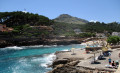
The path from Sant Vicenç to Port de Pollença
 2.62 mi
+240 ft
-253 ft
1h 25
Easy
Departure from Pollença (Balearic Islands)
A pleasant way to get back from Sant Vicenç to Port de Pollença. An easy walk.
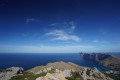
Route from Casa Vicenç to La Mola (Serra de Tramuntana)
 6.24 mi
+1,690 ft
-1,654 ft
4h 20
Difficult
Departure from Pollença (Balearic Islands)
The walk starts from the Casa Vicenç car park. Passing through Coves Blanques, the start of the route is fairly easy. Pointe Perdra Martin features very rocky, stony terrain, exposed sections and magnificent views over the north-west coast. (The map incorrectly labels it ‘Puig de l’Aguila’.) Near the cliff, there is a lovely panoramic viewpoint right on the edge of the precipice. The ascent then begins up to the summit of La Mola. Return via the same route, which offers another lovely viewpoint.
For more walks, use our search engine .
The GPS track and description are the property of this route's author. Please do not copy them without permission.

