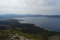
Route from Casa Vicenç to La Mola (Serra de Tramuntana)

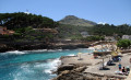
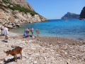
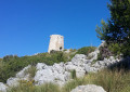
The walk starts from the Casa Vicenç car park. Passing through Coves Blanques, the start of the route is fairly easy. Pointe Perdra Martin features very rocky, stony terrain, exposed sections and magnificent views over the north-west coast. (The map incorrectly labels it ‘Puig de l’Aguila’.) Near the cliff, there is a lovely panoramic viewpoint right on the edge of the precipice. The ascent then begins up to the summit of La Mola. Return via the same route, which offers another lovely viewpoint.

Details

n°110599916
Creation:
Last update:
Last review:
–
  • Walking
    Activity: Walking
  • ↔
    Distance: 6.24 mi
  • ◔
    Average duration: 4h 20 
  • ▲
    Difficulty: Difficult

  • ⚐
    Back to start: Yes
  • ↗
    Ascent: + 1,690 ft
  • ↘
    Descent: - 1,654 ft

  • ▲
    Highest point: 1,594 ft
  • ▼
    Lowest point: 56 ft

Waypoints

  1. S/E : mi 0 - alt. 69 ft - Cala Sant Vicenç
  2. 1 : mi 1.39 - alt. 443 ft - Rock tunnel
  3. 2 : mi 1.55 - alt. 541 ft - Puig de l’Àguila
  4. 3 : mi 2.2 - alt. 781 ft - Viewpoint
  5. 4 : mi 2.55 - alt. 1,037 ft - Viewpoint
  6. 5 : mi 2.99 - alt. 1,549 ft - La Mola
  7. 6 : mi 4.33 - alt. 699 ft - Puig d’Àguila
  8. S/E : mi 6.24 - alt. 105 ft - Cala Sant Vicenç

Notes

Option: climb up to Puig de l’Àguila.

Please note: there are no water sources and no shade, so set off outside the hottest part of the day

Make sure you wear good walking shoes as the path is very stony and rocky.

The path is not signposted, only marked by cairns: the descent is easier to follow than the ascent.

Other walks in the area

For more walks, use our search engine .

The GPS track and description are the property of this route's author. Please do not copy them without permission.