Country:

 City:
City:


The starting point is on the Aya forest road. On leaving Beaudéan, just after the road leading to Le Chiroulet and the bridge, take the Route du Layris, then the Chemin d’Angoué, which continues for several kilometres and climbs into the Bois du Mourgoueilh. At the junction in the woods, leave the Route du Col de la Courade on your left (the starting point for Hount Blanque and Aygue Rouye) and take the Route Forestière de l’Aya (the same road as the one to Lac de Peyrelade). Two kilometres after the junction, at a place called “Antayente”, park in an open area at the start of a U-bend.
GPS coordinates recommended from Les Cabane de Conques.
(S/E) From the car park on the forest track, without crossing the stream, take the path that climbs opposite towards the east, into the forest, and after a few metres join a wider track that climbs and follows the right bank of the Ruisseau de Binaros to the ford.
(1) Cross the Ruisseau de Binaros and continue through the mountain pastures, following the cairns and the yellow markings (which are somewhat faded). The path crosses the stream several times before heading back into the woods. The slope then becomes steeper, alternating between clearings and sections through the woods. However, the path does not present any major difficulties; it is well marked and there are traces of yellow paint.
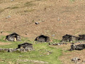
When you reach a flat area, take the time to stop for a break at the Cabanes du Courbet. Some are in ruins, whilst others (private) are still used by the valley’s shepherds during the summer season.
(2) After the huts, veer to the right to begin a gruelling climb up a path that tends to fade into the undergrowth at times. Finding your way is not particularly difficult, however (there are still cairns and traces of yellow markings), but the ascent is steep. The path then crosses two small hills before levelling out slightly. Beautiful views over the valley and the plain below. You’ll reach the lovely Cabane de Conques, which was restored about twenty years ago and is open to walkers. The other hut opposite was destroyed a few years ago by snow. ‘Possible stopover, water available’.
(3) Those who prefer to cut the walk short can turn back here.
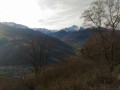
Otherwise, from the hut, the route becomes more rugged and the use of a GPS is recommended. With your back to the Cabane de Conques, head north-west and follow a path that winds along the mountainside. You will then reach a ridge offering magnificent views of the Montaigu and the Lesponne Valley. Continue to follow the path as it descends along the ridge to the edge of the forest at around 1,560 m.
(4) Descend to the right, heading broadly north-east through the woods (where there are a few cairns), to rejoin an old forest track that winds through the woodland. The main difficulty is that there are several remnants of old tracks and fallen trees may hinder your progress. The track zigzags several times through the woods but becomes increasingly well-marked as you descend (with more cairns).
At the end of the descent, leave the woods and arrive back at the clearing you crossed earlier.
(5) Turn immediately left onto a shaded path that is often muddy. This time, the path descends along the left bank of the Ruisseau de Binaros, runs alongside old low walls and past barns, and emerges onto the Route Forestière de l’Aya. A few metres further on, to the right, you’ll find the car park where you started (S/E).

 Visorando Member
 Very difficult
 Difficult