Country:

 City:


Bruay-la-Buissière: a small car park at the entrance to Rue des Peupliers.
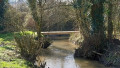
(S/E) Take Rue des Peupliers. At the first left-hand bend, leave the street and take a path between houses nos. 277 and 299. You’ll reach the banks of the Lawe; continue to the left.At the footbridge, carry straight on, first along the path and then through a green space, until you reach the Sentier Wargnier.
(1) Follow it to the right, crossing the River Lawe, for about a hundred metres and, just past No. 223, you’ll find a small lane on the left leading through the housing estate. Follow it, then turn right to reach a street. Follow it to the left (Rue de la Lawe) until you reach the next street (Rue d’Aire). Cross it and follow it to the right until you reach the roundabout (mill). Cross Rue des Festeux to find the entrance to the footbridge.
(2) Follow this footbridge to the left, cross the first street, then negotiate three flights of steps: a short one, a medium one and a long one (you can avoid thesecond one and the descent ofthe third by turning off just before it towards Chemin Latéral). Finish with a short flight of steps leading to a small street. Cross it and take the green space opposite to arrive opposite the Miners’ Memorial (Rue Gaston Blot).
(3) Head towards the memorial. You’ll then come across a path through the woodland. Follow it until you reach a T-junction. Turn right and, 100 metres further on, you’ll reach a Fork in the road.
(4) Turn left and, after a short steep climb, you’ll immediately come to another Fork in the road.You can go either left (along the Biette) or right to reach the bottom of Rue Gaston Blot. Cross the green space on the left to reach Rue Paul Plouviez. Cross it (take care) and follow it to the right. You’ll soon come to a good path that descends towards the Lawe and leads to a footbridge.
(5)Cross the river and follow it to the left (path between the river and the pond). Reach a T-junction, turnleft and join Rue d’Hulluch. Cross the street and take the path opposite which leads back down to the Biette. Follow it to the centre of Bruay.
(6) At the Stop sign, carry on straight ahead into the park (large car park on the right), keeping to the right bank. After the ponds, you’ll reach a street (Rue Cail).
(7) Follow it to the right. At the end, turn left towards the roundabout and then take the second street on the right, Rue C. et H. Bouillez, which climbs slightly towards Béthune.You’ll soon come within sight of a small green space on the left.
You have a choice:
- Climb the stairs there and you’ll find yourself facing a rather daunting embankment. A little further on, near a bench, you’ll find another, much easier embankment. Climb this to reach the level of the bus lane.
- Continue along the road and you’ll very soon find an access point to the bus lane on the left.
(8) Follow it to the left. A little further on, cross over (at the pedestrian crossing) and follow it for another fifty metres or so (to the aerial).
(9) Then leave the bus lane and take a path on the right to join a street (Rue François Évrard). Follow it to the left until you reach Rue René Wallard.
(10) Cross it and take the steps opposite, which lead to the Bois de la Volville. Join a path and follow it to the right. Stay at the edge of the woods until you reach a lovely path (Allée Marguerite Yourcenar).
(11) Follow it to the left. Walk past the École Mendès France and you’ll reach a four-way junction (with the keep on your left).
(12) Turn left and, immediately on the right, take Allée Mahaut d’Artois to reach a T-junction to the right of the keep. Cross the junction and walk up the embankment to find a lovely path through the woodland on the right. Follow it to the end to reach a T-junction.
(13) Follow the path on the left downhill to Rue Pierre Brossolette. The car park is a few metres away on the left (S/E).

 Visorando Member
 Difficult

 Association / Club / Walk leader
 Moderate