Around Bray-sur-Somme

A lovely walk around the Somme, suitable for everyone.

Details

24407508
Creation:
Last update:
Last review:
  • Walking
    Activity: Walking
  • ↔
    Distance: 9.03 mi
  • ◔
    Average duration: 4h 15 
  • ▲
    Difficulty: Moderate

  • ⚐
    Back to start: Yes
  • ↗
    Ascent: + 72 ft
  • ↘
    Descent: - 72 ft

  • ▲
    Highest point: 210 ft
  • ▼
    Lowest point: 112 ft

Photos

Description of the walk

Park near the church in Bray-sur-Somme.

(S/E) Via Rue du Castel, head towards La Neuville-lès-Bray. Cross the bridge over the Somme and pass the town hall and the church.

(1) On leaving La Neuville-lès-Bray, turn right onto a small road signpostedGPR® heading towards Froissy. The silo is clearly visible. At the end of the road, turn left and do not head back up towards the road bridge.

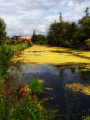
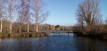
(2) Cross the canal via the green footbridge at the lock, then turn right onto the cycle route towards Méricourt-sur-Somme. Follow the Canal de la Somme for several kilometres, with the Marais des Tourberies on your left. Continue to the bridge. It’s a long ride but very scenic.

(3) At the lock, cross over and return via the other bank. Carry on straight ahead along the canal to Étinehem. A very pretty route.

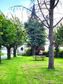
(4) In Étinehem, head towards the church, which is clearly visible, going round the town hall. Pass the town hall and, behind it, take a small road on the left. Follow the road and, on leaving the village, turn right onto the Chemin du Mont des Aigles.

(5) The path crosses the plain. At the end, turn right for a few metres, then take a small track that leads off to the left into the undergrowth.

(6) Follow it. It continues as a wider track. Ignore the first path on the right (which is rather difficult to walk on).

(7) Then, a few hundred metres further on, turn right onto a path (a wide track not shown on the map) which goes round and then runs alongside the bank of the Marais du Coutant as far as the campsite, which you pass by.

(8) Turn right into Rue Gérard Deremarque, turn left into Rue de la République, then turn right to go round the care home. Walk past the town hall and arrive at the church (S/E).

Waypoints

  1. S/E : mi 0 - alt. 138 ft - Church at Bray-sur-Somme. Towards the bridge at the - Somme (la)
  2. 1 : mi 0.63 - alt. 131 ft - Exit at La Neuville (D 329)
  3. 2 : mi 1.36 - alt. 125 ft - Froissy Canal
  4. 3 : mi 4.89 - alt. 118 ft - Lock
  5. 4 : mi 6.12 - alt. 121 ft - Étinehem
  6. 5 : mi 6.6 - alt. 128 ft - Chemin du Mont des Aigles
  7. 6 : mi 7.46 - alt. 135 ft - Junction on a path through the woodland
  8. 7 : mi 7.86 - alt. 121 ft - Marais du Couchant
  9. 8 : mi 8.76 - alt. 128 ft - Junction after the campsite
  10. S/E : mi 9.03 - alt. 138 ft - Church at Bray-sur-Somme

Worth a visit

In Méricourt: at the bridge, you can take a short route through the Marais des Vaches. It’s very beautiful. Follow the signposts. The path then returns to the canal via a footbridge.

Reviews and comments

5 / 5
Based on 2 reviews

Reliability of the description
5 / 5
Ease of following the route
5 / 5
Route interest
5 / 5
erdeg
erdeg

Overall rating : 5 / 5

Date of your route : Aug 10, 2026
Reliability of the description : ★★★★★ Very good
Ease of following the route : ★★★★★ Very good
Route interest : ★★★★★ Very good
Very busy route : No

A very pleasant walk, offering a glimpse of some stunning scenery (the wetlands along the Somme) in contrast to the agricultural plain that makes up the bulk of this region.
We’re going to look for another walk downstream from Bray-sur-Somme, towards Amiens..........

Machine-translated

Marc 62
Marc 62

Overall rating : 5 / 5

Date of your route : Jul 14, 2024
Reliability of the description : Not used / Not applicable
Ease of following the route : ★★★★★ Very good
Route interest : ★★★★★ Very good
Very busy route : No

A lovely walk, with relatively few people about.
You might find the Somme a bit monotonous at the start (a long straight stretch), but it’s very peaceful and the views of the marshes and ponds appear quite quickly.
You can combine it with the “Belvédère du Camp César from Chipilly” walk – an extra 8 km with a bit of a climb – which is also a lovely walk (even prettier!).
Thanks to the author

Machine-translated

Other walks in the area

For more walks, use our search engine .

The GPS track and description are the property of this route's author. Please do not copy them without permission.