In the footsteps of the Celts and the Red Baron

Between the Ancre and Somme valleys.
The “Sur les traces des Celtes” association organises an annual walk between Ribemont, Heilly, Baizieux and Bresle. In 2018, it is launching a new format: each year, a walk starting from one of the four villages, returning to the historic route in the fifth year.
This 11.9 km walk (plus an optional 2.2 km circular route) starts in Heilly and ends in Vaux-sur-Somme, where Manfred von Richthofen, the Red Baron, died 100 years ago.

Details

1008063
Creation:
Last update:
Last review:
  • Walking
    Activity: Walking
  • ↔
    Distance: 8.73 mi
  • ◔
    Average duration: 4h 25 
  • ▲
    Difficulty: Moderate

  • ⚐
    Back to start: Yes
  • ↗
    Ascent: + 492 ft
  • ↘
    Descent: - 486 ft

  • ▲
    Highest point: 348 ft
  • ▼
    Lowest point: 105 ft
  • ⚐ Country: France
  • ⚐ City: Heilly (80113|80800)
  • ⚑
    Start/End: N 49.951196° / E 2.538683°
  • ❏
    IGN map(s): Ref. 2408O
  • Hour-by-hour weather

Photos

Description of the walk

The starting point is on the Grand Canal below Place du Château.

(S/E) Head back up towards the square and Rue du Prévotier, heading west towards Bonnay, until you reach the drinking trough.

(1) Turn left onto Rue du Moulin and continue to the hamlet of Caquevel.

(2) Carry on straight ahead and cross the railway line with care. Continue straight on until you reach the junction with the D120.

(3) Cross the D120 and carry on straight ahead. Walk alongside the Delamotte woods until you reach the top of the hill.

(4) Turn left, then, 50 metres further on, turn right onto the dirt track and carry on until you reach the D1 departmental road.

(5) Cross the D1 with care and turn left onto the hard shoulder, walking for just under a hundred metres until you reach the farm track leading down towards Vaux.
Turn right and walk downhill to the church at Vaux-sur-Somme.

(6) Turn right and walk along the pavement towards Corbie until you reach the edge of the village. Cross the D233 and take a look at the anamorphic painting erected in memory of Manfred von Richthofen and the information panel.

(7) Head back in the other direction towards the centre of Vaux.

(6) Opposite the church, turn right onto Rue de l’Abreuvoir, heading towards Vaire-sous-Corbie until you reach Rue de Sailly. Turn left and follow Rue de Sailly to the cemetery. Carry on to the left, following the tarmac road to the farm buildings. Cross the D233 with care and turn right; walk alongside the road for about a hundred metres to the wayside shrine.

(8) Take the first left, with your back to the wayside cross, until you reach the first junction.

(9) Turn right and head up the Bosquet Duval valley until you reach the D1.

(10) Turn left and follow the D1 for 450 metres.

(11) Cross the D1 and take the road leading down towards Méricourt-l’Abbé until you reach the first junction.

(12) Turn left and follow the flat track, taking in the panoramic view of the lower Ancre valley, until you reach the top of the hill you passed earlier.

(4) Head back down to the right towards Heilly, rejoining the D120.

(3) Cross it with care. Continue to the entrance to Caquevel.

(2) Here, there are two options:
- either carry on to the right, directly towards the finish (option not taken)
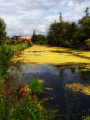
- or turn left and take a detour of about 2.2 km around the Corbie ponds (federal ponds), taking care not to disturb the anglers.

(13) The optional circular loop passes between two ponds, then goes round the one on the left before returning along the railway embankment. Head towards Caquevel.

(2) Walk through the hamlet of Caquevel and continue along Rue du Moulin to the crossroads at the drinking trough.

(1) Turn right and return to the starting point (S/E).

Waypoints

  1. S/E : mi 0 - alt. 118 ft - Grand Canal d’Heilly
  2. 1 : mi 0.11 - alt. 125 ft - Drinking trough - Ancre
  3. 2 : mi 0.59 - alt. 118 ft - Caquevel
  4. 3 : mi 0.77 - alt. 138 ft - Crossing the D120
  5. 4 : mi 1.3 - alt. 341 ft - Top of the page
  6. 5 : mi 1.56 - alt. 338 ft - Crossing the D1
  7. 6 : mi 2.37 - alt. 118 ft - Church of Vaux-sur-Somme. Near the - Somme (la)
  8. 7 : mi 2.76 - alt. 105 ft - Commemorative artwork by the Red Baron
  9. 8 : mi 3.7 - alt. 141 ft - Turn left at Calvaire
  10. 9 : mi 3.89 - alt. 148 ft - Towards the Vallée Sèche
  11. 10 : mi 4.72 - alt. 322 ft - Cote 98
  12. 11 : mi 5.02 - alt. 312 ft - Crossing the D1
  13. 12 : mi 5.41 - alt. 308 ft - Vallée d'Ancre
  14. 13 : mi 7.73 - alt. 112 ft - The Corbie Ponds Circuit
  15. S/E : mi 8.73 - alt. 118 ft - Grand Canal

Notes

An easy walk, but caution is required when walking alongside and crossing local roads and the railway line.

NB: On 10 June 2018, the meeting point is Place du Château at 8.30 am for walkers and at 10.00 am for mountain bikers; the mountain bike route is 25 km long.
On 10 June, both routes will be signposted.
For more information, follow this link.

Worth a visit

Heilly Castle and its grand canal (now dry), as well as the church, date from the 18th century.

(Between 2 and 4) The walk passes the site where a British field hospital was located during the Great War, then the ‘Heilly Station Cemetery’, situated in the municipality of Méricourt l’Abbé, where nearly 3,000 Commonwealth soldiers and 83 Germans are buried.

Vaux-sur-Somme preserves the memory of a German figure from the Great War, Manfred von Richthofen, nicknamed the Red Baron, who died on 21 April 1918 and was buried, after receiving honours from his adversaries, in Bertangles Cemetery.
(Between 4 and 5) Look to the right to see the chimney of the Sainte-Colette brickworks and, a little further on, on the other side of the road, the Corbie woods. It was here that the Red Baron made an emergency landing after being mortally wounded by Australian artillery.
(At 7) Take a look at the anamorphic painting – a work of commemorative art – and the information panel dedicated to it.

Near point (2) – on the left on the way back – another aircraft, a French one, crashed on 20 May 1940 into the Caquevel pond, at the entrance to Heilly. Its pilot, Second Lieutenant Duchêne-Marulaz, who was wounded, managed to parachute to safety and was evacuated along with other French officers, before returning to service as a fighter pilot with the Lafayette Fighter Group.

Reviews and comments

4 / 5
Based on 3 reviews

Reliability of the description
4.3 / 5
Ease of following the route
4.3 / 5
Route interest
3.3 / 5
fredbes
fredbes

Overall rating : 4.7 / 5

Date of your route : Apr 28, 2024
Reliability of the description : ★★★★★ Very good
Ease of following the route : ★★★★★ Very good
Route interest : ★★★★☆ Good
Very busy route : No

A lovely, undulating route through woodland alongside the River Ancre, with the added historical interest of the tragic story of the ‘Red Baron’, a German hero of the First World War, whose life came to an end here.

Machine-translated

dominique.pourchayre

Overall rating : 4.3 / 5

Date of your route : Jun 22, 2019
Reliability of the description : ★★★★★ Very good
Ease of following the route : ★★★★★ Very good
Route interest : ★★★☆☆ Average

The countryside is stunning, and the anamorphic portrait of the Red Baron is well worth seeing, but there’s far too much tarmac on this walk – too many tarmac paths, especially for Nordic walking; worth doing for the 11 November commemorations when the countryside is muddy

Machine-translated

henri57
henri57 ★

Hello,

Thank you for your comments.

You wrote:

Accuracy of the description: Average
Reliability of the route on the map: Average

Did you encounter any problems with the description or the route on the map? If so, how can we resolve them?

See you soon

Machine-translated

orangestreet
orangestreet

Overall rating : 3 / 5

Date of your route : Sep 10, 2018
Reliability of the description : ★★★☆☆ Average
Ease of following the route : ★★★☆☆ Average
Route interest : ★★★☆☆ Average

The “In the Footsteps of the Celts and the Red Baron” walk is a lovely way to stroll through the fields and countryside. The tarmac, the crossings and the sections along local roads aren’t ideal for a leisurely stroll. However, it’s still accessible to everyone for a Sunday afternoon out. Stéphanie

Machine-translated

Other walks in the area

For more walks, use our search engine .

The GPS track and description are the property of this route's author. Please do not copy them without permission.