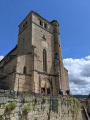
Major geological sites around Saint-Cirq-Lapopie

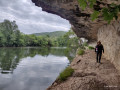
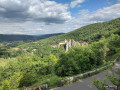
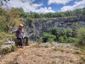
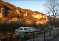
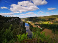
A very challenging circular walk that takes you on a figure-of-eight route (allowing you to do just part of the route), showcasing both the village of Saint-Cirq-Lapopie and the area’s most beautiful UNESCO-listed geological sites: the Cirque de Vènes, the resurgence and the karstic cave of Crégols, and the Chemin de Halage. With a few sections along cliff ledges and stunning views over the Lot Valley, this route will delight lovers of beautiful landscapes and/or geology.

Details

17846026
Creation:
Last update:
Last review:
  • Walking
    Activity: Walking
  • ↔
    Distance: 13.54 mi
  • ◔
    Average duration: 8h 20 
  • ▲
    Difficulty: Difficult

  • ⚐
    Back to start: Yes
  • ↗
    Ascent: + 2,434 ft
  • ↘
    Descent: - 2,441 ft

  • ▲
    Highest point: 1,112 ft
  • ▼
    Lowest point: 423 ft

Photos

Description of the walk

Park in the free car park on the banks of the Lot, at the bottom of the village of Saint-Cirq-Lapopie.

(S/E) As you leave the car park, turn left onto the footpath running alongside the River Lot. Walk past the beautiful Moulin de Ganil; about a hundred metres further on, you’ll come to a crossroads with a footpath.

(1) Turn left onto this path to reach the village of Saint-Cirq-Lapopie. Walk through the village, passing beneath the church and above the cemetery, to return to the D8.

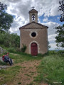
(2) Cross the road and, directly opposite, between a small chapel and a metal wayside cross, take the path that climbs steeply. Look out for the sign: on the heights of Saint-Cirq, this is also theGR®36, marked in red and white. You will then reach a crossroads marked by a cross.

(3) Keep straight ahead on theGR®, following the road to reach the viewpoint over the Cirque de Vènes.

(4) Turn right and continue along the GR®. Walk to the cirque, then take the D42 southwards.
Just before the ‘dangerous bend’ sign, turn left onto the yellow-marked path. You’ll soon rejoin the road.

(5) Return to the road on the left for about a hundred metres. At the junction, leave the road and take the path on the left. You’ll soon reach another Y-junction.

(6) Stay on the left-hand branch, following the blue markings for the ‘Chemin qui Parle’. Continue through the woods, then begin a descent to reach the Combe Guilhaine cliff.

(7) Turn slightly to your left onto the small yellow-marked path, follow it down and, when you’re almost at the bottom, take the path that descends steeply to the left (blue markings), ignoring the path that goes straight on, marked on the ground by a red plastic circle. You’ll reach the D8 road.

(8) Cross the road and turn right at the footbridge. Follow the River Lot along its left bank to the Crégols resurgence, which will be very clearly signposted along the way.

(9) Return to the tarmac road and head back up towards the village. Walk up to the church and take the small path leading uphill to its right. Follow it all the way to reach the highest point on the plateau.

(10) Take the track to the right, then turn right again at the next junction (signposted ‘Sentier Karstique’), and you’ll reach the karstic cave of Crégols.

(11) Continue following the yellow markings on the Karstique trail to descend to the cemetery. Then continue along the tarmac road to reach the junction with the Piste des Travers.

(12) Take this track straight ahead, walk past the cemetery and head towards the village of Crégols.

(13) Turn left into Rue du Château to rejoin the D8. Turn left onto this road; at the junction with the D26, keep right onto the D8. You will then reach the Mas de Laval at a bend on the edge of a wood.

(14) Head up the path opposite; this is the Sentier Découverte. After a series of hairpin bends, you’ll reach a high point where the paths cross.

(15) Keep left on the Sentier Découverte and, via a gentle descent, you’ll reach the Y-junction you passed earlier.

(6) Turn left here, retracing your steps to reach the junction with the D42.

(5) Turn left onto the path leading uphill through the woods, following the yellow markings. You will then reach the Sainte-Croix Chapel and descend again to theGR® junction.

(3) Take theGR® to the left to quickly reach the junction by the small chapel, which you also passed on the way out.

(2) Here you have two options:
- turn right and follow the route back in the opposite direction to the car park at Saint-Cirq-Lapopie (S/E).
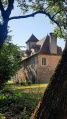
- continue straight ahead and climb up to the village via the footpath leading to the upper car park to reach the Pigeonnier.

(16) Cross the road and immediately take the path marked in yellow. The path alternates between uphill and downhill sections until you reach the crossroads in the hamlet of Les Estayrals.

(17) Continue along the small road and you’ll then emerge in the village of Bouziès

(18) Head for the left bank of the Lot, where you’ll rejoin theGR® 36 andGR® 46. Turn right onto these paths and follow them back to thefirst crossroads you passed on the way out.

(1) Keep left to easily return to the car park at Saint-Cirq-Lapopie (S/E).

Waypoints

  1. S/E : mi 0 - alt. 436 ft - Car park at the foot of - Saint-Cirq Lapopie
  2. 1 : mi 0.49 - alt. 433 ft - Junction of the circular loop
  3. 2 : mi 0.75 - alt. 722 ft - Crossroads by the little chapel
  4. 3 : mi 0.98 - alt. 922 ft - Crossroads of the circular loop – Croix
  5. 4 : mi 1.41 - alt. 791 ft - Cirque de Vènes
  6. 5 : mi 1.66 - alt. 810 ft - D42 road - Cirque de Vènes
  7. 6 : mi 1.85 - alt. 840 ft - Junction of the circular loop: Discovery Trail
  8. 7 : mi 2.49 - alt. 876 ft - Combe Guilhaine
  9. 8 : mi 2.78 - alt. 446 ft - Left bank of the Lot
  10. 9 : mi 3.1 - alt. 446 ft - Crégols spring
  11. 10 : mi 4.14 - alt. 892 ft - High point on the plateau
  12. 11 : mi 4.31 - alt. 801 ft - Karstic cave of Crégols
  13. 12 : mi 4.57 - alt. 597 ft - Track at a place called Les Travers
  14. 13 : mi 4.99 - alt. 482 ft - Crégols
  15. 14 : mi 5.46 - alt. 446 ft - Mas de Laval
  16. 15 : mi 6.33 - alt. 1,089 ft - Trail junction
  17. 16 : mi 8.45 - alt. 850 ft - Pigeonnier
  18. 17 : mi 9.88 - alt. 833 ft - Les Estayrals
  19. 18 : mi 10.72 - alt. 440 ft - Gare de Bouzies
  20. S/E : mi 13.54 - alt. 436 ft - Car park at the foot of - Saint-Cirq Lapopie

Notes

Water points and toilets: Saint-Cirq, Crégols, Bouziès.
Bar and restaurant: Bouziès, Saint-Cirq.
Small grocery shop: La Bodega, Bouziès.
Swimming spot: Crégols.

Worth a visit

Always be cautious and plan ahead when you're outdoors. Visorando and the author of this route cannot be held responsible for any accidents occurring on this route.

The GR® and PR® markings are the intellectual property of the Fédération Française de Randonnée Pédestre.

Reviews and comments

4.3 / 5
Based on 3 reviews

Reliability of the description
4 / 5
Ease of following the route
4 / 5
Route interest
5 / 5
Pascal Peyramaure
Pascal Peyramaure

Overall rating : 5 / 5

Date of your route : Mar 20, 2026
Reliability of the description : ★★★★★ Very good
Ease of following the route : ★★★★★ Very good
Route interest : ★★★★★ Very good
Very busy route : No

Hello, a truly lovely walk between the east and west of Saint-Cirq-Lapopie, with beautiful, varied scenery and plenty to discover.

Machine-translated

User 24708854

Overall rating : 3.7 / 5

Date of your route : May 19, 2025
Reliability of the description : ★★★☆☆ Average
Ease of following the route : ★★★☆☆ Average
Route interest : ★★★★★ Very good
Very busy route : No

This walk is simply magnificent.
The village of Saint Circq Lapopie is stunning, and its shaded surroundings are very relaxing despite the distance and a few steep sections.
The route description is a bit cryptic at times: it meant we ended up walking an extra 3 km, but let’s stay positive as it adds a bit of a challenge to the walk.
You really do need to stay focused, though!!
Just before the towpath in Bouliès, make the most of it and dip your feet (or even more) in the Lot. The water’s cold but very invigorating 🥰

Machine-translated

Thannerhubel
Thannerhubel
• Edited:

Overall rating : 4.3 / 5

Date of your route : May 11, 2025
Reliability of the description : ★★★★☆ Good
Ease of following the route : ★★★★☆ Good
Route interest : ★★★★★ Very good
Very busy route : No

Hello
The walk on 5 May 2025 was brilliant! There are plenty of information boards about the geological sites and the old farm along the route. The towpath along the River Lot is carved into the cliff face. You can do the second section starting from Bouzies. Please note: at point 7, follow the footpath rather than the marked route.

Machine-translated

Other walks in the area

For more walks, use our search engine .

The GPS track and description are the property of this route's author. Please do not copy them without permission.