Around La Richardais

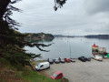
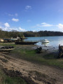
Walk around the village of La Richardais. You start on the banks of the Rance, on the foreshore at La Richardais harbour, near an old tide mill at Pointe de Cancaval. Return via the most inland route possible, following paths through the woodland.

Details

23445777
Creation:
Last update:
Last review:
  • Walking
    Activity: Walking
  • ↔
    Distance: 6.13 mi
  • ◔
    Average duration: 3h 05 
  • ▲
    Difficulty: Easy

  • ⚐
    Back to start: Yes
  • ↗
    Ascent: + 308 ft
  • ↘
    Descent: - 295 ft

  • ▲
    Highest point: 161 ft
  • ▼
    Lowest point: 10 ft

Description of the walk

Park at the Anse des Rivières car park, on the road leading from Dinard to La Richardais (D114), just at the bottom of the descent after the junction with the road to the dam.

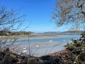
(S/E) Walk along the cove on the beach (if the tide isn’t too high; otherwise, follow the road) until you reach a small park on a headland (sculpture).

(1) From the park, you’ll be on theGR®34, which you follow – sticking to the beach where possible – to the little harbour at La Richardais, passing a sailing school on the way.
Take a short detour via Ruelle du Pontimaron before joining Rue de Dinard, a fairly busy road which you follow to a bridge.

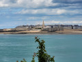
(2) Just after the bridge, turn left (still following theGR®34). You’ll pass an old tide mill and continue through woodland to the Pointe de Cancaval, where you’ll have a lovely view of the Rance and the Rance Dam.

(3) Carry on along theGR®34, passing the Mont Marin wool mill.

(4) Just after this, turn left onto a small path that leads through a courtyard shared by several houses.
At a wash house, take a small road and follow it; then, a little further on, take another small road on the left leading to the hamlet of Le Marquais.

(5) Cross the main Bords de Rance road (D114) with care and, after the hamlet of Les Forges, turn right onto a narrow path through the woodland.

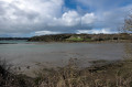
(6) Turn left and walk alongside the little Étang du Dick. When you reach the road, beneath the power lines coming from the Rance tidal power station, turn left onto the road leading to Pleurtuit.

(7) After the hamlet of La Mabonnais, turn right onto a straight road and take the first road on the left.

(8) At a bend bordered by woodland, turn right onto a shaded path. Pass through the hamlet of La Ville Mahé and continue along the small road.

(9) At the junction with Rue Malabry, take Chemin de Belle Entrée, which is at a 45° angle to the right. At the end of this path, turn left and then immediately right onto Chemin de la Théaudais.

(10) Once you reach the road linking Dinard to La Richardais, turn left and cross at the pedestrian crossing. The path to follow (the Chemin du Douet) runs parallel to the pedestrian crossing. About 100 metres further on, turn right and head into the woods along the shaded path leading to the Anse des Rivières car park (S/E).

Waypoints

  1. S/E : mi 0 - alt. 30 ft - Anse des Rivières car park
  2. 1 : mi 0.28 - alt. 23 ft - Pointe de La Richardais
  3. 2 : mi 0.87 - alt. 36 ft - Small bridge
  4. 3 : mi 2.07 - alt. 20 ft - Pointe de Cancaval
  5. 4 : mi 2.87 - alt. 52 ft - Junction after the Malouinière
  6. 5 : mi 3.2 - alt. 69 ft - Le Marquais hamlet
  7. 6 : mi 3.73 - alt. 30 ft - Étang du Dick
  8. 7 : mi 4.2 - alt. 151 ft - The hamlet of La Mabonnais
  9. 8 : mi 4.78 - alt. 82 ft - Chemin de la Ville Mahé
  10. 9 : mi 5.17 - alt. 131 ft - Entrance to the Chemin de la Belle Entrée
  11. 10 : mi 5.71 - alt. 125 ft - Chemin du Douet
  12. S/E : mi 6.13 - alt. 16 ft - Anse des Rivières car park

Worth a visit

Always be cautious and plan ahead when you're outdoors. Visorando and the author of this route cannot be held responsible for any accidents occurring on this route.

The GR® and PR® markings are the intellectual property of the Fédération Française de Randonnée Pédestre.

Reviews and comments

4.4 / 5
Based on 3 reviews

Reliability of the description
4.3 / 5
Ease of following the route
4.3 / 5
Route interest
4.7 / 5
POTTIER Philippe
POTTIER Philippe
• Edited:

Overall rating : 4 / 5

Date of your route : Apr 22, 2026
Reliability of the description : ★★★★☆ Good
Ease of following the route : ★★★★☆ Good
Route interest : ★★★★☆ Good
Very busy route : No

A lovely walk; the banks of the Rance are pleasant.

Machine-translated

User 27496385

Overall rating : 5 / 5

Date of your route : Oct 27, 2025
Reliability of the description : ★★★★★ Very good
Ease of following the route : ★★★★★ Very good
Route interest : ★★★★★ Very good
Very busy route : No

Easy hike in a very pleasant setting.

Machine-translated

"Betty & Bertrand"
"Betty & Bertrand"

Overall rating : 4.3 / 5

Date of your route : Feb 16, 2025
Reliability of the description : ★★★★☆ Good
Ease of following the route : ★★★★☆ Good
Route interest : ★★★★★ Very good
Very busy route : No

A very pleasant walk with a route offering a wide variety of scenery and superb panoramic views at the tip of Cancaval. Easily accessible to everyone, although there are a few slightly muddy sections at this time of year.
At the start, we had to follow the road, as the tide hadn’t gone out far enough yet.

Machine-translated

Other walks in the area

For more walks, use our search engine .

The GPS track and description are the property of this route's author. Please do not copy them without permission.