Circular walk in Sainte-Mère-en-Gascogne

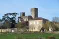
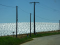
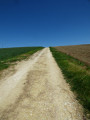
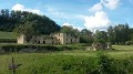
A circular route between Sainte-Mère and its Gascon castle and Sempesserre, offering sweeping panoramic views over fields of cereals or melons.

Details

n°6787206
Creation:
Last update:
Last review:
  • Walking
    Activity: Walking
  • ↔
    Distance: 5.66 mi
  • ◔
    Average duration: 3h 05 
  • ▲
    Difficulty: Easy

  • ⚐
    Back to start: Yes
  • ↗
    Ascent: + 554 ft
  • ↘
    Descent: - 581 ft

  • ▲
    Highest point: 627 ft
  • ▼
    Lowest point: 325 ft

Photos

Description of the walk

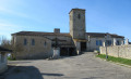
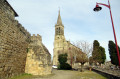
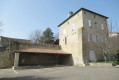
Park in the car park near Sainte-Mère Church, on Chemin du Midi.

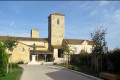
(S/E) Enter the village through the gate to the right of the church, follow Rue du Château, which leads to a grassy area with a cross and picnic tables. Walk past the cross and continue along the wooded path which descends, then turns left and finally right, between two cultivated fields.
On the descent, you’ll see an irrigation lake on the left, then another on the right.
At the end of the descent, after a large oak tree, when you reach the ditch, follow it to the left; then, at a bridge, cross it and follow the path on the other side until you reach the next bridge.

(1) At the junction with theGR® de Pays Cœur de Gascogne trail (marked in yellow and red), turn right onto a grassy path, which then becomes stony. Pass through the hamlet of Mameillac until you reach a road; take this to the left, where there is a viewpoint over the village of Sempesserre. Follow this dead-end road to the farm in the hamlet of Le Peyré.

(2) At the end of the road, at the corner of the shed, follow the dirt track on the left to the Majoulin house. Continue to the right along the dirt track.

(3) Carry on along the bank of the Ruisseau du Rouge until you reach the road.

(4) At the road, turn left, pass the road to Rougé and then the one to La Lausette, and you’ll reach a junction.

(5) At the junction with theGR® de Pays Cœur de Gascogne trail, marked with yellow and red signs, take this dirt or grassy track to the left and follow it. Walk alongside the Ruisseau Bernes for a short distance, then turn left to walk alongside the Ruisseau Palaso.

(6) Just before the end of the woodland on the right-hand side, turn onto a dirt track leading uphill to the left; yellow and red markings are visible on a tree a short distance away.

(7) This path leads onto a small road; follow it for about a hundred metres before leaving it to take a stony then grassy path to the left, before turning right whilst continuing to follow the yellow and red markings.
This track descends and then climbs again to the farm at a place called Le Moulin.

(8) Turn right onto the road towards the N21. Turn left and walk carefully along the grass verge of the N21 for 250 metres until you reach the first road on the left, Rue de la Plaine et du 19 Mars.

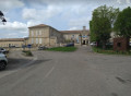
(9) Walk past the Town Hall and continue to the right towards the village, then turn left onto Rue de l’Église, which leads to the car park (S/E)

Waypoints

  1. S/E : mi 0 - alt. 607 ft - Car park near the church
  2. 1 : mi 0.82 - alt. 374 ft - Junction with the GR de Pays Coeur de Gascogne.
  3. 2 : mi 1.9 - alt. 440 ft - Le Peyré hamlet
  4. 3 : mi 2.44 - alt. 325 ft - Ruisseau du Rouge
  5. 4 : mi 3.13 - alt. 367 ft - Junction with a road.
  6. 5 : mi 3.44 - alt. 449 ft - Junction with the GR de Pays Coeur de Gascogne.
  7. 6 : mi 4.22 - alt. 354 ft - Junction with a dirt track on the left-hand side.
  8. 7 : mi 4.69 - alt. 495 ft - Road junction
  9. 8 : mi 5.23 - alt. 574 ft - A place known as Le Moulin
  10. 9 : mi 5.45 - alt. 574 ft - Ste Mère Town Hall
  11. S/E : mi 5.66 - alt. 610 ft - Car park near the church

Notes

This route offers sweeping views of the fields but little shade; best avoided in hot weather.

(9) Public toilets and drinking fountain near the entrance to the Town Hall.

Always be cautious and plan ahead when you're outdoors. Visorando and the author of this route cannot be held responsible for any accidents occurring on this route.

The GR® and PR® markings are the intellectual property of the Fédération Française de Randonnée Pédestre.

Reviews and comments

4.1 / 5
Based on 3 reviews

Reliability of the description
4 / 5
Ease of following the route
4.5 / 5
Route interest
3.7 / 5
User 4058493

Overall rating : 4 / 5

Date of your route : Oct 04, 2026
Reliability of the description : ★★★☆☆ Average
Ease of following the route : Not used / Not applicable
Route interest : ★★★★★ Very good
Very busy route : No

I really enjoyed this route, even the (very short) final stretch along the A-road. I used the GPS track the whole way – there are absolutely no signposts – so I did have a bit of trouble finding the start of the path. I wonder if the route hasn’t actually been taken out of use. I walked whilst the fields were ploughed but not yet sown, and the ground was particularly dry; it seemed to me, not far from the start, that the path had been ploughed: it probably ran across private land that the farmer is cultivating. In which case, this section will prove impassable during the growing season or in wet weather.

Machine-translated

AMV
AMV

We would like to thank you
AMV

Machine-translated

pierredagen
pierredagen

For lemarcheur65

I retraced the route this afternoon, using the amended section via the RN 21, and I can confirm it’s fine.
I’ve updated the route description.
The 250-metre stretch running alongside the RN 21 is a grassy verge 1.5 metres wide, which allows walkers to pass, preferably in single file.

Machine-translated

lemarcheur65
lemarcheur65 ★

Hello AMV

I have forwarded this to the website administrators

Machine-translated

AMV
AMV

That’s not the point; some people do it to go and pick melons.

Machine-translated

lemarcheur65
lemarcheur65 ★

Hello pierredagen
You wrote:

The alternative route suggested, running alongside the RN 21, is certainly possible, but before replying, I wanted to check on site whether it could be done safely, given that it is a busy road.

So, the alternative route:
(8) Turn left onto the GRP and head back to the original junction.
(1) Turn right and follow the route in the opposite direction to the outward journey, returning to (S/E).

Machine-translated

lemarcheur65
lemarcheur65 ★
• Edited:

Hello AMV
I understand perfectly.
The route has been changed and no longer passes through your property.

Machine-translated

AMV
AMV

We allowed access when asked, but at no point were we told that this would be posted on a hiking website.
Since then, we have prohibited access due to various problems, including the inconsiderate behaviour and curiosity of walkers or onlookers who have no qualms about entering our garden.
We request that this route be removed.

Machine-translated

pierredagen
pierredagen

Hello,
Before publishing the route, we met with a group of walkers and the owner of the house at a place called ‘Le Pin’, who told us that the road was private but did not forbid us from using it.
The alternative route suggested, which runs alongside the RN 21, is certainly possible, but before replying, I wanted to check on site whether it could be crossed safely, given that it is a busy road.
Should any problems arise, I will let you know, but in the meantime you can already report it.

Machine-translated

lemarcheur65
lemarcheur65 ★

Hello AMV

20/10/2023 message from the moderators: route amended at (8) to avoid private property.

Machine-translated

AMV
AMV
• Edited:

route passing through a private road where entry is prohibited

Machine-translated

philippetalenton
philippetalenton

Overall rating : 4 / 5

Date of your route : Jan 29, 2023
Reliability of the description : ★★★★★ Very good
Ease of following the route : ★★★★★ Very good
Route interest : ★★☆☆☆ Disappointing
Very busy route : No

Machine-translated

titouver
titouver

Overall rating : 4 / 5

Date of your route : Feb 14, 2022
Reliability of the description : ★★★★☆ Good
Ease of following the route : ★★★★☆ Good
Route interest : ★★★★☆ Good
Very busy route : No

a lovely village and a walk through the fields

Machine-translated

Other walks in the area

For more walks, use our search engine .

The GPS track and description are the property of this route's author. Please do not copy them without permission.