



List of stages:
1 – Eaux-Rousses – Rhêmes-Notre-Dame: the longest stage, with a slight difficulty on the descent from the Col d’Entrelor
2 – Rhêmes-Notre-Dame – Rifugio Benevolo: an easy stage allowing you to leave your belongings at the refuge and complete a circular route to Lake Tsanteleina
3 - Rifugio Benevolo - Rifugio Savoia: a moderately difficult stage, with a long climb to the Col Rosset and a stunning descent amongst the Nivolet lakes
4 – Rifugio Savoia – Eaux-Rousses: an easy stage with views of the Gran Paradiso
Gran Paradiso Park Circular Route


This 4-day circular route can be walked in either direction. You can choose to start from Eaux-Rousses, Rhêmes-Notre-Dame or Rifugio Savoia. All three locations are accessible by car (with on-site car parks) or by bus from Aosta or Ivrea.
You can also complete this circular route in three stages, heading directly from Rifugio Benevolo to Rifugio Savoia. However, this will result in a longer stage and you won’t get to explore the stunning lakes above Rifugio Benevolo.
Details
Creation:
Last update:
Last review:
-
 Activity: Walking
-
 Distance: 32.21 mi
-
 Average duration: 4 days
-
 Difficulty: Difficult
-
-
 Back to start: Yes
-
 Ascent: + 10,633 ft
-
 Descent: - 10,636 ft
-
-
 Highest point: 9,915 ft
-
 Lowest point: 5,482 ft
-
 Country:
Italy
-
 Area: Alps
-
 City:
Valsavarenche
-
 Start/End: N 45.567871° / E 7.208195°
-


 Hour-by-hour weather
Photos



Stages of the route
This route needs several days, find the details below:
Notes
Worth a visit
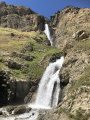
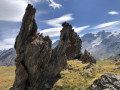
Stunning scenery and almost constant views of the summit of Gran Paradiso and numerous glaciers. Waterfalls, rivers and mountain lakes.
Reviews and comments
4.7 / 5
Based on 1 review
Reliability of the description
4 / 5
4 / 5
Ease of following the route
5 / 5
5 / 5
Route interest
5 / 5
5 / 5

JMG900
Hi. Is it possible to book lodges in Italy as you can in France? Thank you.
Machine-translated
YetiJules
Overall rating : 4.7 / 5
Date of your route : Aug 21, 2023
Reliability of the description : ★★★★☆ Good
Ease of following the route : ★★★★★ Very good
Route interest : ★★★★★ Very good
Very busy route : Yes
A lovely route, done in the opposite direction to the one described (clockwise), starting from Eaux Rousses, with two teenagers and a nine-year-old (camping overnight and eating at a mountain refuge).
It was an introduction to multi-day hiking, which went very well. The scenery is magnificent!
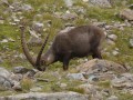
However, we didn’t see as many animals as we’d hoped: a few marmots, four chamois 50 metres away, but no ibex (probably too hot and too ‘late’ in the season).
Some additional and useful information (I hope…):
Eaux-Rousses: stayed overnight at Camping la Grivola in Bien => appalling service and high prices (€55/night for 1 adult + 2 teenagers + 1 child); if possible, opt for the Gran Paradiso campsite, situated a little further up the valley towards Pont
__Colle del Nivolet / Rifugio Savoia:_: PLEASE NOTE: the pass is accessible by car from the south – so it gets very busy during heatwaves – Lac du Nivolet Supérieur is set back from the car park, less crowded and quieter.
Don’t hesitate to head up to Lake Leita or Lake Rosset, which are much quieter and prettier.
The staff at the bar aren’t very friendly.
Bivouacking is possible (despite being in the park) behind the bar – showers available (ask at the bar: €5 per person)
Dinner price: €24 per person.
Light lunch price: €8 per person.
Colle Rosset: The descent from the pass towards the Rhêmes valley is tricky: very steep, over scree that tends to give way underfoot – take care in wet weather!
Rifugio Benevolo: A superb valley offering magnificent scenery!
The refuge staff are very professional and efficient – it must be said they deal with a lot of people
Bivouacking is possible further down by the stream (you’re no longer in the park)
Shower: €3 per person.
Rifugio Delle Marmotta: Rather than staying at Notre Dame de Rhêmes, we preferred to climb up to the Rifugio Delle Marmotta (Alpage d’Entrelor), which shortened the next stage considerably (the crossing of the Col d’Entrelor)
Run by volunteers from an NGO, this refuge opened in 2015 and offers a very warm welcome!
Bivouacking: not possible as it’s within the park and the rangers sleep on site (overnight stay at the refuge is compulsory, so make sure you book in advance) => this was our favourite part of the trip
Col d’Entrelor: The final stretch of the climb to the Col d’Entrelor from the Rhême Valley isn’t straightforward (a ~10-metre section equipped with footrests and a handrail), but if you’ve managed to reach the pass, don’t hesitate to carry on to Cima Percée (head south – to the right as you reach the pass – along the ridge) at 3,200 metres; the walk isn’t difficult and the view over the glaciers and the summit of Gran Paradiso is magnificent.
Machine-translated

Netra

Hello Nanou01,
The IGN is not responsible for producing maps for Italy, only for France. You’ll need to use maps from its Italian counterpart. These maps are generally available in bookshops specialising in hiking or in certain sports shops, but I’m not sure where you might find a shop of that sort in your neighbourhood.
As for the website and the mobile app, unfortunately we do not have Italian maps. We therefore use OSM or OSM Trails maps.
Machine-translated
Other walks in the area
Eaux-Rousses – Rhêmes-Notre-Dame
 Visorando Member
 9.09 mi
+4,383 ft
-4,199 ft
7 hrs
 Very difficult
 Departure from Valsavarenche (Aosta Valley)
First stage of a circular route in the Gran Paradiso National Park, based on the5th stage of the Gran Paradiso Crossing proposed by bernardino.
A long stage: 4 hours 20 minutes’ ascent and 3 hours 10 minutes’ descent. Splendid views of Gran Paradiso and along small mountain lakes.
The Alpine Pasture and Lake Djouan
8.30 mi
+2,808 ft
-2,808 ft
6h 15
Difficult
Departure from Valsavarenche (Aosta Valley)
A walk through the hunting grounds of King Victor Emmanuel, who owned a very large building in Orvieille that is currently being refurbished. Passing through the mountain pastures that follow, the very pretty Lac de Djouan then comes into view.
Eaux Rousses - Refuge Vittorio Sella
 8.70 mi
+5,495 ft
-2,523 ft
10 hrs
Very difficult
Departure from Valsavarenche (Aosta Valley)
From Valsavaranche to Val de Cogne in the middle of a herd of chamois.
Eaux Rousse - Cognes
 Association / Club / Walk leader15.65 mi
+5,804 ft
-6,168 ft
12h 15
Very difficult
Departure from Valsavarenche (Aosta Valley)
A long day lies ahead with the climb to the Col de Lauzon (3,299m). This is the highest point of the TDG. The descent from the pass is pure delight. It is possible to run downhill for 3–4 km to the Vittorio Sella Refuge. It is a large refuge with plenty of people. The descent to Valnontey is also long, but there are plenty of cafés to rest in.
Tour of Cima della Roley in the Aosta Valley
 6.10 mi
+2,979 ft
-2,972 ft
5h 25
 Moderate
Departure from Valsavarenche (Aosta Valley)
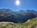
A truly magnificent mountain route. Ascent, crossing the Col du Grand Small Pass, then descent. A fairly classic circuit where you are likely to see animals such as chamois and marmots. This circuit can be done in either direction, but the direction indicated allows you to enjoy impressive views on arrival at the Col du Grand Small Pass.
Borgnoz and Meyes circular mountain pasture loop
9.22 mi
+2,900 ft
-2,917 ft
6h 45
Difficult
Departure from Valsavarenche (Aosta Valley)
Facing the Grand Paradis, these two mountain pastures, now abandoned, offer a beautiful view of the glacier and the summit of this particularly popular mountain.
The Victor Emmanuel Refuge at the foot of Gran Paradiso
 4.11 mi
+2,470 ft
-2,461 ft
4h 05
Moderate
Departure from Valsavarenche (Aosta Valley)
A visit to the Victor Emmanuel Refuge, which, like its neighbour the Chabod Refuge, can be considered the base camp for the summit of Gran Paradiso, located in the province of Aosta in northern Italy. A steep but short climb that ends between the refuge and Lake Moncorvé.
Refuge de la Marmotte - Eaux Rousses
8.35 mi
+2,831 ft
-4,406 ft
6h 20
Difficult
Departure from Rhêmes-Notre-Dame (Aosta Valley)
A short day as the next day takes you into the Gran Paradiso National Park, where camping is prohibited; I had to cut the stage short, otherwise it would have had to be extended unreasonably. The Hostellerie du Gran Paradis is the only place to stay overnight. The food is great, but be warned: at weekends there are often Italians, French people, etc. out mountain biking.
For more walks, use our search engine .
The GPS track and description are the property of this route's author. Please do not copy them without permission.

