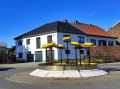
Houtain Saint-Siméon: Houtain derives from the Old High German ‘holt-heim’, meaning ‘wooden house’. Holthem in 976, Holtaim in 1044... The straw industry has its origins in the Geer valley and dates back to the 14th century. From the 15th century onwards, the inhabitants of Houtain took up the craft of straw-working, in which they very quickly excelled. The straw hat makers then took their expertise to France, the Netherlands, Germany and England to set up factories there. Subsequently, new opportunities arose in the United States, but for sentimental reasons and out of a deep attachment to their homeland, the straw hat makers refused to cross the Atlantic… The local character and the quality of the craftsmanship were carefully preserved (documentation from Ets Guinotte and Troquet). Houtain Saint-Siméon’s reputation was built on its ‘tchap’lis’ (hat-makers).
The crowning glory of the hat-makers is undoubtedly the canotier, one of whose most loyal customers was none other than the famous and hugely popular Maurice Chevalier.
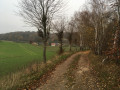
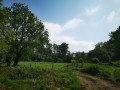
In 1896, there were 206 small businesses, mainly family-run. This craft provided employment for over 300 people. Unfortunately, the Great War brought this industry to an end. Cheap imported ‘braids’ then flooded the market, and most hat-makers, in order to survive, were forced to compromise on the quality of their work. After a brief stroll through the village, walkers setting off from the old local railway station will take the Chemin de Roclenge (Voye di Roclindje), which is tarmacked at the start but ends as a farm track. At the edge of the farmland, you will see a strawberry field.
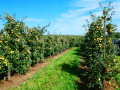
(1) The strawberry field
Two varieties of strawberries are grown on these plots: one that is usually found on shop shelves and the other, for those who prefer a more pronounced flavour.
During your visit (in season), you’ll see that other soft fruits, such as redcurrants and raspberries, are grown under cover.
(2) The Patrotê Tree
Among the main legends behind its name, here are the most frequently cited.
It is said that Napoleon Bonaparte reviewed his troops beneath this lime tree, having them march past at a trot.
•More likely, it is said that before attacking the city of Maastricht, Napoleon camped at Houtain and that, in memory of his visit, the locals planted a lime tree on this spot. The tree was struck by lightning during a violent storm in August 1930. However, to keep the legend alive, the locals immediately replanted another one.
As they follow the route, walkers will discover, depending on the year, a patch of pumpkins.
(3) Pumpkin cultivation
Several varieties of squash (in season) are grown on the land around you.
It was the Halloween tradition, originating in England and the United States, that gave rise to this crop.
Halloween: in the old days, in our region – as those over sixty will recall – we would hollow out a beetroot to shape it like a human head and place a candle inside it. The beetroot, thus transformed and lit from within, was mounted on top of a stick, which was then wrapped in a white sheet. And when night fell, people would wander the village streets to frighten passers-by… who were actually in on the joke. This very old tradition was brought to the US by European settlers, mainly Irish.
Now, this festival, which is spreading successfully, is coming back to us with… an American label. ‘Why not Wallonween?’ an editorialist recently asked.
When we first started celebrating Halloween, beetroot was still the vegetable of choice. But we very quickly realised that pumpkins were much easier to carve, which allowed them to dethrone the beetroot. It’s also worth noting that this squash is edible, thus avoiding any risk of accidents.
Other squashes are also grown, such as the potimarron, the giraumont and the butternut: these varieties are primarily grown for consumption. On your way back to the village, you’ll pass Saint-Siméon Church.
(4) Saint-Siméon Church
Once a simple chapel, this red-brick building was rebuilt in 1873.
The tower, which is relatively tall for a village church, appears to be that of a castle that once stood on the site.
One piece of evidence supporting this theory is the discovery of underground passages originating beneath the church porch, which served as emergency exits leading into the countryside around Bassenge and Heure-Le-Romain.
Continuing on their way, walkers will spot numerous lime trees, remarkable for their size and girth. They then come upon the route of the old local tram line.
(6) Former tram line
This line was intended to link Genk to Liège; on 23 May 1910, the first section opened, connecting Genk to Bassenge via Riemst. The fare ranged from 10 to 15 centimes, depending on the route.
Less than a year later, on 8 March 1911, the line was extended to Liers via Houtain Saint-Siméon, to transport sugar beet from the Limburg plateau to the sugar factory.
It was from Houtain that a new section was to be built as far as Herstal, to enable workers from Limburg to reach the many coal mines in Liège and the industries along the Meuse. But the line had barely opened when the Great War broke out. The Germans did not hesitate to dismantle certain sections to use them elsewhere.
After 1918, the rebuilt line remained in active use until the 1950s; it was then gradually taken out of service and ceased operations on 30 June 1959, the day of the final journey from Riemst to Bassenge via Houtain.
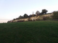
Today, nature has reclaimed the area, and it is now home mainly to black locusts, chestnut trees, ash trees, beech trees, medlar trees and many other species of vegetation. As you ride along, admire the stunning panoramic view of the Meuse Valley.
This former tram line will eventually take you back to your starting point, passing through the hamlet of
Al Tombe. You will then find yourself facing the ‘Arbre du Trentenaire’ (the 30th Anniversary Tree), planted in 1975, and the information panel at the tram station.



 Country:
 City:


 Visorando Member
 Moderate